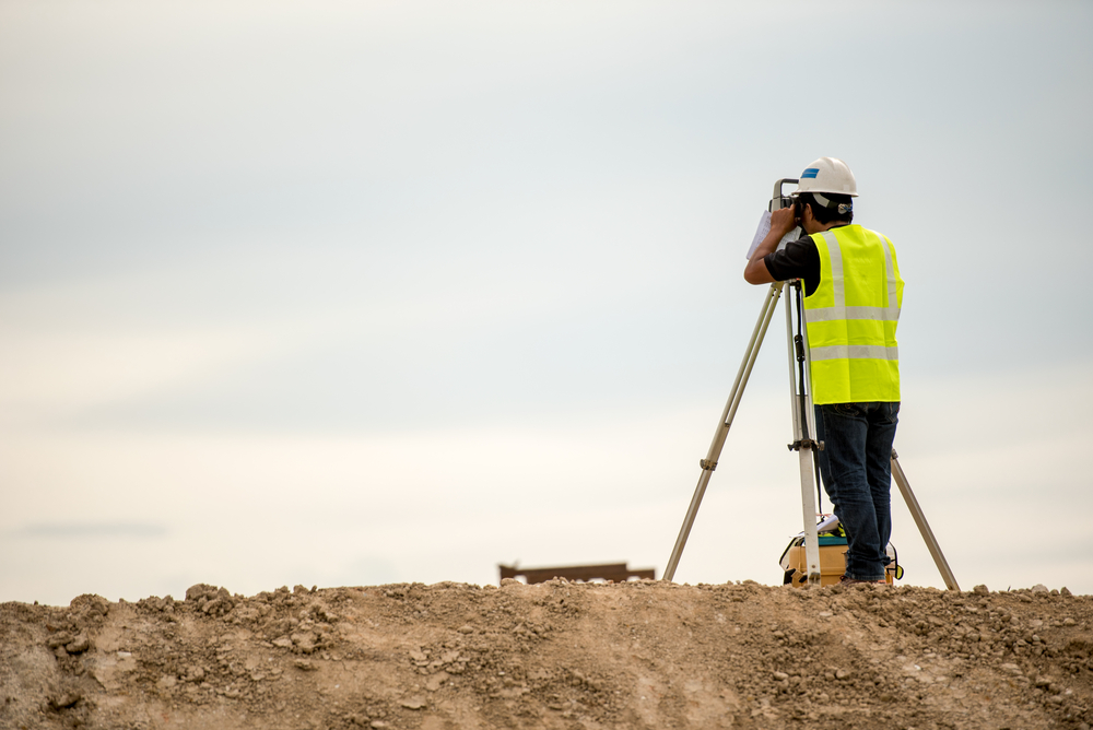
When considering property development in any region, understanding the land’s physical features is vital. In La Pryor, TX, a rural community located in Zavala County, the terrain plays a critical role in determining the feasibility and design of residential, commercial, and agricultural projects. The field of land surveying becomes essential in helping property developers assess these conditions accurately. The relationship between topography and development is far-reaching, influencing everything from drainage systems to construction costs. For stakeholders, recognizing how La Pryor’s unique geographical characteristics shape real estate opportunities is not just insightful — it is necessary for long-term success.
The Role of Topography in Site Selection
Topography refers to the arrangement of natural and manmade physical features of an area. In La Pryor, TX, the land features a relatively flat landscape interspersed with brush-covered areas and occasional low ridges. While flat lands may seem ideal for construction at first glance, a detailed evaluation by a land surveyor reveals the more nuanced impact topography has on development projects.
A professional land surveyor in La Pryor, TX can identify subtle grade changes, soil composition, flood-prone areas, and elevation shifts that are not always visible to the naked eye. These features can determine whether a site is suitable for building structures, installing septic systems, or managing stormwater runoff. For developers, ignoring topographical details may lead to costly engineering fixes later in the construction process. Through topographical land surveying, developers can make informed decisions about where to place buildings, roads, and utilities, optimizing both safety and cost-efficiency.
Infrastructure Planning and Drainage Challenges
One of the most significant effects of topography on property development in La Pryor, TX lies in infrastructure planning, especially when it comes to drainage. Since the region is known for its arid climate interspersed with periods of intense rainfall, proper drainage systems are a necessity rather than a luxury. Even slight inclines in the terrain can affect how and where water pools or flows during a storm event.
Land surveying professionals play a crucial role in mapping out these drainage patterns. Using tools like GPS and GIS technology, a land surveyor can generate a topographic map that pinpoints elevation variations, helping engineers design drainage channels, retention basins, or culverts that work with the natural flow of the land. Inadequate planning in this area can lead to flooding, erosion, and structural damage, especially when developing near creeks or low-lying areas.
For residential developers in La Pryor, TX, understanding drainage implications can guide decisions such as foundation height, driveway slope, and the positioning of landscaping features. Similarly, agricultural operations depend on topographic data to manage irrigation and prevent waterlogging or soil erosion. In this sense, land surveying not only supports initial planning but also enhances long-term sustainability.
Environmental Impact and Land Use Regulations
The environmental implications of developing land in La Pryor are closely tied to its topography. The Texas landscape is ecologically diverse, and local regulations often require environmental assessments before approving large-scale development projects. A qualified land surveyor in La Pryor, TX provides critical data that informs these assessments, especially in areas where the terrain affects water flow, soil stability, or wildlife habitats.
Zoning laws and land use policies often account for topographical constraints. Steep grades or areas with poor drainage may be restricted from certain types of development, or they may require additional permits and engineering controls. Land surveying data can help developers navigate these regulatory requirements and avoid legal complications down the road.
Furthermore, environmentally conscious development practices are becoming increasingly important to both investors and the community. Incorporating topographic insights allows for construction strategies that minimize ecological disruption. In La Pryor, this might include preserving native vegetation, directing runoff away from sensitive areas, or designing around natural contours to reduce the need for excessive grading. Through the lens of responsible land use, topography becomes not an obstacle but a guiding principle for sustainable growth.
Cost Estimation and Construction Feasibility
Another crucial aspect of topography in property development is its direct influence on construction feasibility and budgeting. In La Pryor, TX, land may appear development-ready at first glance, but a topographic land survey often uncovers variables that affect the true cost of building. For instance, if a site includes uneven ground or requires significant earthmoving, the budget can quickly escalate.
Land surveying enables developers to estimate the cost of grading, retaining walls, and foundation adjustments. It also helps identify whether additional structures, such as drainage ditches or erosion control systems, are necessary to prepare the land for construction. By integrating topographical information early in the project lifecycle, developers reduce the likelihood of unexpected expenses and delays.
Contractors also rely on survey data to guide heavy machinery placement, plan for material delivery routes, and ensure compliance with engineering plans. In rural areas like La Pryor, where infrastructure may be limited, the topography dictates whether certain types of equipment can even access a site. This makes the role of a land surveyor in La Pryor, TX particularly vital for rural development, where logistical hurdles can be magnified by challenging terrain.
Enhancing Property Value and Long-Term Usability
Understanding topography doesn’t just help during the initial development stages — it also enhances the long-term usability and value of a property. In La Pryor, TX, buyers and investors often seek land for various uses, including farming, ranching, residential construction, or recreational development. Each of these uses has different requirements, and topographic features play a big role in determining suitability.
A land surveyor can help prospective buyers assess how the land’s slope, orientation, and natural features will affect their intended use. For example, farmland may require level terrain and good drainage, while a recreational site might benefit from varied elevations and natural vistas. Residential developers might prioritize accessibility, flood safety, and aesthetic appeal, all of which are influenced by the land’s topography.
Incorporating this level of detail into a development plan not only makes the property more functional but also increases its resale value. Prospective buyers are more confident in purchasing land when it comes with clear documentation of topographic features and a record of professional land surveying. This transparency can be a major selling point in competitive markets.
Moreover, topography has implications for future adaptability. Properties developed with a keen understanding of the land’s natural characteristics are more likely to withstand environmental changes, accommodate expansion, and require less maintenance over time. In a place like La Pryor, TX, where the land is both a resource and an investment, this foresight pays dividends.
Conclusion
In La Pryor, TX, the significance of topography in property development cannot be overstated. From site selection and drainage planning to regulatory compliance and cost management, the shape and features of the land influence nearly every decision a developer must make. Partnering with a skilled land surveyor in La Pryor, TX ensures that these decisions are based on accurate, detailed information, helping avoid costly surprises and enabling smarter development strategies.
Whether planning a residential neighborhood, a commercial facility, or agricultural operations, developers benefit immensely from a comprehensive topographic assessment. Land surveying offers the data needed to navigate terrain-related challenges, comply with local regulations, and optimize property use for both immediate and future needs. As La Pryor continues to grow and attract new development, the importance of understanding and respecting the land’s topography will only become more essential.
By embracing the insights provided through professional land surveying in La Pryor, TX, developers can turn geographic constraints into opportunities — shaping communities that are resilient, efficient, and in harmony with the natural landscape.
Need Land Surveyors in Texas?
At Smyth Surveyors, Inc., we offer professional, official, and dependable land surveying in Texas. Our staff are all trained and licensed with our owner holding an L.S.L.S license. We can offer surveying for gas and oil well locations, pipeline right-of-way acquisition and construction alignment, determination of original survey boundaries, title boundary surveys, topographic surveys, and construction staking. If you are looking for a surveying company that has a prestigious record and an impeccable reputation look no further than Smyth Surveyors, Inc. Contact us today to speak with one of our friendly project managers and set up some time with us!
Flooding has always been a serious concern in Texas, but in recent years, the risk has increased significantly due to the accelerating impacts of climate change. Rising global temperatures have led to more frequent and intense storms, erratic weather patterns, and shifting rainfall trends, all of which contribute to higher flood risks across the state. From densely populated urban centers like Houston to rural communities such as La Pryor, TX, no part of the state is immune.
Texas has experienced a range of catastrophic flood events in the past few decades, with billions of dollars in damage and countless lives disrupted. Now, with the added uncertainty of climate change, understanding and mitigating these risks has never been more urgent. One of the essential tools in flood risk assessment and property protection is the flood elevation certificate, a document that plays a critical role in determining flood insurance rates and evaluating a property’s elevation relative to the base flood level.
This blog explores how climate change is reshaping the flood landscape in Texas, the increasing importance of flood elevation data, and what residents and policymakers can do to prepare.
Changing Rainfall Patterns and Intensity
Climate change has had a noticeable effect on rainfall patterns in Texas, making storms not only more unpredictable but also more intense. The state has seen an increase in the frequency of extreme weather events, particularly hurricanes and tropical storms, which often bring intense downpours in short periods. This kind of rainfall overloads natural waterways and urban drainage systems, leading to flash floods and prolonged inundation in vulnerable areas.
In regions like La Pryor, TX, where the landscape is generally flat and the drainage infrastructure is limited, these sudden deluges can be devastating. What used to be rare 100-year flood events are now happening more frequently, challenging the existing standards for flood risk modeling. The flood elevation certificate becomes even more crucial in such scenarios, as it helps homeowners and insurers understand the relative safety of a property and determine accurate insurance premiums.
Rural communities that once considered themselves relatively safe are discovering that increased rainfall, combined with outdated floodplain maps, may leave them more exposed than previously thought. Modern elevation data and updated certificates are essential tools to reassess and prepare for these evolving risks.
Rising Sea Levels and Coastal Vulnerability
While much of Texas is inland, its vast coastline makes it particularly vulnerable to the dual threats of rising sea levels and storm surges. Cities like Galveston, Corpus Christi, and Houston are already seeing the effects, with higher baseline water levels making it easier for even minor storms to cause significant coastal flooding.
The ripple effects reach inland as well. As storm surges push water further up rivers and bayous, flooding can affect communities dozens of miles from the coast. Residents of places like La Pryor, TX, may feel removed from these direct coastal influences, but the interconnectedness of Texas’s hydrological systems means that no region is entirely isolated from the broader climatic changes.
For homeowners across the state, understanding flood elevation is critical. The flood elevation certificate provides key information about the elevation of a building’s lowest floor relative to the expected flood level, helping assess how susceptible a property is to rising waters. As sea levels continue to rise, homes previously deemed “safe” may need to be reevaluated and retrofitted, and having an accurate certificate is the first step in that process.
Urban Development and Impervious Surfaces
Rapid urbanization in Texas has led to a significant increase in impervious surfaces such as concrete and asphalt. These surfaces prevent water from naturally soaking into the ground, instead funneling it into storm drains and creeks, often at volumes that exceed design capacities. As a result, even moderate rainfall can lead to urban flooding, especially in poorly planned areas.
Major metropolitan areas such as Austin, Dallas, and Houston have struggled with these challenges, with floods damaging infrastructure, disrupting daily life, and causing long-term economic consequences. As more people move to Texas and housing developments expand, small towns like La Pryor, TX, are also beginning to experience the side effects of this trend. New developments often overlook the cumulative impact of reduced permeability and increased runoff, further straining existing drainage systems.
One way communities can mitigate this risk is through better planning and zoning policies that incorporate flood risk data. Accurate flood elevation certificates provide essential insights into how land and structures interact with potential floodwaters. These certificates not only help with insurance but also inform responsible development practices, ensuring that new construction does not worsen flooding for others.
The Role of FEMA and Insurance Regulations
The Federal Emergency Management Agency (FEMA) plays a vital role in managing flood risk nationwide. Through its National Flood Insurance Program (NFIP), FEMA provides flood insurance to homeowners, renters, and businesses. However, eligibility and pricing under this program depend heavily on a property’s elevation relative to the base flood elevation. That’s where the flood elevation certificate comes in.
For property owners in Texas, particularly in flood-prone areas, obtaining this certificate is often a requirement for purchasing flood insurance through the NFIP. The document includes detailed information such as the building’s location, lowest floor elevation, and flood zone designation. All of this data helps FEMA assess risk more accurately and assign a fair insurance premium.
In areas like La Pryor, TX, where official flood zone maps may be outdated or incomplete, elevation certificates can help bridge the information gap. Local surveyors and engineers play an important role in gathering and submitting this data, helping residents qualify for insurance and understand their vulnerability.
As climate change continues to shift the boundaries of flood zones, FEMA is revising its mapping and risk rating methods. These changes may lead to higher insurance premiums for some homeowners, particularly those in previously low-risk zones that are now more flood-prone. Keeping flood elevation certificates up to date is critical for residents who want to avoid surprises and ensure they’re adequately protected.
Adapting to the New Normal: Community and Policy Responses
Texas communities are beginning to recognize that climate-driven flooding is not a future threat, but a present reality. Municipal governments, nonprofits, and individual homeowners are all playing a role in adapting to this new normal. Resilience planning, infrastructure upgrades, and better land-use policies are all part of the broader strategy to manage flood risk in a warming world.
Local governments can help by investing in green infrastructure such as wetlands restoration, rain gardens, and permeable pavements, which reduce surface runoff and improve natural water absorption. Educating homeowners about the importance of flood elevation certificates is another critical component, as it empowers individuals to make informed decisions about their property and insurance needs.
In rural communities like La Pryor, TX, these efforts are just as important. Though the resources may be more limited than in urban centers, local leadership and collaboration with state and federal agencies can yield effective flood mitigation strategies. Involving residents in the planning process and ensuring they understand how to obtain and use flood elevation certificates can lead to more resilient, informed communities.
At the policy level, integrating climate projections into floodplain mapping, building codes, and infrastructure design will help Texas prepare for a wetter, more volatile future. The key is not just reacting to disaster but planning ahead with reliable data and proactive strategies.
Conclusion
The threat of flooding in Texas is intensifying under the influence of climate change. From shifting rainfall patterns and rising sea levels to rapid urban development and outdated infrastructure, the factors contributing to flood risk are complex and interconnected. Understanding these dynamics is essential for communities, especially in vulnerable areas such as La Pryor, TX, where flood protection resources may be limited.
One of the most practical and powerful tools available to homeowners, developers, and policymakers is the flood elevation certificate. This document provides crucial information that can guide insurance decisions, building practices, and community planning. As Texas faces an uncertain climatic future, relying on accurate elevation data and incorporating it into everyday decisions will be vital for reducing risk and enhancing resilience.
Climate change is not just a global issue; it’s a deeply local one as well. By focusing on local solutions, informed by tools like flood elevation certificates and driven by community engagement, Texas can rise to meet the challenges of a changing environment.
Need Land Surveyors in Texas?
At Smyth Surveyors, Inc., we offer professional, official, and dependable land surveying in Texas. Our staff are all trained and licensed with our owner holding an L.S.L.S license. We can offer surveying for gas and oil well locations, pipeline right-of-way acquisition and construction alignment, determination of original survey boundaries, title boundary surveys, topographic surveys, and construction staking. If you are looking for a surveying company that has a prestigious record and an impeccable reputation look no further than Smyth Surveyors, Inc. Contact us today to speak with one of our friendly project managers and set up some time with us!
When dealing with property ownership, real estate transactions, or construction projects, the expertise of a land surveyor is invaluable. In La Pryor, TX, land surveyors play a critical role in defining property boundaries, identifying potential disputes, and ensuring compliance with local zoning and legal regulations. Whether you are a homeowner, a developer, or a lender, having precise and professional survey work ensures that your investment and property rights are protected.
A land surveyor is trained to use advanced equipment and techniques to measure land accurately. These measurements are essential in creating legal descriptions that appear in deeds, mortgage documents, and other property-related records. In areas like La Pryor, TX, where agricultural land, residential plots, and commercial properties coexist, clarity in boundaries can prevent conflicts and costly litigation. Surveyors also provide crucial data for infrastructure planning, road development, and utility installations, making their work vital to both private owners and public agencies.
By hiring a qualified land surveyor, property owners in La Pryor, TX gain peace of mind, knowing that their boundaries are documented correctly and that they can confidently move forward with sales, construction, or financing.
Understanding Mortgage Surveys in La Pryor, TX
A mortgage survey is a specific type of property survey often required by lenders during the process of approving a home loan. In La Pryor, TX, mortgage surveys provide assurance to both the lender and the buyer that the property being financed is accurately represented and free of encroachments or boundary disputes that could affect its value.
Mortgage surveys typically involve examining the boundaries of a property and documenting the location of structures, fences, driveways, easements, and potential encroachments. This type of survey verifies that the home or building being purchased lies within the proper property lines and that it complies with zoning and setback regulations. For lenders, the survey reduces financial risk by confirming that the property is legally sound and marketable. For buyers, it ensures that they are aware of exactly what they are purchasing, including potential issues that might require resolution before closing.
In La Pryor, TX, where real estate transactions often include both residential and rural properties, a mortgage survey provides an extra layer of protection. It helps prevent future disputes between neighbors and avoids complications that could arise if structures or improvements extend beyond the actual property boundaries.
The Process of Conducting a Survey in La Pryor, TX
When hiring a land surveyor in La Pryor, TX, property owners can expect a systematic process designed to deliver accurate and reliable results. The surveyor begins by reviewing historical property records, deeds, and maps to understand the legal description of the land. This research helps identify existing markers, easements, and potential conflicts that may affect the survey.
Next, the land surveyor conducts a physical inspection of the property using specialized tools such as GPS equipment, total stations, and digital mapping technology. Fieldwork involves measuring distances, angles, and elevations to establish precise coordinates for boundary lines and features on the land. The surveyor then uses this data to create a detailed plat or map that visually represents the property, including structures, improvements, and encroachments.
For mortgage surveys in La Pryor, TX, the results are compiled into a formal document that is provided to the lender, buyer, and title company. This report serves as a legal reference, ensuring that all parties are working with accurate information. Depending on the complexity of the property and the purpose of the survey, the process can take anywhere from a few days to several weeks.
By working with an experienced surveyor, clients in La Pryor, TX can trust that the survey will be conducted with precision, professionalism, and adherence to Texas state regulations.
Benefits of Professional Surveying Services in La Pryor, TX
Investing in professional land surveying services offers multiple benefits for property owners, buyers, and lenders in La Pryor, TX. First and foremost, surveys establish clear and legally recognized property boundaries, which are crucial for avoiding disputes with neighbors. When property lines are accurately defined, homeowners can confidently build fences, structures, or landscaping features without fear of encroachment issues.
For real estate buyers, a mortgage survey provides assurance that the property they are purchasing is exactly as represented. This prevents surprises that might arise from encroachments, zoning violations, or misrepresented boundaries. Lenders also benefit, as mortgage surveys confirm that their investment is protected from potential legal complications.
Surveying also plays an essential role in land development. Builders and developers in La Pryor, TX rely on surveyors to provide the data needed to design subdivisions, plan infrastructure, and ensure compliance with local ordinances. Without professional surveys, construction projects could face costly delays, legal challenges, or design errors.
Additionally, accurate surveys contribute to long-term property value. A well-documented plat of survey provides a record that can be referenced for future sales, refinancing, or improvements. In the dynamic real estate market of La Pryor, TX, this documentation can prove to be a significant advantage for both current and future property owners.
Choosing the Right Land Surveyor in La Pryor, TX
Selecting a land surveyor in La Pryor, TX requires careful consideration of experience, credentials, and reputation. A qualified surveyor should be licensed by the state of Texas and possess the technical knowledge to handle both residential and commercial projects. Reviewing a surveyor’s portfolio and client testimonials can provide insight into their reliability and attention to detail.
Local expertise is especially valuable. A surveyor familiar with La Pryor, TX understands the unique characteristics of the area’s land, including soil conditions, agricultural layouts, and zoning requirements. This knowledge enables them to anticipate potential challenges and deliver accurate results tailored to the region’s needs.
Communication is another important factor. A professional surveyor should be able to explain complex measurements and legal terms in a way that is clear to clients. They should also provide realistic timelines, transparent pricing, and responsive customer service. By choosing the right surveyor, property owners in La Pryor, TX can feel confident that their mortgage survey or land survey will be completed with accuracy and professionalism.
Conclusion
In La Pryor, TX, land surveyor and mortgage survey services are essential to property ownership, development, and real estate transactions. From establishing clear boundaries to verifying property details for lenders, surveys provide the legal and practical foundation needed to protect investments and avoid disputes.
A skilled land surveyor ensures that property lines are measured precisely, that mortgage surveys meet lender requirements, and that all parties involved have confidence in the integrity of the transaction. For buyers, lenders, and developers in La Pryor, TX, investing in professional surveying services is not just a precaution but a necessity for long-term success.
Whether purchasing a new home, financing through a mortgage, or planning a construction project, property owners in La Pryor, TX can benefit significantly from the expertise of a licensed and experienced land surveyor. By doing so, they secure not only their land but also the peace of mind that comes with knowing their property rights are clearly defined and legally protected.
Need Land Surveyors in Texas?
At Smyth Surveyors, Inc., we offer professional, official, and dependable land surveying in Texas. Our staff are all trained and licensed with our owner holding an L.S.L.S license. We can offer surveying for gas and oil well locations, pipeline right-of-way acquisition and construction alignment, determination of original survey boundaries, title boundary surveys, topographic surveys, and construction staking. If you are looking for a surveying company that has a prestigious record and an impeccable reputation look no further than Smyth Surveyors, Inc. Contact us today to speak with one of our friendly project managers and set up some time with us!
When planning any type of development, from residential construction to large-scale infrastructure, precise land measurement is essential. In Concan, TX, property owners, developers, and contractors depend on the expertise of a professional surveyor to ensure accuracy in their projects. A topographic surveying company in Concan, TX provides services that go beyond boundary mapping, offering valuable insights about the land’s elevation, natural features, and man-made structures. This information supports everything from design decisions to regulatory compliance and helps prevent costly mistakes during construction.
In this blog, we will explore the role of a surveyor in Concan, TX, explain the importance of topographic surveying, and highlight the benefits of hiring a reliable topographic surveying company in Concan, TX.
The Importance of Hiring a Surveyor in Concan, TX
A surveyor plays a pivotal role in helping property owners and developers fully understand their land. In Concan, TX, where the landscape includes rolling hills, the Frio River, and a mix of rural and residential development, accurate land measurements are essential. Surveying ensures that boundaries are clearly defined, disputes are avoided, and construction projects are completed according to legal and engineering standards.
A licensed surveyor in Concan, TX is trained to use advanced technology such as GPS, drones, and laser scanners to capture precise data. This information is then compiled into maps and reports that provide a clear picture of the property. Without a surveyor, property owners risk relying on outdated or inaccurate records, which could lead to boundary disputes, code violations, or structural issues.
Hiring a surveyor is not just about compliance. It is also about protecting your investment. Whether you are purchasing land, building a home, or developing a commercial property, a survey provides the knowledge you need to move forward with confidence.
Understanding Topographic Surveying in Concan, TX
Topographic surveying is a specialized branch of surveying that focuses on mapping the features of the land. Unlike boundary surveys, which establish property lines, topographic surveys record the natural and artificial elements within a parcel of land. This includes elevation changes, slopes, trees, water bodies, roads, utilities, and existing structures.
In Concan, TX, where terrain can vary dramatically, topographic surveying is crucial for planning. For example, builders need to know where high and low points exist on a property to determine proper drainage and foundation placement. Engineers designing roads or utilities rely on topographic data to plan safe and efficient routes. Even landscape architects use this information to design outdoor spaces that work harmoniously with the natural terrain.
A topographic surveying company in Concan, TX delivers maps that show contour lines and detailed site features. These surveys form the basis of design plans and are often required by local permitting authorities before construction can begin. By working with an experienced surveyor, property owners in Concan, TX gain insight into the land’s characteristics and ensure that their projects are planned with precision.
Benefits of Working with a Topographic Surveying Company in Concan, TX
Choosing the right topographic surveying company in Concan, TX provides multiple advantages for property owners, developers, and contractors. First and foremost, professional surveyors bring technical expertise and access to advanced equipment. This ensures the accuracy of elevation data, boundary mapping, and site analysis.
Another benefit is the ability to anticipate potential challenges before construction begins. For instance, a topographic survey might reveal areas prone to flooding or steep slopes that require grading. By identifying these issues early, project managers can make informed decisions that save both time and money.
Topographic surveying companies also provide documentation that is vital for legal and regulatory compliance. In Concan, TX, certain permits require proof of accurate site conditions. A licensed surveyor’s report can satisfy these requirements, helping avoid delays during the approval process.
Beyond technical accuracy, working with a local topographic surveying company ensures familiarity with the unique geography of Concan, TX. Local surveyors understand the area’s terrain, environmental factors, and municipal requirements. This local knowledge enhances the efficiency of the surveying process and provides clients with tailored solutions.
Applications of Surveying Services in Concan, TX
Surveying services in Concan, TX extend beyond basic property boundary definitions. For residential property owners, surveys are essential when buying land, building fences, or adding new structures. Commercial developers rely on surveys to design buildings that comply with zoning laws and environmental regulations. Public agencies use surveys for infrastructure projects like roads, bridges, and utility systems.
Topographic surveys, in particular, have applications in a wide range of industries. For construction, they guide site grading and foundation planning. In environmental management, they help identify areas that need protection from erosion or flooding. For recreational developments such as parks, golf courses, or riverfront areas in Concan, TX, topographic surveys support design decisions that enhance the natural beauty of the landscape while maintaining safety and accessibility.
In every case, the surveyor provides critical data that forms the foundation of planning and design. Without accurate survey information, projects risk running into unforeseen complications that could cause delays, increase costs, or even result in failure.
Choosing the Right Surveyor in Concan, TX
Selecting the right surveyor or topographic surveying company in Concan, TX is a decision that should be made with care. Experience, licensing, and reputation are key factors to consider. A qualified surveyor should hold the proper state certifications and demonstrate a track record of delivering precise, reliable results.
Communication is another important factor. The best surveyors take the time to explain their findings clearly and provide maps and documents that are easy to understand. They also work closely with engineers, architects, and contractors to ensure that the survey data is integrated effectively into project plans.
Technology is equally important. Companies that use modern surveying tools such as drones, laser scanning, and GPS mapping can capture data with a higher degree of accuracy and efficiency. This reduces the risk of errors and speeds up the overall process.
By carefully selecting a surveyor in Concan, TX, property owners can ensure that their investment is protected and their project begins with a strong foundation of knowledge and accuracy.
Conclusion
In Concan, TX, the role of a surveyor goes far beyond drawing boundary lines. Surveying services, especially topographic surveying, provide essential data that supports informed decision-making, ensures compliance with regulations, and reduces the risk of costly errors. A topographic surveying company in Concan, TX offers the technical expertise and local knowledge necessary to navigate the area’s unique landscape.
From residential projects to commercial developments, accurate surveys form the foundation of successful construction and land management. Property owners, developers, and contractors in Concan, TX who partner with an experienced surveyor can move forward with confidence, knowing that every decision is backed by precise and reliable data.
For anyone considering development or land improvement in Concan, TX, investing in professional surveying services is not just a smart choice, it is an essential step toward long-term success.
Need Land Surveyors in Texas?
At Smyth Surveyors, Inc., we offer professional, official, and dependable land surveying in Texas. Our staff are all trained and licensed with our owner holding an L.S.L.S license. We can offer surveying for gas and oil well locations, pipeline right-of-way acquisition and construction alignment, determination of original survey boundaries, title boundary surveys, topographic surveys, and construction staking. If you are looking for a surveying company that has a prestigious record and an impeccable reputation look no further than Smyth Surveyors, Inc. Contact us today to speak with one of our friendly project managers and set up some time with us!
Topographic surveying is a critical process in Texas for professionals involved in land development, construction, environmental planning, and infrastructure projects. With Texas’ vast and diverse landscapes, ranging from rolling hills and river valleys to arid plains and coastal zones, accurate mapping and data collection are essential for making informed decisions. A topographic survey gathers detailed information about the natural and man-made features of a given area, including elevations, contours, slopes, vegetation, drainage systems, and built structures. These surveys form the foundation for project planning, ensuring efficiency, safety, and regulatory compliance.
In Texas, the importance of topographic surveying continues to grow due to the rapid expansion of urban areas, industrial facilities, and renewable energy projects. Whether it’s mapping a residential subdivision in Austin, analyzing flood-prone regions near Houston, or supporting oil and gas infrastructure in West Texas, developers and engineers rely on precise land data provided by a professional topographic surveying company. Understanding the fundamentals of this process, the technologies used, and the unique geographical considerations specific to Texas can help landowners, contractors, and planners make better decisions.
Understanding Topographic Surveying in Texas
Topographic surveying involves capturing accurate, three-dimensional representations of land surfaces. The data collected is used to create maps and models that show variations in elevation, locations of natural features, and man-made structures. Unlike boundary surveys, which focus primarily on property lines, topographic surveys provide a more detailed picture of the terrain and are essential for planning construction projects, environmental assessments, and land-use strategies.
In Texas, where the terrain varies dramatically between regions, surveyors must account for a wide range of conditions. For example, the Hill Country west of Austin is characterized by rugged limestone ridges and deep canyons, requiring specialized equipment and techniques. In contrast, the Gulf Coast’s flat plains demand different surveying approaches, especially in areas prone to flooding or subsidence.
A reputable topographic surveying company in Texas employs cutting-edge technologies, including GPS-based positioning systems, drones equipped with LiDAR (Light Detection and Ranging) sensors, robotic total stations, and advanced software for modeling and analysis. These innovations allow surveyors to collect more data with greater accuracy and efficiency than ever before. Furthermore, Texas’ strict environmental and land-use regulations often require detailed topographic data before construction can begin, making the role of surveyors indispensable.
The Role of a Topographic Surveying Company in Texas
Choosing the right topographic surveying company in Texas is a critical step for any project. These companies provide expertise not only in data collection but also in interpreting and presenting survey results that meet local regulations and client needs. A professional surveying team typically works alongside engineers, architects, environmental consultants, and construction managers to ensure that site development plans are accurate and compliant.
In major metropolitan areas like Dallas, Houston, San Antonio, and Austin, topographic surveying companies are often tasked with handling complex urban projects. These may include high-rise developments, road expansions, or stormwater management systems. In rural areas, surveyors may work on agricultural projects, oil and gas operations, or wind and solar energy sites.
A reliable surveying company in Texas ensures precision and consistency by following industry standards set by organizations such as the Texas Board of Professional Land Surveying (TBPLS) and the American Society for Photogrammetry and Remote Sensing (ASPRS). They also provide detailed reports, CAD drawings, and digital terrain models that integrate seamlessly into broader project workflows. Given the size and diversity of Texas, local expertise is also vital — understanding regional topography, soil conditions, and climate patterns often makes the difference between a successful and problematic project.
Applications of Topographic Surveying in Texas
Topographic surveying has countless applications across Texas’ diverse industries and landscapes. In real estate development, accurate surveys ensure that subdivisions, commercial complexes, and industrial parks are designed to match the terrain and comply with zoning and environmental regulations. In transportation, Texas’ rapidly growing highway networks and urban transit systems rely on topographic surveys to map existing conditions, plan alignments, and manage grading and drainage.
Environmental management is another area where topographic surveying plays a crucial role. From mapping wetlands and floodplains to supporting conservation projects, survey data helps stakeholders make informed decisions that protect natural resources while balancing development needs. With Texas’ susceptibility to hurricanes, flooding, and drought, precise elevation data is often required to design resilient infrastructure and mitigate potential hazards.
The energy sector, a major driver of the Texas economy, also depends heavily on topographic surveying. Surveyors are involved in pipeline planning, well site preparation, wind farm layouts, and solar energy installations. For renewable energy projects in particular, understanding slope angles, sunlight exposure, and soil stability is essential for optimizing efficiency and safety.
Conclusion
Topographic surveying in Texas is far more than a technical process — it is the foundation for informed decision-making across industries, from construction and energy to environmental management and urban planning. The state’s diverse geography, rapid growth, and regulatory requirements make working with an experienced topographic surveying company essential for success. By leveraging advanced technologies, expert knowledge, and local insights, surveyors provide critical data that enables developers, engineers, and policymakers to plan and execute projects efficiently and responsibly.
As Texas continues to evolve, the demand for precise, high-quality topographic surveying will only grow. Whether you are a landowner preparing for development, an engineer designing infrastructure, or an environmental planner assessing sensitive terrain, investing in professional surveying services ensures accurate data, reduces risks, and supports long-term sustainability. In a state as vast and varied as Texas, topographic surveying isn’t just valuable — it’s indispensable.
Need Land Surveyors in Texas?
At Smyth Surveyors, Inc., we offer professional, official, and dependable land surveying in Texas. Our staff are all trained and licensed with our owner holding an L.S.L.S license. We can offer surveying for gas and oil well locations, pipeline right-of-way acquisition and construction alignment, determination of original survey boundaries, title boundary surveys, topographic surveys, and construction staking. If you are looking for a surveying company that has a prestigious record and an impeccable reputation look no further than Smyth Surveyors, Inc. Contact us today to speak with one of our friendly project managers and set up some time with us!