Buying property is an exciting milestone, but it also comes with important responsibilities. Whether you’re purchasing a home, ranch, commercial lot, or vacant land in Uvalde, understanding exactly what you’re buying can help you avoid costly surprises after closing.
A land survey provides accurate information about property boundaries, improvements, easements, and potential issues before ownership changes hands. While some buyers view it as optional, it is often one of the smartest investments you can make during the purchasing process.
Quick Answer
A land survey helps property buyers confirm boundary lines, identify easements, prevent disputes, verify improvements, and ensure they understand the property they are purchasing. In an area like Uvalde, where properties range from residential neighborhoods to large rural tracts, a current survey provides valuable information that can protect your investment before closing.
What Local Buyers Should Know
Property records may not always reflect current fences, driveways, or other improvements.
Rural properties throughout Uvalde County often have larger acreage where boundary verification is especially valuable.
Easements for utilities, access roads, or drainage can affect how you use your property.
A survey can help identify encroachments before they become expensive legal issues.
Buyers planning future construction should understand setback requirements and property boundaries from the beginning.
Why This Matters Locally
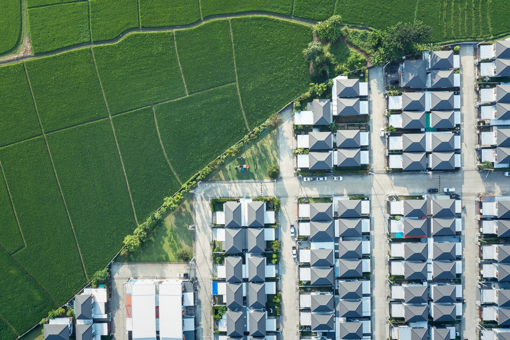
Property throughout Uvalde includes everything from historic homes near downtown to ranchland, agricultural acreage, and commercial development along major corridors like U.S. Highway 90. These different property types each present unique surveying considerations.
Larger parcels, irregular lot shapes, and older property descriptions are common throughout South Texas. Buyers may also encounter shared access roads, utility easements, irrigation features, or neighboring fences that do not necessarily reflect the legal property line.
Smyth Surveyors, Inc. helps buyers understand these details before they finalize a purchase. After this first mention, we focus on helping clients make informed decisions by providing accurate surveys that support confident real estate transactions.
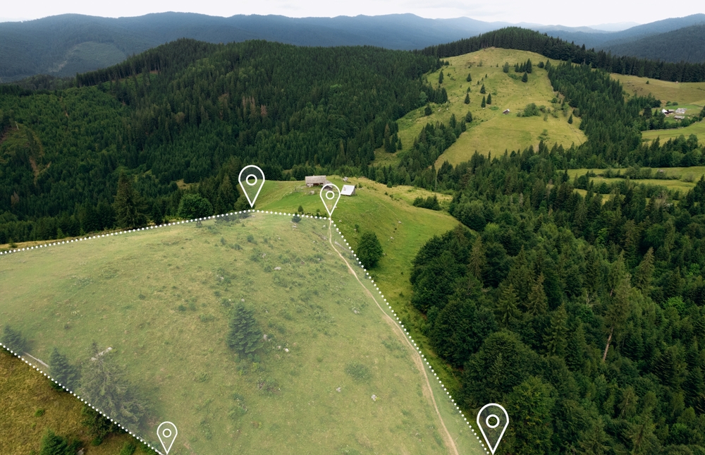
Top Reason #1: You Need to Know Exactly Where Your Property Begins and Ends
Knowing your exact property boundaries is one of the most important reasons to order a land survey.
Fence lines, tree rows, and existing structures often appear to define ownership, but they may not match the legal property description. Previous owners may have installed improvements without realizing they crossed a property line.
A professional survey identifies the legal boundaries so buyers understand precisely what land is included in the purchase.
This information becomes especially valuable if you plan to install fencing, build a workshop, add a driveway, or subdivide property later.
Top Reason #2: A Survey Can Reveal Easements and Access Rights
A land survey identifies easements and access rights that may affect how you use the property.
Utility companies, neighboring landowners, municipalities, or drainage districts may have legal rights to portions of the property. These easements often do not prevent ownership, but they can limit where future structures may be built.
In rural parts of Uvalde County, access easements are especially important because some properties rely on shared private roads or recorded access agreements.
Understanding these details before closing helps prevent unexpected limitations after purchase.
Top Reason #3: Surveys Help Prevent Boundary Disputes
Boundary disputes are much easier to avoid than to resolve.
Disagreements between neighbors often arise when fences, sheds, garages, driveways, or landscaping extend beyond legal property lines.
A current survey provides documented evidence of the property’s boundaries, helping buyers avoid conflicts that could require legal action or expensive corrections later.
Having this information before closing gives buyers an opportunity to address concerns with the seller if necessary.
Top Reason #4: You Can Verify Existing Improvements
A land survey helps verify that improvements are located appropriately on the property.
Homes, barns, pools, detached garages, patios, retaining walls, and other permanent improvements should be reviewed in relation to property lines and recorded easements.
If improvements cross property boundaries or violate setback requirements, resolving those issues after closing can become complicated and expensive.
Knowing the property’s existing conditions gives buyers greater confidence before completing the transaction.
Top Reason #5: A Survey Supports Future Plans
A survey provides valuable information that supports future development plans.
Many buyers intend to add buildings, fences, driveways, livestock facilities, or commercial improvements after purchasing property.
Having an accurate survey allows architects, contractors, engineers, and permitting agencies to begin projects using reliable boundary information instead of assumptions.
Whether you’re purchasing a residential lot in Uvalde or acreage near communities like Knippa, Sabinal, or Concan, an updated survey provides a solid foundation for future improvements.
Professional Field Observations
Based on common surveying experience, buyers are often surprised to learn that visible features do not always match recorded property boundaries.
Older fences may have been installed for convenience rather than accuracy. Previous owners may have expanded driveways or placed storage buildings without confirming boundary locations. Rural properties may also contain older legal descriptions that require careful interpretation during surveying.
These situations reinforce why many buyers choose to obtain a current survey before closing.
Without a current survey, buyers may unknowingly inherit boundary disputes, encroachments, or development limitations that affect property value and future plans.
Understanding the property’s legal boundaries allows buyers throughout Uvalde County to move forward with greater confidence.
Warning Signs You Should Order a Survey
Property corners are not clearly marked.
Existing fences appear inconsistent with neighboring properties.
Multiple driveways or shared access roads serve the property.
Large acreage is involved.
Improvements sit close to property lines.
The property has changed ownership many times.
You plan to build soon after purchasing.
Existing survey documents are outdated or unavailable.
When to Call a Professional
A professional land survey should be considered before closing whenever property boundaries could affect your purchase decision.
While buyers can review public records and property descriptions, only a licensed professional survey provides accurate boundary verification based on legal documents and field measurements.
If questions arise regarding easements, encroachments, or future construction, professional surveying becomes even more valuable.
Common Local Factors That Make Surveys Important
Several regional characteristics make land surveys especially helpful in this part of South Texas.
Larger Rural Properties
Many properties outside city limits include multiple acres with irregular boundaries that are difficult to identify without professional measurements.
Older Property Descriptions
Some parcels have legal descriptions that reference historic monuments, older surveys, or long-standing property lines requiring updated verification.
Agricultural and Ranch Land
Working land often includes fencing, gates, water features, or shared access that should be accurately documented before purchase.
Ongoing Growth
As residential and commercial development continues throughout the region, accurate property information becomes increasingly important for buyers and developers alike.
Prevention and Planning Tips
Before purchasing property:
Request the most recent survey if one is available.
Compare survey information with the property’s legal description.
Ask questions about easements and access rights.
Discuss future building plans with your surveyor.
Review any visible improvements near property boundaries before closing.
These steps help buyers identify potential concerns early in the transaction.
What to Expect From a Professional Survey
A professional survey provides accurate boundary information, identifies visible improvements, documents easements when applicable, and creates a reliable record that buyers, lenders, attorneys, and title companies can reference during the purchase process.
The exact scope depends on the property and the type of survey requested.
Common Mistakes Buyers Make
Assuming fences mark the property line. Fences often do not match legal boundaries.
Skipping the survey to save money. Unexpected boundary issues can become much more expensive later.
Waiting until after closing. Discovering problems after ownership transfers may limit available solutions.
Planning construction before confirming boundaries. Future projects should always begin with accurate property information.
Common Local Scenario
A buyer purchases several acres outside Uvalde with plans to build a workshop and install new fencing. Before construction begins, a professional survey identifies an existing utility easement and confirms the actual property corners, allowing the owner to adjust the project before investing in materials and labor.
Related Surveying Services
Depending on the property, buyers may benefit from:
We proudly serve property buyers throughout Uvalde, Uvalde County, and surrounding communities including Sabinal, Knippa, Concan, Camp Wood, and nearby areas across South Texas.
The Cost of Ignoring a Survey
Skipping a survey may result in unexpected boundary disputes, construction delays, easement conflicts, or costly corrections after closing.
Understanding the property before completing the purchase is often much simpler than resolving ownership questions later.
Do I need a land survey when buying property in Uvalde?
Yes. A current land survey helps verify property boundaries, identify easements, and confirm improvements before you finalize the purchase.
Are older surveys still valid?
Older surveys may still provide useful information, but they may not reflect current property conditions or recent improvements.
Can a survey identify easements?
Yes. A survey can identify many recorded easements and show how they relate to the property boundaries and visible improvements.
Is a survey important for rural property in Uvalde County?
Yes. Larger rural parcels often have more complex boundaries, access agreements, and acreage that benefit from professional verification.
Will my lender require a survey?
Some lenders or title companies may require specific types of surveys depending on the transaction. Requirements vary by property and loan type.
Can I build immediately after buying if I have a survey?
A survey provides important boundary information, but future construction may also require permits, setbacks, or other local approvals.
Protect Your Property Investment Before Closing
Buying real estate is a major investment, and understanding exactly what you’re purchasing is an important part of the process. A professional land survey provides accurate information that supports informed decisions and helps reduce surprises after closing.
Know Your Property With Confidence
Whether you’re purchasing a home, commercial property, or rural acreage, we’re here to provide accurate surveying services that help you move forward with confidence.
Whether you are buying your first home, selling agricultural land, or settling a boundary dispute with a neighbor, understanding the relationship between land surveying and Texas property law is essential. Texas has some of the most distinct and detailed property laws in the country, and those laws place land surveys at the center of nearly every real estate decision.
For property owners and buyers in Uvalde, TX, and throughout the Hill Country region, working with qualified boundary surveyors is not just a smart step; it is often a legal necessity.
How Texas Property Law Treats Surveys as Legal Documents
Texas operates under a land ownership framework unlike most other states. Texas operates under a unique system of land ownership called “land patent,” which grants rights from the state to individuals. This framework differentiates Texas property law from other states, particularly in its emphasis on land boundaries and the definition of property lines.
Because of this deep-rooted framework, surveys carry enormous legal weight. In Texas, property boundaries are legally defined through surveys, deeds, and county records. These boundaries determine where one property ends and another begins. A survey is not merely a formality during closing; it is a foundational document that can be used as evidence in court, referenced during title transfers, and relied upon by lenders before financing a transaction.
Due to the unique history and laws regarding boundaries and title of real property in Texas, it is necessary to maintain a land title survey standard that is specific to Texas. The minimum standards set forth by the Texas Board of Professional Engineers and Land Surveyors (TBPELS) do not address matters that are unique to land title surveys, making it necessary to maintain an independent standard for land title surveys.
This means that simply meeting the bare minimum technical standard is not always sufficient. For buyers, sellers, and lenders involved in complex transactions, a more comprehensive title survey may be required to fully protect all parties.
The Role of Licensed Land Surveyors in Texas
Not just anyone can perform a legal land survey in Texas. The state imposes strict licensing requirements on all professionals in this field. A Texas Registered Professional Land Surveyor is required to supervise the creation of all documents and data that are intended to show the precise location of a boundary. This includes plats, descriptions, maps, graphics files, easements, dispositions, encroachment exhibits, reports, and geodatabases.
Texas law stipulates that aspiring land surveyors must hold a degree in surveying or a related field, accrue experience under a licensed surveyor, and complete the appropriate state examinations. This rigorous process ensures that only qualified professionals are entrusted with such a pivotal role in property transactions.
For those seeking land surveyors in Uvalde, TX, verifying that the professional holds an active license from the TBPELS is a critical first step. Being a Texas-licensed state land surveyor gives you the ability to seal any survey and provide legal evidence that all work has been done by you or under your management, which is extremely important in case of mishaps and gives clients security during reworks.
The types of surveys available also vary depending on the nature of the property. Surveys for residential properties usually focus on the location of structures such as houses, driveways, and fences, along with boundary lines and easements. Commercial land surveys, such as ALTA or NSPS surveys, may be more comprehensive and include details on zoning classifications, rights of way, and other factors relevant to financing and development projects.
Understanding Boundary Disputes Under Texas Law
One of the most common reasons property owners seek out boundary surveyors in Uvalde, TX, and across the state is to resolve a boundary dispute. These conflicts can arise from unclear markers, outdated records, or long-standing misunderstandings between neighbors.
In Texas, property boundaries are established primarily through deeds and surveys. Physical boundaries such as fences do not automatically change legal property lines. However, Texas law does allow certain exceptions when both property owners have treated a particular line as the boundary for a long time.
Texas recognizes several specific legal doctrines that can affect how a dispute is settled. If both parties acknowledge a line and agree to treat it as the property boundary, an oral boundary agreement may be enforceable. When neighbors respect a certain boundary for many years without dispute, a court may uphold that line through the concept of boundary by acquiescence, even if it differs from the legal description. Additionally, under adverse possession, if someone occupies and uses a portion of land openly and without permission for a sufficient amount of time, they may be able to claim legal ownership.
The Texas statute allows for a 3, 5, and 10 year time period for adverse possession claims, with different requirements applying to each time frame. This makes early action critical. If you notice a potential encroachment, contacting land surveyors in Uvalde, TX, or wherever your property is located should be a top priority before time-sensitive legal thresholds pass.
How Surveys Protect You During Property Transactions
Beyond disputes, surveys play a protective role in everyday property transactions. Lenders routinely require a current survey before approving a mortgage, and title insurance companies rely on survey data to determine coverage. Working with a professional land surveyor is crucial to accessing precise details about the property boundary, easements, and potential encroachments, whether you are purchasing commercial or residential property. For buyers, sellers, and property developers, the information from a land survey helps reduce the risk of legal disputes and common problems.
When a survey reveals a problem, the parties involved in a transaction have several options. Some survey issues do not justify termination of a deal. Minor encroachments with title insurance coverage, unused easements with minimal practical impact, and small acreage variances on large properties may all be manageable without ending the transaction.
However, ignoring a survey issue can have serious consequences down the road. Even small encroachments can affect property values, title insurance, and future sales. Before confronting a neighbor or taking legal action, verifying the exact property line is essential, and that requires reviewing your property deed and legal description rather than relying on fences, landscaping, or historical use.
When issues do escalate, having a professionally conducted survey in hand is a major asset. Employing a professional land surveyor to perform a current survey of your property delivers precise details about your property lines, providing solid evidence of any encroachments and substantial backing should the issue proceed to legal forums.
Why Local Knowledge Matters for Surveyors in Uvalde, TX
Uvalde County sits in a region where large rural tracts, agricultural land, and Hill Country terrain create unique surveying challenges. Working with experienced boundary surveyors who understand local terrain, county deed records, and Texas-specific legal standards can make the difference between a clean transaction and a costly legal fight.
General Land Office surveys in Texas define the boundaries of all state land across all 254 Texas counties, including over 200,000 miles of boundary between private and state-owned properties along navigable streams, private uplands, and state-owned submerged lands along the Texas Gulf Coast. Accurate surveys are vital to protecting both public and private interests.
Local land surveyors in Uvalde, TX, bring familiarity with the county’s specific parcel history, which is particularly important for properties that have been subdivided or passed through multiple generations of family ownership. They understand the types of monuments used historically, the local terrain challenges, and the applicable county records that must be cross-referenced during a proper survey.
All surveying must conform to all applicable surveying laws, the Professional Land Surveying Practices Act, and the General Rules of Procedures and Practices of the Texas Board of Professional Engineers and Land Surveyors. A surveyor rooted in the local community will be well-versed in these requirements and how they apply to properties in Uvalde County specifically.
Conclusion
Texas property law places the land survey at the heart of ownership, transactions, and dispute resolution. From the moment a parcel changes hands to the day a neighbor questions a fence line, having an accurate and legally sound survey is your best protection. For property owners throughout the region, partnering with experienced boundary surveyors in Uvalde, TX, is not just a good idea; it is a foundational step toward protecting your investment and ensuring your property rights are fully secured under Texas law.
Need Land Surveyors in Texas?
At Smyth Surveyors, Inc., we offer professional, official, and dependable land surveying in Texas. Our staff are all trained and licensed with our owner holding an L.S.L.S license. We can offer surveying for gas and oil well locations, pipeline right-of-way acquisition and construction alignment, determination of original survey boundaries, title boundary surveys, topographic surveys, and construction staking. If you are looking for a surveying company that has a prestigious record and an impeccable reputation look no further than Smyth Surveyors, Inc. Contact us today to speak with one of our friendly project managers and set up some time with us!
Land and boundary surveying represents one of the most critical professional services in real estate, construction, and property management. Boundary surveyors in Uvalde, TX play an essential role in determining exact property lines, establishing legal boundaries, and resolving disputes between neighboring property owners. These skilled professionals use advanced technology and decades of established surveying practices to create accurate maps and documentation that protect property rights and facilitate smooth real estate transactions.
The practice of surveying has existed for thousands of years, with evidence suggesting that ancient civilizations used surveying techniques to manage agricultural lands and construct monumental buildings. Today’s land surveyors in Uvalde, TX continue this tradition while incorporating cutting-edge technology such as GPS systems, laser measurement tools, and sophisticated software programs. This combination of traditional knowledge and modern innovation allows surveyors to deliver precise results that meet all legal and regulatory requirements.
When property owners in Uvalde, TX need to understand their land boundaries, they rely on professional surveyors to conduct thorough investigations. These investigations involve examining historical records, analyzing previous surveys, conducting field measurements, and creating detailed documentation that clearly establishes property lines. Whether you are planning a construction project, purchasing property, or dealing with a boundary dispute, understanding what boundary surveyors do can help you appreciate the value they bring to your transaction or project.
The Process of Professional Surveying
The surveying process begins long before surveyors step foot on a property. Boundary surveyors in Uvalde, TX first conduct extensive research into property records, deed documents, and historical surveys. This research phase is crucial because it provides the foundation for all subsequent field work. Surveyors examine courthouse records, title documents, and previous survey maps to understand how the property has been described and measured over time.
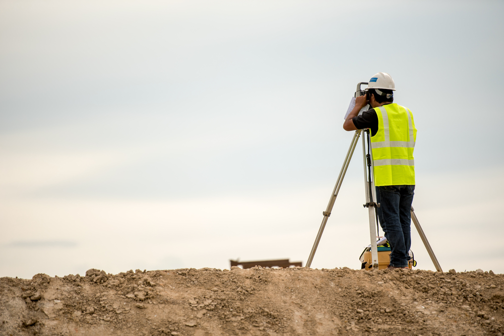
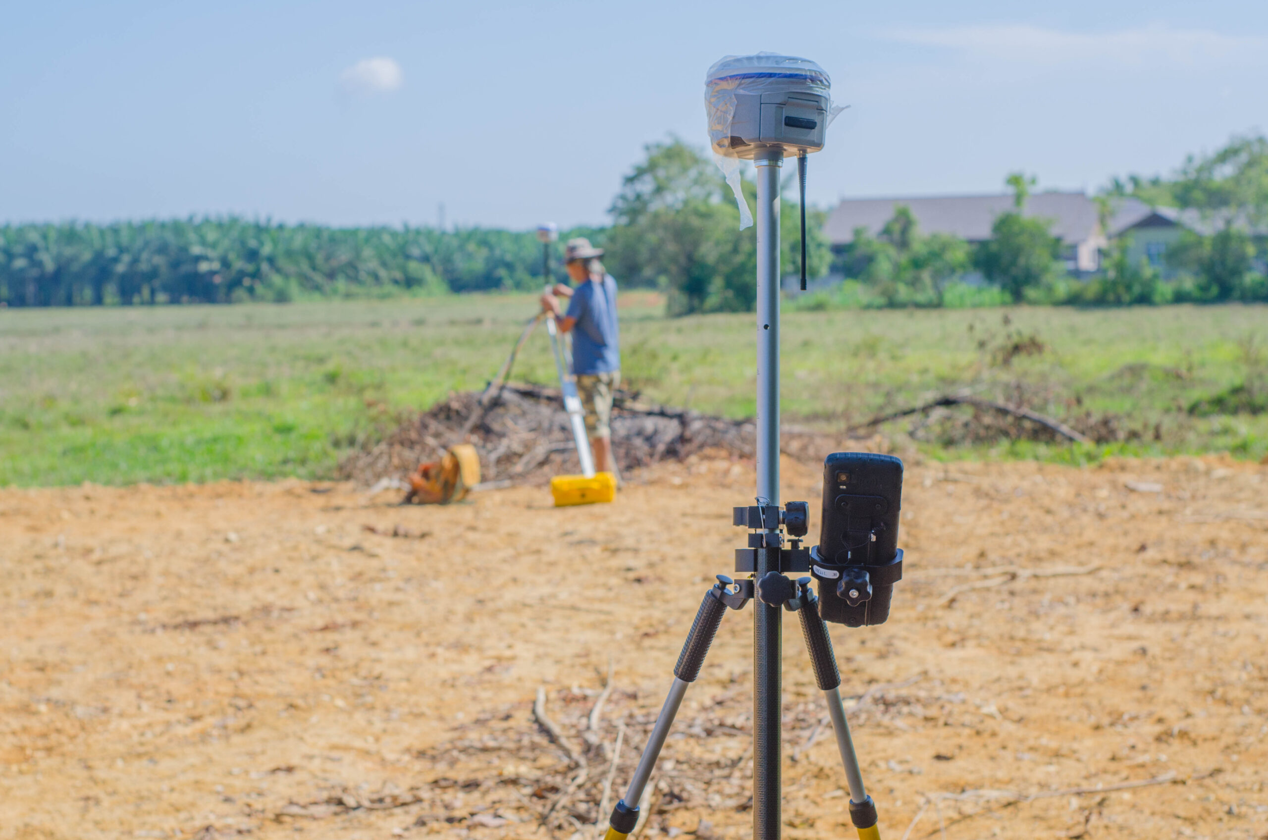
Once the research phase is complete, land surveyors in Uvalde, TX move into the field survey portion of the project. This phase involves physically visiting the property to take precise measurements and locate existing boundary markers such as corners, stakes, or monuments. Using modern GPS technology and laser measurement equipment, surveyors establish exact positions and distances between property boundaries. This fieldwork requires expertise, attention to detail, and understanding of how various environmental factors can affect measurement accuracy.
After completing field work, surveyors process all collected data using specialized software programs. This analysis phase involves comparing field measurements against historical records and determining the legal boundaries based on the property’s deed and local regulations. The surveyor must resolve any discrepancies between historical data and current field conditions, which sometimes requires additional research or legal interpretation.
Finally, boundary surveyors in Uvalde, TX prepare comprehensive reports and maps documenting their findings. These documents become legal records that establish property boundaries and can be used in real estate transactions, construction projects, or legal proceedings. The final survey map includes all relevant measurements, boundary descriptions, and certification by the licensed surveyor, making it an official document recognized by courts and government agencies throughout Texas.
Why Boundary Surveyors Matter in Uvalde
Property boundaries matter tremendously in Uvalde, TX and throughout the surrounding area. Disputes between neighbors often arise from unclear boundary lines, encroaching structures, or misunderstandings about where one property ends and another begins. Professional boundary surveyors in Uvalde, TX help prevent costly and stressful legal battles by establishing clear, documented boundaries that both parties can trust.
The importance of accurate surveying becomes especially apparent during real estate transactions. Buyers want to know exactly what land they are purchasing, and lenders require accurate surveys before approving mortgages. Land surveyors in Uvalde, TX provide the documentation that lenders and title companies need to ensure that property boundaries are clear and unencumbered. Without this professional verification, buyers risk purchasing property with boundary issues that could create problems for years to come.
For construction projects, accurate boundary surveys are absolutely essential. Contractors need to know exactly where they can build, and local zoning regulations often require specific setbacks from property lines. Boundary surveyors in Uvalde, TX ensure that construction projects comply with local ordinances and do not encroach on neighboring properties. This careful attention to boundaries protects contractors from legal liability and ensures that projects can proceed smoothly without complications.
Uvalde, TX features a diverse landscape with properties ranging from small residential lots in town to large rural tracts. Each type of property presents unique surveying challenges. Land surveyors in Uvalde, TX have experience working with all property types and understand local terrain, vegetation, and development patterns that can affect surveying work. Their familiarity with Uvalde’s specific conditions makes them invaluable partners for anyone dealing with property boundary issues.
Advanced Technology in Modern Surveying
Contemporary boundary surveyors in Uvalde, TX rely on technology that would have seemed impossible just a few decades ago. Global Positioning System technology allows surveyors to establish precise coordinates that are accurate to within inches or centimeters. This level of accuracy far exceeds what earlier surveying methods could achieve and provides a scientific foundation for all boundary determinations.
Laser measurement technology represents another significant advancement in surveying. These instruments allow surveyors to measure distances across difficult terrain and through vegetation with remarkable precision. Combined with traditional measuring techniques, laser technology enables land surveyors in Uvalde, TX to tackle complex surveying projects efficiently while maintaining the highest accuracy standards.
Drone technology is increasingly becoming part of the surveying toolkit. Aerial imagery captured by drones provides surveyors with comprehensive views of large properties and helps identify potential issues that might not be visible from ground level. This technology proves especially valuable for large rural properties in areas surrounding Uvalde, TX where traditional surveying methods might require significantly more time and resources.
Software programs designed specifically for surveying allow boundary surveyors in Uvalde, TX to process complex data sets and create accurate representations of property boundaries. These programs incorporate mathematical modeling, historical data analysis, and legal boundary interpretations to produce comprehensive survey maps and reports. The sophistication of modern surveying software ensures that results are consistent, reliable, and compliant with all applicable Texas surveying standards.
When to Hire Professional Surveyors
Property owners in Uvalde, TX should consider hiring boundary surveyors in several specific situations. If you are purchasing property, hiring a surveyor provides independent verification that boundary descriptions in the deed match actual ground conditions. This protection can prevent future disputes and clarify your actual property rights.
If you are experiencing a boundary dispute with a neighbor, land surveyors in Uvalde, TX can provide objective, professionally documented evidence about where the actual boundary line exists. Courts recognize surveyor testimony and documentation as authoritative evidence in property disputes, making professional surveying an important tool for resolving disagreements.
Before undertaking any significant construction or landscaping project, boundary surveyors in Uvalde, TX can verify that your plans comply with property line requirements and local zoning regulations. This verification prevents costly mistakes and legal complications down the road.
If you are dividing property or transferring ownership of a portion of your land, boundary surveyors in Uvalde, TX must create new survey maps showing the legal boundaries of each resulting parcel. These surveys ensure that each portion of property is properly documented and legally transferable.
Conclusion
Boundary surveyors in Uvalde, TX provide essential services that protect property rights, facilitate real estate transactions, and prevent costly disputes. Whether you are buying property, constructing a building, or managing a boundary question, professional land surveyors in Uvalde, TX bring expertise, advanced technology, and legal knowledge that make surveying services invaluable. Understanding what these professionals do and when to hire them helps ensure that your property matters are handled correctly and that your legal interests are fully protected.
Need Land Surveyors in Texas?
At Smyth Surveyors, Inc., we offer professional, official, and dependable land surveying in Texas. Our staff are all trained and licensed with our owner holding an L.S.L.S license. We can offer surveying for gas and oil well locations, pipeline right-of-way acquisition and construction alignment, determination of original survey boundaries, title boundary surveys, topographic surveys, and construction staking. If you are looking for a surveying company that has a prestigious record and an impeccable reputation look no further than Smyth Surveyors, Inc. Contact us today to speak with one of our friendly project managers and set up some time with us!
Surveying in Uvalde, Texas presents unique challenges that stem directly from the region’s distinctive climate and diverse terrain. Professional boundary surveyors and land surveyors in Uvalde, TX must develop specialized expertise to navigate these environmental factors effectively. Understanding how local conditions influence surveying work is essential for property owners, developers, and surveying professionals operating in this South Texas region.
Uvalde’s Geographic Position and Climate Patterns
Uvalde, TX sits in a transitional zone between the arid Chihuahuan Desert to the west and the more humid subtropical climate to the east. This geographic position creates a semi-arid climate characterized by hot summers and mild winters. The region receives approximately 24 inches of annual rainfall, which is significantly less than the national average. This precipitation pattern directly impacts how land surveyors in Uvalde, TX conduct their work and maintain their equipment.
The temperature fluctuations in Uvalde can be dramatic throughout the year. Summer temperatures frequently exceed 95 degrees Fahrenheit, while winter temperatures occasionally dip below freezing. These temperature swings cause significant expansion and contraction in surveying equipment, soil, and rock formations. Boundary surveyors must account for thermal expansion when taking precise measurements, as metal surveying instruments can shift slightly in length when exposed to extreme heat or cold. This thermal sensitivity requires land surveyors in Uvalde, TX to conduct measurements during optimal times of day and adjust calculations to compensate for environmental conditions.
Humidity levels in Uvalde tend to be relatively low compared to other Texas regions, averaging around 50 percent annually. While this might seem advantageous for surveying work, the low humidity combined with intense sun exposure creates unique challenges. The dry conditions accelerate equipment wear and increase the risk of static electricity interference with sensitive electronic surveying instruments. Professional boundary surveyors in the area must implement rigorous equipment maintenance schedules and protective measures to ensure accuracy and longevity of their tools.
The Impact of Limestone and Rocky Terrain on Survey Work
Uvalde, TX is located in an area characterized by extensive limestone formations and rocky terrain. This geological composition significantly influences surveying operations and creates specific challenges for land surveyors in Uvalde, TX. The Edwards Plateau, which dominates the landscape, consists primarily of limestone bedrock covered by relatively thin soil layers. This geological reality affects everything from establishing survey monuments to conducting underground utility locates.
The prevalence of limestone presents particular challenges when establishing permanent survey markers. Boundary surveyors must often drill into solid rock to place survey monuments securely. This requires specialized equipment and increased time investment compared to regions with softer soil composition. The rocky terrain also makes it difficult to locate existing survey markers that may have been buried or obscured over decades. Land surveyors in Uvalde, TX frequently use ground-penetrating radar and metal detection equipment to identify historic survey monuments hidden beneath limestone rubble or vegetation.
The limestone formations in the region also create karst topography, characterized by sinkholes, caves, and underground drainage systems. This subsurface instability can complicate boundary surveys and property assessments. Boundary surveyors must account for potential ground subsidence when establishing survey lines and property boundaries. The presence of underground voids affects how water drains through the land and can influence erosion patterns visible on the surface, which impacts survey accuracy and property line establishment.
Water Management and Seasonal Flooding Considerations
The Nueces River and various creeks running through Uvalde create important boundary references for many properties. However, these water features present significant challenges for land surveyors in Uvalde, TX during seasonal variations. While the area experiences an overall moisture deficit, sudden intense rainfall events can cause flash flooding in low-lying areas and creek beds.
These seasonal water level fluctuations directly impact boundary surveying work. Land surveyors in Uvalde, TX must account for varying water levels when establishing property boundaries that follow water courses. Standard practice requires boundary surveyors to measure from the mean water level rather than current water conditions, but identifying the mean level requires careful analysis of historical water data and topographic studies. During dry seasons, creeks may appear as dry washes, making it difficult for surveyors to locate water course boundaries.
The episodic nature of flooding in Uvalde also affects survey monument placement and preservation. Boundary surveyors must position monuments where they won’t be swept away during flood events or buried under sediment deposits. This requires sophisticated understanding of local flooding patterns and topographic flow analysis. Land surveyors in Uvalde, TX often work with hydrologists and engineers to understand flow patterns before establishing permanent survey markers in riparian zones.
Vegetation Patterns and Their Role in Surveying Challenges
The vegetation in Uvalde reflects the semi-arid climate, ranging from dense oak and mesquite brush in well-watered areas to sparse grassland on drier hillsides. This variable vegetation coverage creates unique challenges for land surveyors in Uvalde, TX. Dense brush and thorny vegetation can obscure survey lines and make field work physically challenging for boundary surveyors conducting measurements and establishing survey monuments.
The presence of protected indigenous vegetation adds another layer of complexity to surveying operations. Boundary surveyors working in Uvalde, TX must navigate regulatory requirements protecting certain plant species while conducting their fieldwork. Some surveying activities might require environmental assessments before proceeding, particularly in areas with protected grassland species or oak-covered slopes.
Vegetation growth patterns also affect the visibility and preservation of survey monuments. Boundary surveyors in the region design permanent markers and posts that can be located despite vegetation overgrowth. Land surveyors in Uvalde, TX use various techniques including metal caps, witness stakes, and GPS integration to ensure survey monuments remain discoverable even after years of vegetation encroachment. The rapid growth of mesquite and brush during wetter periods can completely obscure older survey markers within a few seasons.
Equipment Adaptation and Professional Practices for Uvalde Surveyors
Modern boundary surveyors in Uvalde, TX employ advanced technology to overcome regional challenges. GPS and other satellite-based surveying methods offer significant advantages in the semi-arid landscape where clear sky visibility is often excellent. However, land surveyors in Uvalde, TX still encounter signal interference from the region’s rock formations and canyon features, particularly in areas near the Nueces River drainage systems.
Professional land surveyors in Uvalde, TX invest in specialized equipment suited to local conditions. This includes durable instruments designed to withstand temperature extremes, sealed equipment cases protecting against dust and limestone particles, and backup systems for cases where primary equipment fails. Boundary surveyors maintain detailed local knowledge about survey monument placement patterns used by previous surveyors, which helps them predict where historical markers might be located.
The surveying community in Uvalde has developed best practices specifically adapted to local conditions. These practices include conducting winter surveys when temperatures are moderate and vegetation is dormant, scheduling surveys before seasonal flooding events, and using established reference points from the Texas General Land Office historical survey records. Land surveyors in Uvalde, TX work closely with local government offices to access historical survey data and understand long-established property boundaries.
Conclusion
Climate and terrain fundamentally shape how boundary surveyors and land surveyors in Uvalde, TX conduct their professional work. The semi-arid climate with temperature extremes, combined with limestone-dominated geology and episodic flooding patterns, requires specialized expertise and adaptive practices. Professional boundary surveyors in the region have developed sophisticated approaches to overcome these environmental challenges while maintaining accuracy and establishing reliable property boundaries. Understanding these local factors is essential for anyone commissioning survey work in Uvalde, TX.
Need Land Surveyors in Texas?
At Smyth Surveyors, Inc., we offer professional, official, and dependable land surveying in Texas. Our staff are all trained and licensed with our owner holding an L.S.L.S license. We can offer surveying for gas and oil well locations, pipeline right-of-way acquisition and construction alignment, determination of original survey boundaries, title boundary surveys, topographic surveys, and construction staking. If you are looking for a surveying company that has a prestigious record and an impeccable reputation look no further than Smyth Surveyors, Inc. Contact us today to speak with one of our friendly project managers and set up some time with us!
Buying or selling property is one of the most significant financial decisions many people make. In the excitement of negotiations, inspections, and closing timelines, one important step can sometimes be overlooked until late in the process: obtaining a professional land survey. A survey provides critical information about the exact boundaries and features of a property, helping everyone involved understand precisely what is being bought or sold.
For property owners and buyers in Uvalde and the surrounding Texas Hill Country, accurate surveying is especially important. Many properties in this region include large parcels of land, historic boundaries, or rural features that can make property lines less obvious. Working with experienced boundary surveyors in Uvalde, TX ensures that real estate transactions move forward with clarity and confidence. Professional land surveyors in Uvalde, TX, play a vital role in protecting property rights and preventing disputes that could arise long after the closing documents are signed.
What a Land Survey Reveals About a Property
A land survey provides an accurate map of a property’s legal boundaries and physical features. This document identifies the exact location of property lines, corner markers, and improvements such as houses, fences, driveways, and utility easements. It also highlights potential encroachments where structures or features may extend beyond the property line.
Without a survey, buyers and sellers often rely on assumptions about where property boundaries lie. Fences, tree lines, and natural landmarks are sometimes mistaken for boundary lines, even though they may not reflect the legal description of the property. Over time, these assumptions can lead to misunderstandings between neighbors or complications during real estate transactions.
By hiring qualified land surveyors in Uvalde, TX, property owners gain precise documentation that clearly defines the property’s dimensions and boundaries. This information provides peace of mind and helps both parties move forward with confidence during the transaction process.
Why Surveys Matter When Buying or Selling Property
When purchasing real estate, buyers want to know exactly what they are acquiring. A boundary survey confirms that the property described in the purchase agreement matches the actual land on the ground. This verification helps ensure there are no surprises once the transaction is complete.
For sellers, a survey can also be extremely valuable. Providing a current survey demonstrates transparency and helps answer questions about property lines before they become obstacles in the negotiation process. It also reduces the likelihood that unexpected issues will delay closing.
In Uvalde, where properties may include farmland, ranch land, or large residential lots, boundary clarity becomes even more important. Property lines can stretch across acres of land, making it difficult to visually determine where one property ends and another begins.
Boundary surveyors in Uvalde, TX, help resolve these uncertainties by carefully measuring the land and documenting the exact limits of ownership. This step protects both buyers and sellers from potential disputes that could arise after the sale.
Preventing Boundary Disputes Before They Start
One of the most common problems that surveys help prevent is property boundary disputes. These disputes can occur when neighboring property owners have different assumptions about where a boundary line exists. Sometimes a fence, driveway, or building may unintentionally cross into a neighboring parcel.
Without a professional survey, these issues may remain unnoticed until years later when a property changes hands or construction is planned. At that point, resolving the conflict can involve legal expenses, delays, or costly property adjustments.
A boundary survey performed by experienced land surveyors in Uvalde, TX, identifies these situations early in the process. If an encroachment exists, it can be addressed before the real estate transaction moves forward. Buyers and sellers can then make informed decisions about how to resolve the issue.
By establishing clear boundaries from the beginning, a survey helps maintain positive relationships between neighbors and prevents disputes that could otherwise create long-term complications.
Supporting Lenders, Title Companies, and Real Estate Professionals
Land surveys are not only valuable for buyers and sellers. They also play a critical role for lenders, title companies, and real estate professionals involved in the transaction. Financial institutions often require surveys to confirm that the property used as collateral for a loan is accurately described and free of boundary conflicts.
Title companies may review survey information to ensure there are no encroachments, easement conflicts, or other issues that could affect the ownership rights being transferred. If problems are identified during the survey process, they can often be resolved before the transaction reaches closing.
Real estate agents also benefit from the clarity that surveys provide. When agents understand the exact boundaries and features of a property, they can communicate more effectively with clients and answer questions with confidence.
Professional boundary surveyors in Uvalde, TX, provide the detailed documentation needed to support all of these parties throughout the real estate process. Their work helps ensure that each step of the transaction is based on accurate and reliable information.
The Value of Local Surveying Expertise
Surveying is both a technical science and a profession that requires deep knowledge of local land records, historical documents, and regional terrain. In areas like Uvalde County, many properties have histories that stretch back decades or even generations. Older property descriptions may reference natural landmarks, historical markers, or boundary lines established long before modern surveying technology existed.
Experienced land surveyors in Uvalde, TX, understand how to interpret these records and combine them with modern measurement techniques. Using advanced equipment, they perform precise field measurements that confirm the legal boundaries described in property documents.
Smyth Surveyors brings this combination of experience and technology to every project. Their team works carefully to ensure that each survey reflects the most accurate representation of the property. This attention to detail provides property owners with reliable documentation that stands up to legal and professional scrutiny.
Local expertise also allows surveyors to navigate the terrain and land characteristics common in the region. From rural acreage to residential neighborhoods in and around Uvalde, experienced surveyors understand the unique factors that can influence property boundaries.
Protecting Your Investment Through Accurate Surveying
Real estate transactions involve significant financial commitments and long-term investments. Whether purchasing a family home, farmland, or investment property, understanding the exact boundaries of the land is essential. A professional survey provides the clarity needed to avoid misunderstandings and protect property rights.
Working with qualified boundary surveyors in Uvalde, TX, ensures that property boundaries are clearly defined and properly documented. This step helps buyers make informed decisions, allows sellers to provide accurate information, and supports the many professionals involved in completing a successful real estate transaction.
Smyth Surveyors is dedicated to helping property owners throughout the Uvalde area understand their land with confidence. By combining modern surveying technology with deep knowledge of local property records, their team delivers reliable results that support smooth real estate transactions. When property boundaries are clearly established, everyone involved can move forward with certainty, knowing that the land being bought or sold is accurately defined and protected for years to come.