Gradient Surveying: What Is It and Why Is It Important in Uvalde, TX
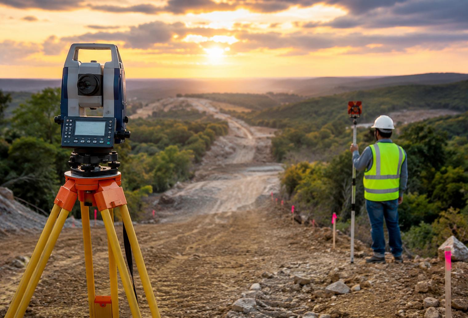
A property can look relatively level while still having enough elevation change to affect drainage, construction, road access, and site planning. In Uvalde, TX, understanding how land rises and falls can be especially useful before designing improvements, preparing a site, or making decisions that depend on accurate ground elevations.
Quick answer: Gradient surveying is the process of measuring changes in elevation and slope across a property or project area. A surveyor can use field measurements to establish elevations, identify grade changes, and document how the terrain slopes between points. For property owners, builders, developers, and other professionals in Uvalde, this information can support drainage planning, site design, road and driveway work, construction, and other projects where elevation matters.
What local readers should know
-
Gradient surveying measures elevation differences so the slope of the land can be accurately understood rather than estimated by sight.
-
Properties throughout Uvalde County can have drainage and site-planning needs that depend on relatively small changes in elevation.
-
Gradient information may be useful for driveways, roads, building sites, drainage improvements, utilities, and land development.
-
Sites near the Leona River or other natural drainage areas may require particular attention to existing terrain and water movement.
-
The type and extent of surveying needed depend on the property, proposed work, and information required for the project.
What Is Gradient Surveying?
Gradient surveying measures the rate and direction of elevation change across land, allowing a surveyor to document how steeply the ground rises or falls between locations. Instead of relying on what a site appears to do, surveying provides measured elevation information that can be used for planning, design, construction, and drainage-related decisions.
Gradient is closely connected to slope. A surveyor collects elevation measurements at relevant points and uses those measurements to establish the change in height over a horizontal distance.
For a property in Uvalde, that information can help answer practical questions. Does the ground fall away from a proposed building area? How much elevation changes along a driveway route? Where are the higher and lower portions of a tract? Is the existing terrain suitable for a planned improvement, or will additional design work be necessary?
Gradient surveying turns those questions into measurable site information.
Why Is Gradient Surveying Important in Uvalde, TX?
Gradient surveying is important in Uvalde, TX because elevation affects how land can be developed, accessed, drained, and improved. Even where a tract appears mostly level, relatively subtle grade changes can influence where water travels and how roads, foundations, utilities, and other improvements fit the existing terrain.
Uvalde sits at an important transition between different South and Central Texas landscapes. Properties around Uvalde County range from developed city parcels to agricultural acreage, ranchland, and larger rural tracts.
Local transportation corridors such as US 90 and US 83 also connect properties with very different development and access needs. Nearby communities including Knippa, Sabinal, Concan, and Utopia add to the variety of terrain and property uses found throughout the broader service area.
Accurate elevation information helps project professionals work from measured conditions rather than assumptions.
Smyth Surveyors, Inc. provides surveying services for property and project needs in the area. When gradient information is part of the required surveying work, we can help establish the site measurements needed to support informed planning and decision-making.
What Can Gradient Surveying Tell You About a Property?
Gradient surveying can show how elevation changes across a property, where higher and lower areas occur, and how steeply the terrain changes between measured points. This information provides a clearer picture of existing ground conditions before construction, drainage work, access improvements, or other site modifications begin.
For example, measurements may be useful when evaluating:
-
Proposed building locations
-
Roads and private access routes
-
Driveway grades
-
Drainage paths
-
Utility routes
-
Site grading
-
Development layouts
-
Other improvements affected by elevation
On larger Uvalde County properties, changes that are difficult to judge visually may become more significant across longer distances. A measured survey gives designers and property owners a better basis for evaluating those conditions.
How Does Gradient Affect Drainage?
Gradient affects drainage because water generally moves from higher elevations toward lower elevations, making the direction and degree of slope important when evaluating a site. Accurate elevation measurements help identify existing grades and provide information that engineers, designers, contractors, or other professionals may use when planning drainage-related improvements.
This can matter during periods of heavy rainfall, when existing low areas and natural drainage paths become more noticeable.
Around the Leona River and other drainage features in the region, understanding existing elevations can be particularly relevant to site planning. Gradient surveying itself does not determine every drainage solution, but it can provide essential measurements for professionals responsible for drainage design.
A survey can show what the ground is actually doing. The appropriate design response depends on the specific project and site conditions.
What Are the Signs You May Need Gradient Information?
You may need gradient information when a planned project depends on knowing existing elevations, slopes, or the direction in which the ground changes. The need often becomes apparent during early planning, particularly when drainage, access, construction elevations, or substantial grading will be involved.
Common signs include:
-
You cannot confidently tell which direction part of the property slopes.
-
A proposed driveway or access road crosses changing terrain.
-
A building or improvement must be positioned at specific elevations.
-
Water collects in low portions of the property after rainfall.
-
A project involves grading or changing existing ground elevations.
-
Utility planning requires reliable elevation information.
-
A designer, engineer, contractor, or permitting authority requests elevation data.
-
A larger rural tract has noticeable changes in terrain across the project area.
These conditions do not automatically mean the same type of survey is required. They are reasons to determine what elevation information the project actually needs.
When Should You Call a Professional Surveyor?
A professional surveyor should be involved when accurate, project-ready elevation or gradient measurements are needed rather than a rough personal estimate of slope. Visual observations can help a property owner recognize a possible issue, but they are not a substitute for survey measurements when construction, design, development, or other significant decisions depend on elevation.
Property owners can safely observe where water tends to collect, note visible high and low areas, and document drainage behavior after rainfall.
Professional measurement becomes more important when those observations need to be converted into reliable site information. This is especially true for projects involving construction layouts, substantial grading, roads, utilities, or coordination with engineers and other project professionals.
What Common Local Conditions Make Gradient Surveying Useful?
Common conditions that make gradient surveying useful around Uvalde include rural acreage, changing terrain, drainage concerns, road access, and construction or development that must work with existing elevations. The importance of each condition varies considerably from one parcel to another.
1. Large rural tracts: On acreage outside the city, elevation changes can extend over substantial distances and may affect access routes or proposed improvements.
2. Natural drainage patterns: Existing terrain influences where runoff travels and where lower areas occur.
3. Driveway and road planning: Routes connecting rural properties to local roads may need to account for grade changes along their length.
4. Construction sites: Proposed structures and surrounding improvements may require accurate existing elevation information before final design or grading decisions.
5. Development activity: Dividing or improving land can create new questions about roads, utilities, drainage, and site elevations.
Properties near Knippa or Sabinal may have different site characteristics from acreage toward Concan or Utopia. Surveying allows the actual parcel conditions to guide the project instead of relying on broad regional assumptions.
Can Property Owners Prevent Gradient-Related Problems?
Property owners can reduce avoidable problems by identifying elevation and drainage questions early, before construction or major site work begins. Gradient itself is a physical characteristic of the land, so the goal is not necessarily to change it but to understand it before making decisions that depend on the terrain.
Before starting a project in Uvalde, property owners can:
-
Observe the property during and after rainfall.
-
Identify obvious high and low areas.
-
Avoid assuming that visually flat land has no measurable slope.
-
Discuss elevation requirements with designers, contractors, or engineers early.
-
Determine whether professional survey measurements are needed before finalizing plans.
-
Avoid major grading until the effects on the overall project are understood.
Early information can make coordination easier and reduce the chance that important site conditions are discovered only after work has progressed.
What Results Should You Expect From Gradient Surveying?
Gradient surveying should provide reliable measurements of relevant elevations and grade changes within the defined scope of the survey. The exact deliverables depend on why the survey is being performed and what the property owner, designer, engineer, contractor, or other project professional requires.
A simple elevation question and a larger development project may require very different amounts of fieldwork and documentation.
For that reason, property owners should explain the intended project when requesting surveying services. Knowing whether the information will support drainage planning, construction, road design, utilities, or another purpose helps determine the appropriate scope.
What Are Common Gradient Surveying Mistakes?
The most common gradient-related mistakes involve estimating elevations visually, waiting too long to obtain measurements, or using survey information for purposes beyond its intended scope. Avoiding these mistakes can help Uvalde-area projects begin with a more accurate understanding of existing site conditions.
Mistake: Assuming a property is completely flat because it looks flat.
Consequence: Small but meaningful elevation differences may be overlooked.
Better approach: Obtain measurements when slope affects the project.
Mistake: Planning major improvements before evaluating terrain.
Consequence: Elevation issues may emerge after design decisions have already been made.
Better approach: Identify surveying and elevation needs during early project planning.
Mistake: Treating drainage as a visual guess.
Consequence: The actual relationship between high and low areas may not be fully understood.
Better approach: Use measured elevations when accurate drainage information is required.
Mistake: Assuming every project requires the same survey.
Consequence: The requested work may not match the information actually needed.
Better approach: Explain the project purpose so the surveying scope can be determined appropriately.
What Is a Common Gradient Surveying Scenario in Uvalde?
A common local scenario involves a property owner planning improvements on acreage where the proposed building area, driveway, and drainage paths cross different elevations. The land may appear gently sloped, but visual inspection alone cannot provide the measurements needed to understand exactly how elevation changes across the project area.
The owner may first need existing elevation information. Depending on the project, those measurements can then help the appropriate professionals evaluate access, grading, drainage, and construction plans.
This is a general scenario, not a Smyth Surveyors, Inc. project example. Actual surveying requirements depend on the property and proposed work.
What Surveying Services Can Support Elevation-Sensitive Projects?
Surveying services that establish existing elevations, site conditions, and relevant property information can support projects where gradient affects planning or construction. The exact service should be selected based on the project’s purpose rather than assuming that one survey type fits every situation.
We recommend discussing what you plan to build, improve, design, or evaluate when requesting service. That allows us to better understand what surveying information may be appropriate and whether other project professionals will need specific measurements or deliverables.
How Do Professional Measurements Compare With DIY Estimates?
Professional gradient measurements are appropriate when decisions require reliable elevation data, while DIY observations are better suited to identifying questions that may need further investigation. A level, phone application, or visual inspection may suggest that ground rises or falls, but significant property and construction decisions should not depend on casual estimates.
DIY observation can be useful for noting standing water, visible slopes, drainage paths, and areas of concern.
Professional surveying is the better option when measured elevations will influence construction, design, grading, access, utilities, or other project work. In those situations, accuracy and clearly defined measurements matter more than a rough understanding of the terrain.
What Areas Can Have Gradient Surveying Needs?
Gradient surveying needs can arise throughout Uvalde and the surrounding Uvalde County area wherever construction, drainage, access, or land improvements depend on elevation. Similar needs can also occur on properties around communities such as Knippa, Sabinal, Concan, and Utopia, although terrain and project requirements vary by location.
The property itself should determine the surveying scope.
What Can Happen If Elevation Questions Are Ignored?
Ignoring important elevation questions can lead to planning conflicts, redesign, unexpected grading needs, or drainage and access concerns becoming apparent later in a project. The risk depends on the site and proposed work, but resolving necessary survey questions early can provide better information before more expensive decisions are made.
For a Uvalde property owner preparing for construction or land improvements, obtaining the appropriate site information at the planning stage may also make communication with contractors, designers, engineers, and other professionals more efficient.
Frequently Asked Questions About Gradient Surveying
What does gradient mean in land surveying?
Gradient describes how elevation changes over a given horizontal distance. Survey measurements can establish elevations at relevant locations so the rise or fall of the terrain can be determined. This information may support construction, drainage, access, grading, utilities, and other projects where understanding existing ground conditions is necessary.
Why might I need gradient surveying in Uvalde, TX?
You may need gradient surveying in Uvalde, TX when your project depends on accurate elevation or slope information. Examples include planning a driveway, evaluating a building site, preparing for grading, gathering information for drainage design, or providing elevation measurements required by another professional involved in a property improvement.
Can gradient surveying help with drainage on Uvalde County property?
Yes, gradient surveying can provide elevation measurements that help professionals understand how a Uvalde County site rises and falls. Because terrain influences the direction water tends to travel, this information can be useful for drainage evaluation and design. The survey measurements provide site data, while drainage solutions may require additional professional design.
Do I need gradient information if my Uvalde property looks flat?
You may still need gradient information if your Uvalde property looks flat but the planned work depends on precise elevations. Small grade changes can be difficult to recognize by eye, particularly across larger distances. Whether measurements are necessary depends on the proposed construction, drainage, access, utility, or development work.
Is gradient surveying only used for large properties?
No, gradient surveying concepts can be relevant to properties of many sizes. A large rural tract may involve long-distance elevation changes, while a smaller site may require precise elevation information around a building, driveway, or drainage feature. The appropriate amount of surveying depends on the project rather than acreage alone.
Can gradient measurements be useful for rural roads and driveways near Uvalde?
Yes, elevation and slope measurements can be useful when planning rural roads or driveways near Uvalde. Access routes may cross changing terrain between a public road and a proposed improvement. Accurate existing elevations give project professionals better information for evaluating how the route relates to the surrounding land.
Does gradient surveying tell me exactly how to fix a drainage problem?
No, gradient surveying primarily provides measurements of elevations and slopes rather than automatically prescribing a drainage solution. Those measurements can help identify existing terrain conditions and support drainage planning. Depending on the issue, an engineer or another qualified professional may need to use the survey information to develop an appropriate design.
When should I arrange surveying for a Uvalde County construction project?
Surveying should generally be discussed early when a Uvalde County construction project depends on property, elevation, or site information. Determining survey needs before plans are finalized can help ensure that designers, engineers, contractors, and property owners are working with the necessary measurements rather than discovering important terrain questions later.
Get Clear Elevation Information for Your Uvalde Property
Understanding the gradient of a property can provide valuable information before construction, grading, drainage work, access improvements, or other elevation-sensitive projects begin. We help local property owners and project professionals obtain surveying information suited to the work they are planning.
Start Your Uvalde Project With Better Site Information
Get the measurements you need to make informed decisions about your property and coordinate the next stage of your project.