If you own property in La Pryor, TX, or are considering buying a home in Zavala County, understanding flood zones is one of the most important steps you can take to protect your investment and your family. South Texas is no stranger to heavy rainfall events and flash flooding, and even a small community like La Pryor can face significant flood exposure depending on where a structure sits relative to local waterways and drainage patterns.
This guide breaks down what flood zones mean, why a Flood Elevation Certificate matters, and what steps residents can take to stay informed and financially protected.
What Are Flood Zones and How Are They Determined?
Flood maps are one of the key tools that communities use to identify which areas carry the highest risk of flooding. FEMA maintains and updates this data through flood maps and risk assessments. Flood maps show how likely it is for an area to flood, and any place with a 1% chance or higher chance of experiencing a flood each year is considered high risk. Properties in those areas carry at least a one-in-four chance of flooding over the course of a 30-year mortgage.
Importantly, floods do not follow city limits or property lines. Using a flood map, you can see the relationship between your property and the areas with the highest risk of flooding. There is no such thing as a “no-risk zone,” but some areas have a lower or moderate risk.
In Texas, flood zone designations that begin with the letters A or V are considered Special Flood Hazard Areas (SFHAs). Properties in Zone X are not subject to the federal mandate for flood insurance, but lenders may still require coverage, and it is often recommended given Texas’s flood history.
The FEMA Flood Map Service Center (MSC) is the official public source for flood hazard information produced in support of the National Flood Insurance Program (NFIP). Residents can use the MSC to find their official flood map, access a range of other flood hazard products, and better understand their flood risk. For La Pryor, TX residents, this is the most reliable starting point for understanding your property’s flood zone classification.
The Unique Flood Risk Landscape of La Pryor, TX
La Pryor is a census-designated place in Zavala County, Texas, situated at an elevation of 745 feet above sea level. While its relatively modest elevation places it in the South Texas Plains, the region is crossed by waterways that can rise dramatically during heavy rain events. The Nueces River runs through Zavala County, and the Averhoff Reservoir, located on the Nueces River about 10 miles north of Crystal City, was constructed in 1948 in part for flood control purposes.
The Nueces River originates on the Edwards Plateau in Central Texas. The Sabinal, Atascosa, Leona, and Frio Rivers and their numerous tributaries all feed the Nueces on its journey south. This river system crosses through the South Texas Plains ecoregion, the same landscape that encompasses La Pryor and the surrounding Zavala County area.
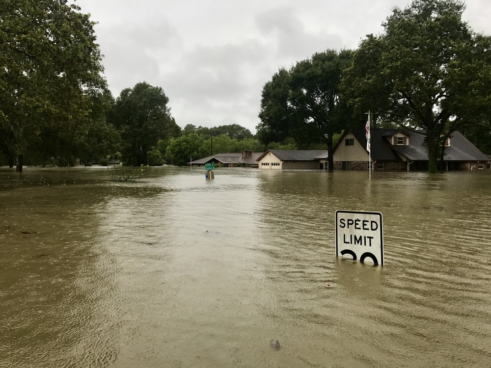
South Central Texas has experienced repeated catastrophic flooding events, with record flows recorded along the Nueces River during major storm cycles. These events have caused hundreds of millions of dollars in property losses and claimed lives, often because motorists drove through flooded low-water crossings. For La Pryor, TX residents, this regional history is a reminder that flood risk is real and must be taken seriously regardless of how a property is currently zoned.
What Is a Flood Elevation Certificate and Why Do You Need One?
A Flood Elevation Certificate is a critical document that directly affects your flood insurance premiums and your ability to comply with local building requirements. A FEMA Elevation Certificate is an official document that records the elevation of your building and its lowest floor in relation to the Base Flood Elevation (BFE), which is the anticipated height that floodwaters will reach during a 100-year flood event. This detailed elevation information is vital for determining flood risk and, consequently, flood insurance premiums for properties located in communities participating in the NFIP.
In Texas, many communities participate in the NFIP, requiring property owners in designated flood zones to obtain flood insurance. The cost of this insurance is directly influenced by the information provided on the elevation certificate. Common terms encountered on an elevation certificate include Base Flood Elevation (BFE), Lowest Adjacent Grade (LAG), Highest Adjacent Grade (HAG), Flood Insurance Rate Map (FIRM), and National Flood Insurance Program (NFIP).
Elevation Certificates show where the building is, the height of its lowest floor compared to the Base Flood Elevation, and other details about the building and its flood zone. An Elevation Certificate can help property owners in high-risk flood areas understand what actions could lower their flood risk and ensure their properties follow local floodplain management ordinances.
The Elevation Certificate is also used to support a request for a Letter of Map Amendment (LOMA) or a Letter of Map Revision based on fill (LOMR-F). It is required to properly rate post-FIRM buildings for flood insurance in high-risk zones such as Zones AE, AH, A with BFE, VE, and others.
How to Obtain a Flood Elevation Certificate in La Pryor, TX
Getting a Flood Elevation Certificate in La Pryor, TX does not have to be a complicated process. There are several ways to obtain an elevation certificate. You can contact your local floodplain manager, ask the sellers when buying a property, check with the developer or builder of the home, look through the property deed, or hire a licensed land surveyor, professional engineer, or certified architect who is authorized by law to certify elevation information.
In Texas, the state does not keep elevation certificates on file, but your local floodplain administrator should have them. You can check a listing of floodplain administrators and their contact information through the Texas Water Development Board.
Without an accurate Elevation Certificate, property owners in Special Flood Hazard Areas may pay higher-than-necessary insurance rates or face hurdles in securing the permits required for construction. This makes obtaining a Flood Elevation Certificate one of the smartest financial moves a La Pryor, TX property owner can make, especially for those located near drainage channels, creeks, or low-lying terrain.
For certain buildings in a high-risk zone, an Elevation Certificate may be required if the flood insurance policy is written through a federally regulated insurance lender such as the NFIP. Private insurers do not typically require ECs for any zone. Having a copy of your EC when you contact an insurance agent to purchase flood insurance is strongly recommended if you live in a high-risk area.
How a Flood Elevation Certificate Can Lower Your Insurance Costs
One of the most practical benefits of obtaining a Flood Elevation Certificate is its potential to reduce your flood insurance premiums, sometimes by a significant amount. Property owners may choose to provide an Elevation Certificate and submit it to their agent to see if it will lower their insurance cost. Insurance agents are responsible for reviewing the certificate annually and determining the best rate and coverage for their clients each year.
Discounts are based on characteristics such as foundation type, first floor height, and flood openings. If your home sits above the Base Flood Elevation, the Elevation Certificate provides the documentation needed to demonstrate that reduced risk to your insurer. In some cases, a Flood Elevation Certificate can even support a formal challenge to your flood zone classification.
This precision is especially valuable when challenging a high-risk flood zone classification or seeking to lower prohibitive flood insurance premiums. For residents of La Pryor, TX who feel their property has been incorrectly classified in a higher-risk zone, the Elevation Certificate is the essential first step in initiating that appeal process through FEMA.
Some communities participate in FEMA’s voluntary incentive program called the Community Rating System (CRS), which recognizes and encourages floodplain management activities that exceed minimum NFIP requirements. Participation in this program can reduce flood insurance premiums for property owners throughout the community. Residents should check whether Zavala County or La Pryor participates in the CRS, as this can provide additional savings on top of what an individual Elevation Certificate already offers.
Conclusion
For residents and property owners in La Pryor, TX, understanding flood zones and securing a Flood Elevation Certificate are foundational steps toward financial protection and long-term peace of mind. The Nueces River watershed and South Texas weather patterns create real flood exposure in this region, and being unprepared can lead to costly consequences. Whether you are buying a home, building a new structure, or simply reassessing your current insurance coverage, working with a licensed surveyor to obtain a Flood Elevation Certificate in Texas is one of the most impactful actions you can take. Stay informed, stay prepared, and do not wait for a flood event to prompt you into action.
Need Land Surveyors in Texas?
At Smyth Surveyors, Inc., we offer professional, official, and dependable land surveying in Texas. Our staff are all trained and licensed with our owner holding an L.S.L.S license. We can offer surveying for gas and oil well locations, pipeline right-of-way acquisition and construction alignment, determination of original survey boundaries, title boundary surveys, topographic surveys, and construction staking. If you are looking for a surveying company that has a prestigious record and an impeccable reputation look no further than Smyth Surveyors, Inc. Contact us today to speak with one of our friendly project managers and set up some time with us!
A Flood Elevation Certificate is a crucial document for property owners in flood-prone areas. It provides detailed information about a building’s elevation relative to the estimated height floodwaters could reach during a major flood. Specifically, this certificate helps determine insurance rates under the National Flood Insurance Program (NFIP). It also ensures compliance with local floodplain management ordinances.
In Texas, and particularly in smaller communities like La Pryor, understanding the role of this certificate is essential. The state experiences frequent extreme weather events, including hurricanes and heavy rainstorms that can lead to sudden flooding. Therefore, property owners in La Pryor, TX, must be aware of how floodplain regulations affect them and the value of a Flood Elevation Certificate.
While the certificate is not always required by law, it becomes necessary in several circumstances, including when applying for federal flood insurance or when constructing new buildings in flood zones. Knowing whether your property requires one can save you money and prevent future legal or financial complications.
Why La Pryor, TX Residents Need a Flood Elevation Certificate
La Pryor is a small community in Zavala County, Texas. While it may not seem like an area prone to large-scale flooding, its geography and proximity to the Nueces River and various drainage channels mean that it is not immune to flood risks. In recent years, Texas has seen an increase in both the frequency and severity of flood events, making it more important for residents of rural towns like La Pryor to prepare adequately.
A Flood Elevation Certificate is especially relevant if your property lies within a Special Flood Hazard Area (SFHA), as designated by the Federal Emergency Management Agency (FEMA). Mortgage lenders often require flood insurance for properties in SFHAs, and an Elevation Certificate helps determine the appropriate level of coverage. Without one, you might be classified as high-risk and charged significantly higher premiums, even if your home is relatively safe from flooding.
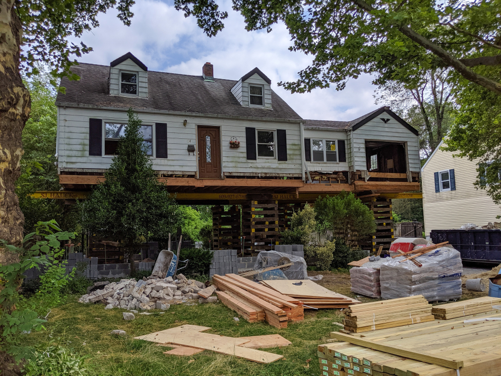
Local officials in La Pryor use Elevation Certificates as part of their building permit processes. When constructing a new home or significantly remodeling an existing one, you may be asked to submit a certificate to verify that your property meets floodplain management standards. This ensures that buildings are elevated above the base flood elevation, minimizing the potential for flood damage.
How a Flood Elevation Certificate Affects Insurance Costs
One of the most immediate financial impacts of a Flood Elevation Certificate is its influence on flood insurance premiums. The NFIP, administered by FEMA, bases its rates in part on the elevation data provided in this certificate. The lower your property sits compared to the base flood elevation, the higher your insurance costs will likely be.
Conversely, if your property is elevated above the expected flood level, having a certificate can demonstrate reduced risk and result in lower insurance premiums. This is particularly important in Texas, where extreme weather can lead to fast-changing floodplain maps and fluctuating insurance rates. For residents of La Pryor, TX, the savings can be significant over the lifetime of property ownership.
Insurance agents and NFIP providers use the information on the Elevation Certificate to assess risk more accurately. This includes details such as the building’s location, construction type, foundation, and the elevation of the lowest floor. With this data, underwriters can classify the property properly, avoiding worst-case risk assumptions that lead to inflated premiums.
The savings on insurance can often outweigh the one-time cost of obtaining the certificate, which usually involves hiring a licensed land surveyor or engineer. For homeowners in La Pryor trying to manage living costs and protect their investments, getting a certificate is often a wise financial move.
What Information is Included in a Flood Elevation Certificate
A Flood Elevation Certificate is a standardized document issued by FEMA. It includes several pieces of important data that inform both floodplain management and insurance decisions. In Texas, and especially in rural towns like La Pryor, these details can be the difference between affordable and costly insurance or compliant and non-compliant construction.
The certificate includes basic property information, such as the address and legal description. It then outlines the flood zone in which the property lies according to FEMA’s Flood Insurance Rate Map (FIRM). This designation affects insurance requirements and development rules.
Next, it provides specific elevation data for the building. This includes the elevation of the lowest floor, including basements or enclosures, and the height of equipment like HVAC units that could be damaged in a flood. These measurements must be taken and verified by a qualified surveyor or engineer to ensure accuracy.
The document also describes the building’s type of construction and foundation system. For example, whether it is slab-on-grade or elevated on piers, which can drastically affect flood resilience. Additionally, the certificate includes photographs of the structure, providing visual documentation of its elevation and surrounding features.
This detailed data supports the assessment of flood risk and can be shared with multiple stakeholders: homeowners, insurers, local officials, and emergency planners. For La Pryor residents, having this information on file helps create a clearer picture of their flood exposure and informs future decisions.
Steps to Obtain a Flood Elevation Certificate in La Pryor, TX
Securing a Flood Elevation Certificate in La Pryor involves a few key steps, typically starting with determining whether you need one. If your property is in a FEMA-designated flood zone, or if your lender requires flood insurance, you will likely need to provide this documentation.
The process begins by hiring a licensed professional, such as a surveyor, architect, or engineer, to perform the necessary elevation measurements. They will visit your property, conduct a field survey, and complete the FEMA form with the required data. In Texas, only professionals with state certification can provide official Elevation Certificates, ensuring accuracy and compliance with federal standards.
Once the form is completed, it should be submitted to your local floodplain administrator or building department. In La Pryor, this may be handled by the county office or a regional authority responsible for land development and zoning. They will review the certificate to confirm that your building meets local floodplain management rules.
If you are purchasing flood insurance, your insurance agent will also require a copy. Be sure to retain the certificate in your personal records, as it may be useful for future claims, permit applications, or when selling your property.
Property owners can also check with the previous owner or the local building department to see if a certificate already exists. This can save time and money, particularly if no major changes have been made to the building or its elevation since the certificate was issued.
Conclusion
In La Pryor, TX, a Flood Elevation Certificate is more than just a technical document. It is a vital tool that protects your investment, ensures compliance with floodplain regulations, and can significantly reduce your flood insurance premiums. Given the unpredictable nature of Texas weather and the potential for sudden floods, understanding and obtaining this certificate should be a priority for all property owners in designated flood zones.
Whether you are buying a home, building a new structure, or simply trying to reduce insurance costs, a Flood Elevation Certificate provides the clarity and data needed to make informed decisions. It supports long-term resilience and financial planning in a region where preparedness can make all the difference.
By investing in this essential document, residents of La Pryor not only safeguard their homes but also contribute to a community-wide effort to mitigate flood risk and protect local infrastructure. With proper planning and documentation, navigating the challenges of floodplain management in Texas becomes a much more manageable task.
Need Land Surveyors in Texas?
At Smyth Surveyors, Inc., we offer professional, official, and dependable land surveying in Texas. Our staff are all trained and licensed with our owner holding an L.S.L.S license. We can offer surveying for gas and oil well locations, pipeline right-of-way acquisition and construction alignment, determination of original survey boundaries, title boundary surveys, topographic surveys, and construction staking. If you are looking for a surveying company that has a prestigious record and an impeccable reputation look no further than Smyth Surveyors, Inc. Contact us today to speak with one of our friendly project managers and set up some time with us!
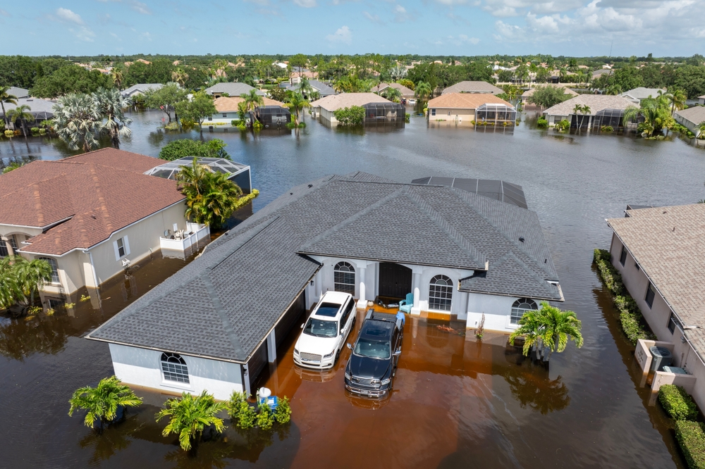
Flooding has always been a serious concern in Texas, but in recent years, the risk has increased significantly due to the accelerating impacts of climate change. Rising global temperatures have led to more frequent and intense storms, erratic weather patterns, and shifting rainfall trends, all of which contribute to higher flood risks across the state. From densely populated urban centers like Houston to rural communities such as La Pryor, TX, no part of the state is immune.
Texas has experienced a range of catastrophic flood events in the past few decades, with billions of dollars in damage and countless lives disrupted. Now, with the added uncertainty of climate change, understanding and mitigating these risks has never been more urgent. One of the essential tools in flood risk assessment and property protection is the flood elevation certificate, a document that plays a critical role in determining flood insurance rates and evaluating a property’s elevation relative to the base flood level.
This blog explores how climate change is reshaping the flood landscape in Texas, the increasing importance of flood elevation data, and what residents and policymakers can do to prepare.
Changing Rainfall Patterns and Intensity
Climate change has had a noticeable effect on rainfall patterns in Texas, making storms not only more unpredictable but also more intense. The state has seen an increase in the frequency of extreme weather events, particularly hurricanes and tropical storms, which often bring intense downpours in short periods. This kind of rainfall overloads natural waterways and urban drainage systems, leading to flash floods and prolonged inundation in vulnerable areas.
In regions like La Pryor, TX, where the landscape is generally flat and the drainage infrastructure is limited, these sudden deluges can be devastating. What used to be rare 100-year flood events are now happening more frequently, challenging the existing standards for flood risk modeling. The flood elevation certificate becomes even more crucial in such scenarios, as it helps homeowners and insurers understand the relative safety of a property and determine accurate insurance premiums.
Rural communities that once considered themselves relatively safe are discovering that increased rainfall, combined with outdated floodplain maps, may leave them more exposed than previously thought. Modern elevation data and updated certificates are essential tools to reassess and prepare for these evolving risks.
Rising Sea Levels and Coastal Vulnerability
While much of Texas is inland, its vast coastline makes it particularly vulnerable to the dual threats of rising sea levels and storm surges. Cities like Galveston, Corpus Christi, and Houston are already seeing the effects, with higher baseline water levels making it easier for even minor storms to cause significant coastal flooding.
The ripple effects reach inland as well. As storm surges push water further up rivers and bayous, flooding can affect communities dozens of miles from the coast. Residents of places like La Pryor, TX, may feel removed from these direct coastal influences, but the interconnectedness of Texas’s hydrological systems means that no region is entirely isolated from the broader climatic changes.
For homeowners across the state, understanding flood elevation is critical. The flood elevation certificate provides key information about the elevation of a building’s lowest floor relative to the expected flood level, helping assess how susceptible a property is to rising waters. As sea levels continue to rise, homes previously deemed “safe” may need to be reevaluated and retrofitted, and having an accurate certificate is the first step in that process.
Urban Development and Impervious Surfaces
Rapid urbanization in Texas has led to a significant increase in impervious surfaces such as concrete and asphalt. These surfaces prevent water from naturally soaking into the ground, instead funneling it into storm drains and creeks, often at volumes that exceed design capacities. As a result, even moderate rainfall can lead to urban flooding, especially in poorly planned areas.
Major metropolitan areas such as Austin, Dallas, and Houston have struggled with these challenges, with floods damaging infrastructure, disrupting daily life, and causing long-term economic consequences. As more people move to Texas and housing developments expand, small towns like La Pryor, TX, are also beginning to experience the side effects of this trend. New developments often overlook the cumulative impact of reduced permeability and increased runoff, further straining existing drainage systems.
One way communities can mitigate this risk is through better planning and zoning policies that incorporate flood risk data. Accurate flood elevation certificates provide essential insights into how land and structures interact with potential floodwaters. These certificates not only help with insurance but also inform responsible development practices, ensuring that new construction does not worsen flooding for others.
The Role of FEMA and Insurance Regulations
The Federal Emergency Management Agency (FEMA) plays a vital role in managing flood risk nationwide. Through its National Flood Insurance Program (NFIP), FEMA provides flood insurance to homeowners, renters, and businesses. However, eligibility and pricing under this program depend heavily on a property’s elevation relative to the base flood elevation. That’s where the flood elevation certificate comes in.
For property owners in Texas, particularly in flood-prone areas, obtaining this certificate is often a requirement for purchasing flood insurance through the NFIP. The document includes detailed information such as the building’s location, lowest floor elevation, and flood zone designation. All of this data helps FEMA assess risk more accurately and assign a fair insurance premium.
In areas like La Pryor, TX, where official flood zone maps may be outdated or incomplete, elevation certificates can help bridge the information gap. Local surveyors and engineers play an important role in gathering and submitting this data, helping residents qualify for insurance and understand their vulnerability.
As climate change continues to shift the boundaries of flood zones, FEMA is revising its mapping and risk rating methods. These changes may lead to higher insurance premiums for some homeowners, particularly those in previously low-risk zones that are now more flood-prone. Keeping flood elevation certificates up to date is critical for residents who want to avoid surprises and ensure they’re adequately protected.
Adapting to the New Normal: Community and Policy Responses
Texas communities are beginning to recognize that climate-driven flooding is not a future threat, but a present reality. Municipal governments, nonprofits, and individual homeowners are all playing a role in adapting to this new normal. Resilience planning, infrastructure upgrades, and better land-use policies are all part of the broader strategy to manage flood risk in a warming world.
Local governments can help by investing in green infrastructure such as wetlands restoration, rain gardens, and permeable pavements, which reduce surface runoff and improve natural water absorption. Educating homeowners about the importance of flood elevation certificates is another critical component, as it empowers individuals to make informed decisions about their property and insurance needs.
In rural communities like La Pryor, TX, these efforts are just as important. Though the resources may be more limited than in urban centers, local leadership and collaboration with state and federal agencies can yield effective flood mitigation strategies. Involving residents in the planning process and ensuring they understand how to obtain and use flood elevation certificates can lead to more resilient, informed communities.
At the policy level, integrating climate projections into floodplain mapping, building codes, and infrastructure design will help Texas prepare for a wetter, more volatile future. The key is not just reacting to disaster but planning ahead with reliable data and proactive strategies.
Conclusion
The threat of flooding in Texas is intensifying under the influence of climate change. From shifting rainfall patterns and rising sea levels to rapid urban development and outdated infrastructure, the factors contributing to flood risk are complex and interconnected. Understanding these dynamics is essential for communities, especially in vulnerable areas such as La Pryor, TX, where flood protection resources may be limited.
One of the most practical and powerful tools available to homeowners, developers, and policymakers is the flood elevation certificate. This document provides crucial information that can guide insurance decisions, building practices, and community planning. As Texas faces an uncertain climatic future, relying on accurate elevation data and incorporating it into everyday decisions will be vital for reducing risk and enhancing resilience.
Climate change is not just a global issue; it’s a deeply local one as well. By focusing on local solutions, informed by tools like flood elevation certificates and driven by community engagement, Texas can rise to meet the challenges of a changing environment.
Need Land Surveyors in Texas?
At Smyth Surveyors, Inc., we offer professional, official, and dependable land surveying in Texas. Our staff are all trained and licensed with our owner holding an L.S.L.S license. We can offer surveying for gas and oil well locations, pipeline right-of-way acquisition and construction alignment, determination of original survey boundaries, title boundary surveys, topographic surveys, and construction staking. If you are looking for a surveying company that has a prestigious record and an impeccable reputation look no further than Smyth Surveyors, Inc. Contact us today to speak with one of our friendly project managers and set up some time with us!
Living in a flood-prone area like Knippa, TX, makes it crucial to understand how to protect your property and comply with regulatory requirements. One of the most important documents you may need is a flood elevation certificate. This document not only helps establish your property’s elevation relative to the base flood elevation (BFE) but also determines flood insurance premiums and compliance with local building codes. Whether you’re buying property, constructing a home, or simply ensuring you’re not overpaying for flood insurance, obtaining a flood elevation certificate in Texas is a strategic and necessary move.
The Importance of a Flood Elevation Certificate in Knippa, TX
Knippa, Texas, while small and rural, is not immune to the effects of severe weather and flooding. The town is located in Uvalde County, which has experienced flood events due to its proximity to rivers and the semi-arid climate that can quickly turn rainfall into dangerous runoff. For property owners in Knippa, a flood elevation certificate is not just a bureaucratic formality—it’s a document that can significantly impact your insurance premiums and your legal ability to build or renovate structures.
A flood elevation certificate provides the Federal Emergency Management Agency (FEMA), insurance companies, and local government officials with critical information about a building’s elevation. This includes the lowest floor elevation, the location of machinery and utilities, and the BFE for the area. This data determines whether a property is compliant with floodplain management ordinances and helps underwriters accurately assess flood risk.
Having this certificate on file can dramatically lower National Flood Insurance Program (NFIP) premiums if your home is above the BFE, or it can help you understand what improvements may be needed if your property is below it. Additionally, lenders may require it for properties in high-risk flood zones, making it essential for real estate transactions in flood-prone areas like Knippa.
Who Can Issue a Flood Elevation Certificate in Texas?
In Texas, including Knippa, a flood elevation certificate can only be completed and signed by licensed professionals authorized by FEMA. These include state-licensed surveyors, engineers, or architects. They use advanced tools and techniques to measure your building’s elevation in relation to FEMA’s designated BFE for your property.
To ensure accuracy and compliance, it’s critical to hire a professional who is familiar with FEMA standards and local floodplain ordinances. Surveying firms in nearby cities such as Uvalde, San Antonio, or even regional offices that serve rural counties often offer elevation certificate services. Many have experience working directly with FEMA’s flood maps and understand the documentation standards required for the NFIP.
Local government offices, such as the Uvalde County Floodplain Administrator or the city engineer (if applicable), may also provide guidance or maintain a list of approved professionals. Some municipalities participate in the NFIP’s Community Rating System (CRS), which encourages lower flood insurance premiums in exchange for proactive flood management, including accurate record-keeping of elevation certificates.
The Step-by-Step Process to Obtain a Flood Elevation Certificate in Knippa
The process of obtaining a flood elevation certificate in Knippa, TX, begins with determining whether your property is located in a FEMA-designated Special Flood Hazard Area (SFHA). You can check this online using FEMA’s Flood Map Service Center by inputting your property address. If your property falls within an SFHA, your lender, insurer, or local ordinance may require a certificate.
The next step is hiring a licensed surveyor or engineer. In Texas, many firms offer online scheduling and can provide a cost estimate based on your property’s size, location, and complexity. Prices can vary, but generally range between $300 and $800, depending on accessibility, urgency, and travel fees, especially in rural areas like Knippa.
Once hired, the surveyor visits the property and collects elevation data using GPS instruments or laser levels. They identify the lowest adjacent grade, the lowest floor of the structure, and the location of mechanical equipment. This information is then compared to the BFE listed in FEMA’s Flood Insurance Rate Map (FIRM) to assess whether the building complies with local and federal floodplain requirements.
After collecting and analyzing the data, the professional completes FEMA’s Elevation Certificate form, which includes diagrams, measurements, and photographs. This finalized document can then be submitted to your insurance company, mortgage lender, or local government office as needed.
Maintaining and Using Your Flood Elevation Certificate
Once you’ve obtained a flood elevation certificate for your Knippa property, it’s vital to store it securely and maintain copies for future use. Most certificates remain valid as long as there are no changes to the structure or significant updates to FEMA’s flood maps for your area. However, if you make structural changes—such as adding a new floor, elevating the foundation, or relocating utilities—you may need a new certificate to reflect those changes.
Using your elevation certificate effectively can result in significant cost savings on flood insurance. By proving that your structure sits above the BFE, you reduce your perceived risk and potentially lower your NFIP premiums. In some cases, the savings can be substantial—hundreds or even thousands of dollars annually.
Moreover, the certificate can be used during property sales to provide potential buyers with transparent risk information. Some realtors even use elevation certificates as a selling point, especially when the property is safely above flood elevation and therefore not subject to exorbitant insurance costs.
If you believe your property is incorrectly included in a high-risk zone, you may use the elevation certificate to file a Letter of Map Amendment (LOMA) with FEMA. This process can result in the property being removed from the SFHA designation, which can eliminate the need for flood insurance altogether.
Resources and Local Support in Knippa, TX
In Knippa and throughout Uvalde County, residents can turn to a variety of resources for assistance with flood elevation certificates. Start by contacting the Uvalde County Floodplain Administrator, who may be based in the county engineering or planning department. This official can help determine whether you need a certificate, provide guidance on flood zones, and share lists of qualified surveyors or engineers.
FEMA’s Flood Map Service Center is an invaluable online tool that offers free access to current FIRMs and helps property owners identify flood zones by address. Additionally, the Texas Division of Emergency Management and the Texas General Land Office provide statewide guidance on floodplain management and can direct you to local resources.
For insurance-related questions, the NFIP Help Center and local insurance agents who specialize in flood coverage can help interpret the results of your certificate and determine premium impacts. If you are applying for a LOMA or appealing a flood zone designation, FEMA’s eLOMA online portal offers step-by-step submission assistance for eligible cases.
It’s also wise to connect with neighbors and community leaders in Knippa. In rural towns, word-of-mouth referrals for reputable surveyors and engineers are often more reliable than online reviews. Additionally, if you’re part of a homeowners’ association, they may already have certificates or recommendations on file for your subdivision.
While Knippa may not have the same bureaucratic infrastructure as larger cities, the steps to obtain a flood elevation certificate remain clear and attainable. With the right resources and a certified professional by your side, you can ensure your property complies with floodplain regulations, minimizes insurance costs, and remains protected from flood-related risks.
Conclusion
Acquiring a flood elevation certificate in Knippa, TX is a proactive and often essential step for homeowners and property developers. It’s a vital document that affects insurance rates, legal compliance, and even future property value. By understanding the process, engaging with qualified professionals, and leveraging local and federal resources, you can navigate the requirements with confidence and ensure your home or investment remains secure in the face of potential flooding in this Texas town.
Need Land Surveyors in Texas?
At Smyth Surveyors, Inc., we offer professional, official, and dependable land surveying in Texas. Our staff are all trained and licensed with our owner holding an L.S.L.S license. We can offer surveying for gas and oil well locations, pipeline right-of-way acquisition and construction alignment, determination of original survey boundaries, title boundary surveys, topographic surveys, and construction staking. If you are looking for a surveying company that has a prestigious record and an impeccable reputation look no further than Smyth Surveyors, Inc. Contact us today to speak with one of our friendly project managers and set up some time with us!
Changing weather patterns have had a profound impact on communities across the United States, and Concan, TX is no exception. Situated along the Frio River in the heart of Texas Hill Country, Concan has long been recognized for its picturesque scenery and recreational opportunities. However, in recent years, increasingly unpredictable weather events have created new challenges related to flooding, impacting local land surveying practices, flood elevation certificates, and the overall resilience of the region. Understanding how these shifting weather patterns influence flood elevation and risk is crucial for residents, developers, and policymakers in Concan, TX, who must adapt to these changing realities to safeguard lives and property.
The Impact of Increased Rainfall Variability
One of the most significant climate-driven shifts affecting Concan, TX is the rise in rainfall variability. Historically, the Hill Country region has experienced seasonal rains with relatively predictable patterns. Today, however, intense downpours are becoming more frequent and more severe, often interspersed with periods of prolonged drought. This volatility is reshaping the hydrology of local rivers and creeks, including the Frio River, where sudden and powerful surges can overwhelm previously sufficient flood mitigation systems. In this environment, flood elevations — the vertical measurement from a reference point to the potential floodwater surface — can change dramatically from year to year. For property owners in Concan, understanding these fluctuating flood elevations is no longer a theoretical exercise but a practical necessity.
As heavy storms become more common, the need for a reliable Flood Elevation Certificate has grown. This document, usually prepared by licensed land surveying professionals in Texas, verifies the elevation of a structure relative to the Base Flood Elevation (BFE). With increasing rainfall and flash flood events, FEMA flood maps are frequently updated, requiring residents and builders to re-examine their flood risk in a rapidly changing environment. Land Surveying in Concan, TX has thus become a vital tool in providing the data necessary to support insurance decisions, permitting processes, and safety planning.
Rising Temperatures and Their Effect on Flood Dynamics
While rainfall is a key driver of flooding, rising temperatures in Texas also play a subtle but important role. Warmer weather increases evaporation rates, which can intensify periods of drought and leave soils parched and less capable of absorbing heavy rain when storms do arrive. As a result, runoff volumes can be far greater than in the past, with water flowing over hardened, sun-baked ground straight into rivers, streams, and low-lying neighborhoods. In Concan, TX, where vacation homes, cabins, and businesses cluster near the Frio River, this phenomenon means floods can develop faster and reach higher elevations than previously anticipated.
Flood modeling systems are still catching up with the cumulative impact of these temperature-related changes. Traditional models that assumed relatively consistent infiltration and groundwater recharge rates may now be underestimating how quickly floodwaters can rise. As a result, property owners who once considered their land safe based on older surveys may find that their Flood Elevation Certificate no longer accurately reflects the current risk. In these situations, hiring professional land surveying services in Texas becomes essential to revalidate property elevations and to plan flood-resistant designs for new construction or renovations.
Land Use Changes and Compounded Flood Risks
Beyond weather alone, human-driven changes to the landscape in Concan, TX have further complicated flood elevation dynamics. Over the last several decades, more homes, roads, and parking lots have been constructed throughout the region to support tourism and recreation around the Frio River. These developments often add significant amounts of impermeable surfaces, which accelerate the speed and quantity of stormwater runoff. When these land use changes are combined with increasingly erratic weather patterns, the result is a perfect storm for more severe and unpredictable flooding.
Flood elevation and risk assessments must now account for both climate factors and the built environment. Updated land surveys that incorporate new impervious surfaces are essential for providing an accurate picture of potential water flow paths and flood extents. In Texas, these surveys are frequently used to update Flood Elevation Certificates, which then inform local planning boards, insurance underwriters, and emergency management agencies. In Concan, with its rapid seasonal population growth and heavy tourist influx during summer, these certificates play a crucial role in maintaining safety and resilience. They serve not only to protect property owners but also to support broader community disaster preparedness efforts.
The Role of Flood Elevation Certificates in a Changing Climate
Against this backdrop of shifting weather patterns, higher temperatures, and expanding development, the importance of maintaining a current and accurate Flood Elevation Certificate cannot be overstated. In Concan, TX, these certificates have evolved from a box-checking exercise into an essential planning tool that guides insurance premiums, construction codes, and emergency evacuation strategies. They provide a standardized reference for how high floodwaters might rise in a given location, allowing property owners to make informed decisions about protecting their homes and businesses.
Because flood risk is now so dynamic, property owners are encouraged to review and, if necessary, update their certificates regularly. Modern land surveying techniques in Texas — using GPS, lidar, and advanced GIS modeling — have made it easier than ever to generate highly accurate flood elevation data. These tools can account for changes in river channels, sediment build-up, and shifting topographies caused by heavy rains and floods. By investing in a new or updated Flood Elevation Certificate, Concan residents can gain peace of mind, knowing they are prepared for the increasing risks of extreme weather.
Furthermore, local governments and agencies use aggregated data from these certificates to guide regional flood management policies. As the climate continues to evolve, floodplain maps and hazard mitigation plans will depend on up-to-date elevation surveys to allocate resources, design new infrastructure, and develop flood warning systems. In Concan, this proactive approach is essential to preserving its status as a vibrant, safe community.
Future Strategies for Adapting to Flood Risk in Concan
Looking ahead, Concan, TX faces a complex challenge: how to adapt to more intense and unpredictable flooding without sacrificing the natural beauty and economic vitality that make the area so appealing. Land Surveying professionals will continue to play a central role in this effort, providing the technical expertise required to measure, model, and map flood elevations with ever greater precision. As part of a broader resilience strategy, community leaders may also need to encourage the use of more flood-resistant building materials, elevate critical infrastructure, and expand green infrastructure projects that help absorb rainwater naturally.
Public education will be critical to these efforts. Many homeowners and business owners in Concan may still not fully understand the value of their Flood Elevation Certificate or the meaning of floodplain designations. Outreach campaigns, workshops, and incentives for updating certificates can help close this knowledge gap. Equally important will be partnerships between local officials, surveyors, insurance companies, and residents to ensure that flood mitigation efforts are coordinated and comprehensive.
Finally, as Texas continues to experience dramatic weather swings — from record droughts to torrential rain — a mindset of flexibility and preparedness will serve Concan best. Communities that recognize the reality of climate change and proactively update their flood risk assessments will be best positioned to protect people, property, and their treasured Hill Country lifestyle. By respecting the power of water and acknowledging that flood elevations are no longer static but dynamic, Concan can build a more resilient and secure future.
Conclusion
Changing weather patterns are forcing a reevaluation of flood risk and flood elevation in Concan, TX. With heavier rains, higher temperatures, and ongoing land use changes, the stakes are higher than ever. Through vigilant land surveying, updated Flood Elevation Certificates, and community-wide education, Concan can rise to meet these challenges and safeguard its people and its future.
Need Land Surveyors in Texas?
At Smyth Surveyors, Inc., we offer professional, official, and dependable land surveying in Texas. Our staff are all trained and licensed with our owner holding an L.S.L.S license. We can offer surveying for gas and oil well locations, pipeline right-of-way acquisition and construction alignment, determination of original survey boundaries, title boundary surveys, topographic surveys, and construction staking. If you are looking for a surveying company that has a prestigious record and an impeccable reputation look no further than Smyth Surveyors, Inc. Contact us today to speak with one of our friendly project managers and set up some time with us!