The Importance of Flood Elevation Certificates in La Pryor
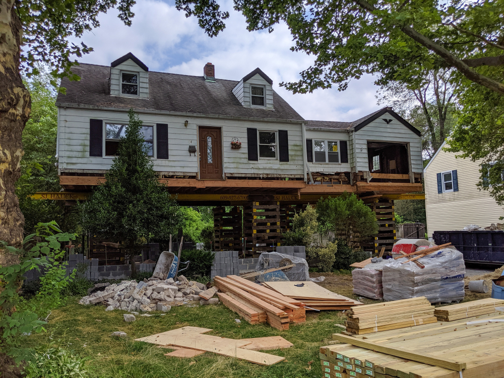
Flooding is a reality that many South Texas property owners must consider, especially after periods of heavy rainfall or changing weather patterns. Whether you’re buying property, building a new structure, or reviewing your flood insurance, understanding flood elevation certificates can help you make informed decisions and avoid unexpected costs in La Pryor.
Quick Answer
A flood elevation certificate is an official document prepared by a licensed land surveyor that identifies a building’s elevation in relation to the Federal Emergency Management Agency (FEMA) flood maps. In La Pryor, an elevation certificate may help determine flood insurance requirements, support permitting, verify compliance with local floodplain regulations, and provide valuable information during real estate transactions.
What Local Readers Should Know
-
Property owners in La Pryor may need an elevation certificate when building, improving, or purchasing structures located within or near FEMA-designated flood hazard areas.
-
Flood insurance premiums can be influenced by elevation information, making an accurate certificate valuable for many property owners.
-
Areas throughout Zavala County may experience localized flooding from heavy rainfall, even outside major waterways.
-
An elevation certificate must be completed by a qualified licensed surveyor using precise field measurements.
-
Having updated elevation information before a property transaction can help prevent delays during closing or permitting.
Why This Matters Locally
Flood risks in South Texas are not limited to properties located directly beside rivers or creeks. Intense thunderstorms, tropical weather systems moving inland, and periods of heavy rainfall can create localized flooding throughout La Pryor and surrounding communities such as Crystal City, Batesville, Uvalde, and Carrizo Springs. Portions of Zavala County contain mapped flood hazard areas, and property owners often discover that floodplain requirements affect construction, financing, or insurance decisions.
For anyone planning to build, renovate, refinance, or purchase property, understanding how elevation certificates fit into the process can save time and provide greater confidence.
Smyth Surveyors, Inc. helps property owners throughout the region obtain accurate surveying information needed for flood-related documentation. After this introduction, we’ll simply refer to ourselves as we because our goal is to help local property owners understand the process and make informed decisions.
Local Data and Professional Field Observations
Flood hazard information used throughout the country is maintained through FEMA Flood Insurance Rate Maps. Local governments use these maps during permitting and development reviews to determine whether floodplain regulations apply to a property.
From our experience working with properties across South Texas, we know that floodplain questions frequently arise during new construction, additions, commercial development, and property sales. Even when a property owner has never experienced flooding personally, lenders or permitting authorities may still require elevation documentation based on mapped flood zones.
How Flood Elevation Certificates Affect Local Property Owners
Flood elevation certificates provide objective information that supports important property decisions.
They may help:
-
Determine whether flood insurance is required.
-
Provide information used in flood insurance rating.
-
Support building permit applications in regulated floodplain areas.
-
Verify finished floor elevations for new construction.
-
Assist buyers during real estate transactions.
-
Document compliance with applicable floodplain requirements.
For homeowners and commercial property owners alike, having accurate elevation information can reduce uncertainty during projects involving financing, permitting, or development.
Warning Signs You May Need an Elevation Certificate
Several situations commonly indicate that obtaining an elevation certificate is worthwhile.
-
You’re purchasing property located in or near a mapped flood zone.
-
Your lender requests flood documentation before closing.
-
You’re planning new construction or a substantial improvement.
-
Your insurance company requests elevation information.
-
Your local permitting office requires floodplain documentation.
-
You’re disputing a flood insurance requirement.
-
You’re considering improvements that could affect floodplain compliance.
If any of these situations apply, consulting a licensed surveyor early in the process can help avoid unnecessary delays.
When to Call a Professional
A licensed surveyor should be involved whenever an official elevation certificate is required for permitting, lending, insurance, or regulatory purposes.
While property owners can review FEMA flood maps online to understand whether their property may fall within a flood hazard area, only a qualified professional can perform the field measurements necessary to prepare an official elevation certificate.
Early planning is especially helpful before construction begins or before a real estate closing is scheduled.
Common Local Causes for Elevation Certificate Requests
Several situations commonly trigger requests for elevation certificates in La Pryor and nearby communities.
New Construction
New residential and commercial buildings in regulated floodplain areas often require elevation documentation before project completion.
Property Sales
Buyers, lenders, and title companies sometimes request elevation certificates to clarify flood insurance requirements.
Flood Insurance Reviews
Insurance providers may request updated elevation information when issuing or renewing certain flood insurance policies.
Building Additions or Improvements
Major renovations or additions may require updated floodplain documentation depending on local permitting requirements.
Prevention and Planning Tips
Property owners can simplify future projects by planning ahead.
Helpful steps include:
-
Review FEMA flood maps before purchasing land.
-
Ask about floodplain requirements before beginning construction.
-
Keep copies of previous surveys and elevation documentation.
-
Contact your local permitting office early during project planning.
-
Schedule surveying services well before permit deadlines or real estate closings.
Taking these steps early often helps prevent scheduling delays later.
What Results Can You Expect?
An accurately prepared elevation certificate provides reliable documentation of a building’s elevation relative to FEMA flood information.
While an elevation certificate does not remove flood risk or automatically change insurance costs, it supplies important information used by insurers, lenders, local officials, and property owners when making flood-related decisions.
Common Mistakes Property Owners Make
Waiting Until Closing
Mistake: Waiting until the final stages of a property sale.
Consequence: Closing delays while required surveying is completed.
Better Approach: Schedule surveying as soon as floodplain questions arise.
Assuming Flood Maps Never Change
Mistake: Relying on outdated flood information.
Consequence: Unexpected permitting or insurance issues.
Better Approach: Verify current flood mapping before beginning projects.
Using Old Documentation
Mistake: Assuming previous surveys meet current requirements.
Consequence: Additional surveying may still be necessary.
Better Approach: Confirm whether updated documentation is needed for your specific project.
Common Local Scenario
A homeowner in the La Pryor area plans to build an addition after purchasing property several years ago. During the permitting process, they learn the structure is located within a mapped flood hazard area. Because they schedule an elevation survey early, they obtain the necessary documentation before construction begins, avoiding unnecessary project delays.
Related Surveying Services
Elevation certificates are often completed alongside other professional surveying services, including:
-
Boundary surveys
-
Construction staking
-
Topographic surveys
-
ALTA/NSPS land title surveys
-
Improvement location surveys
-
Development support for residential and commercial projects
Each service provides different information depending on the property’s intended use.
Comparing Your Options
| Option | Best For | Considerations |
|---|---|---|
| Review FEMA maps yourself | Initial research | Does not replace an official elevation certificate. |
| Obtain a professional elevation certificate | Insurance, permitting, financing, and construction | Provides official measurements prepared by a licensed surveyor. |
| Wait until documentation is requested | No immediate project planned | May delay construction, permitting, or property transactions. |
Service Areas
We proudly assist property owners in La Pryor, Crystal City, Batesville, Uvalde, Carrizo Springs, and surrounding communities throughout Zavala County and nearby areas of South Texas. Our surveying services support homeowners, businesses, developers, and property professionals across the region.
The Cost of Ignoring Flood Elevation Requirements
Waiting until the last minute can create unnecessary delays for permits, construction schedules, financing, and real estate closings. Understanding your property’s elevation before a major project begins helps you prepare for potential floodplain requirements and reduces avoidable complications.
Frequently Asked Questions
Do I need an elevation certificate for every property in La Pryor?
Not necessarily. Requirements depend on the property’s location, lender requirements, insurance needs, and whether the structure is within a FEMA-designated flood hazard area.
Who prepares a flood elevation certificate?
A licensed land surveyor or other qualified professional authorized under FEMA requirements prepares the official elevation certificate using field measurements.
Can an elevation certificate lower flood insurance costs?
An elevation certificate provides information used by insurers when determining flood insurance ratings. The effect on premiums depends on several property-specific factors and insurer requirements.
How long does an elevation survey take?
The field work itself is often completed relatively quickly, although scheduling, property conditions, and project complexity can affect the overall timeline.
Are flood elevation certificates important for new construction in Zavala County?
Yes. If construction occurs within regulated floodplain areas, elevation documentation may be required during permitting or project completion.
Can I use an old elevation certificate?
Possibly, but it depends on whether the existing certificate meets current requirements and accurately reflects the property. We can help determine whether updated documentation is appropriate.
Does every property near Crystal City or Uvalde need flood documentation?
No. Requirements vary based on the property’s mapped flood zone, lender policies, local permitting requirements, and the type of project being completed.
When should I schedule an elevation survey?
The best time is before permit applications, construction, refinancing, or real estate closings begin. Early planning helps avoid unnecessary delays.
Closing
Flood elevation certificates provide valuable information that supports informed property decisions throughout La Pryor and the surrounding South Texas region. Whether you’re building, buying, or preparing for a permitting process, understanding your property’s elevation can make each step smoother and more predictable.
Protect Your Property with Accurate Surveying
Our team is here to provide professional surveying services that support your project from start to finish. Contact us today to schedule your elevation certificate or discuss your surveying needs with our experienced team.