What Are the Different Types of Surveying in Texas?
What Are the Different Types of Surveying in Texas?
Surveying is an essential element in various industries and plays a crucial role in construction, engineering, and land development projects. It involves gathering and analyzing data about land and its features to create accurate measurements, maps, and plans. There are various types of surveying, each with its own specific purpose and techniques. In this blog post, we will explore some of the different types of surveying in Texas and their significance to local land surveyors.
1. Land Surveying
Land surveying is the most commonly known type of surveying. It involves measuring and mapping the physical characteristics of a piece of land, including its boundaries, elevation, and distances. Topographic surveying is crucial in real estate transactions, property development, and land division. It ensures that legal boundaries are accurately defined and helps in resolving disputes related to land ownership.
2. Topographic Surveying
Topographic surveying focuses on recording the natural and man-made features of a specific piece of land. It includes the identification and measurement of elevation changes, contours, vegetation, streams, and buildings. This type of surveying is often employed in urban planning, architectural and engineering design projects, and environmental assessments. The data collected in a topographic survey is used to create detailed maps, plan infrastructure projects, and assess potential risks.
3. Geodetic Surveying
Geodetic surveying is a type of surveying that takes into account the curvature of the Earth’s surface. It extends over large areas and involves high-precision measurements to establish accurate positions of control points. Geodetic surveying is used to create geodetic networks, determine global positions for satellite navigation systems, and calculate distances on a global scale. It is particularly vital in the fields of GPS navigation, mapping, and satellite imaging.
4. Construction Surveying
Construction surveying is performed during the planning and construction phases of a building or infrastructure project. It aims to ensure that the project is executed according to the plans and specifications. Construction surveyors mark the locations of various elements, such as foundations, walls, and utilities, on the ground. They also monitor and report any deviations from the design, ensuring that the construction adheres to Texas safety standards.
5. Hydrographic Surveying
Hydrographic surveying is mainly conducted in bodies of water, such as rivers, lakes, and oceans. It involves measuring and mapping the water depth, the shape of the seabed, and the presence of any underwater features. Hydrographic surveying is essential for navigation purposes, dredging projects, and marine construction. It helps ensure safe navigation by identifying potential hazards and providing accurate charts for ships and submarines.
6. Archaeological Surveying
Archaeological surveying is conducted to locate and document archaeological sites and artifacts. It includes the use of various surveying techniques, such as ground-penetrating radar and aerial photography, to identify potential burial grounds, ancient structures, or cultural remains. Archaeological surveying helps in preserving historical sites, understanding ancient civilizations, and planning for future excavations.
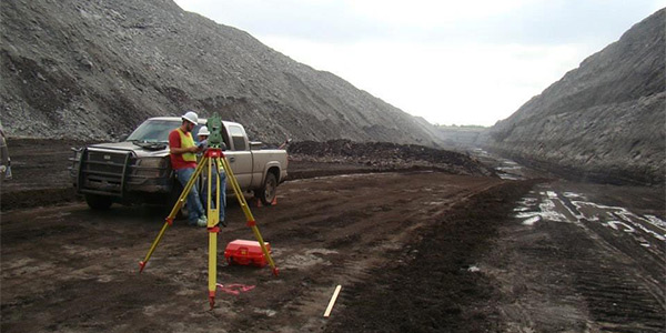
7. Mining Surveying
Mining surveying involves mapping and measuring mineral deposits and mining-related activities. It includes determining the boundaries of mining claims, creating accurate maps of underground mines, and monitoring the extraction process. Mining surveyors play a vital role in maximizing the efficiency of mining operations, ensuring the safety of miners, and complying with environmental regulations.
Summary
Surveying encompasses various types that cater to different industries and purposes. Land surveying ensures accurate land measurements, boundaries, and legal ramifications. Topographic surveying focuses on mapping the features and characteristics of a particular area. Geodetic surveying accounts for Earth’s curvature, enabling precise location determination. Construction surveying ensures compliance with plans and specifications during construction projects. Hydrographic surveying is essential for safe navigation in bodies of water. Archaeological surveying aids in preserving historical sites and studying ancient civilizations. Lastly, mining surveying plays a crucial role in mining operations and environmental compliance. These types of surveying contribute to the progress and development of various industries, delivering accurate, reliable data that is crucial for planning, design, and execution.
Need Land Surveyors in Texas?
At Smyth Surveyors, Inc., we offer professional, official, and dependable land surveying in Texas. Our staff are all trained and licensed with our owner holding an L.S.L.S license. We can offer surveying for gas and oil well locations, pipeline right-of-way acquisition and construction alignment, determination of original survey boundaries, title boundary surveying, topographic surveys, and construction staking. If you are looking for a surveying company that has a prestigious record and an impeccable reputation look no further than Smyth Surveyors, Inc. Contact us today to speak with one of our friendly project managers and set up some time with us!