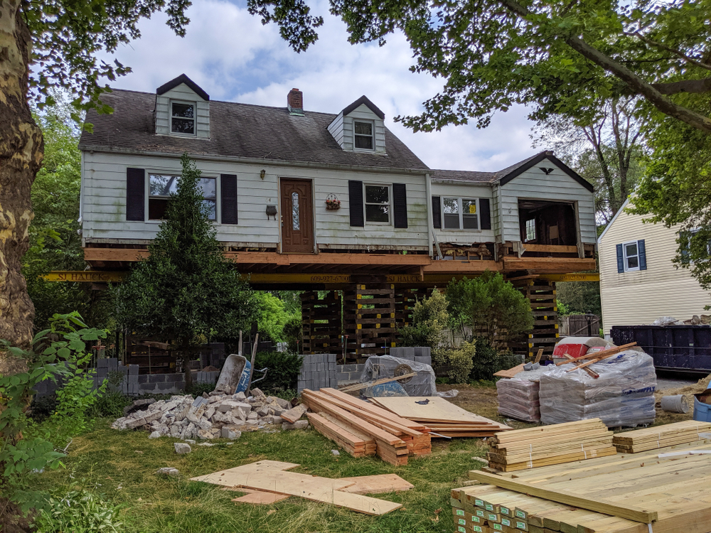
When buying, selling, or developing land in Texas, choosing the right land surveyor can make a significant difference in ensuring your property boundaries are accurate, disputes are avoided, and legal requirements are met. Land surveying is a crucial step in property transactions, construction, and infrastructure projects. Whether you’re working on a residential plot or a large-scale project that involves a pipeline surveyor, understanding the right questions to ask can save you time, money, and stress. This blog will guide you through the most important questions to ask your Texas land surveyor and explain why they matter for your property goals.
What Type of Survey Do I Need for My Texas Property?
Before hiring a land surveyor, it’s important to understand the type of survey required for your project. Land surveying in Texas covers several categories, each serving a specific purpose. A boundary survey is ideal for homeowners seeking to confirm property lines, while topographic surveys are commonly used for construction planning and engineering projects. If you’re dealing with land that requires infrastructure, such as roads, pipelines, or utility systems, you may need a specialized pipeline surveyor.
Texas also has unique property laws and boundary regulations that make it essential to work with a surveyor who is knowledgeable about local codes and county-specific requirements. Asking your surveyor about their experience with different survey types ensures you get the right solution for your needs. They can also guide you on whether you need an ALTA survey for title insurance, a subdivision plat, or even specialized oil and gas surveys depending on your property’s location.
Additionally, Texas’s rapid urban expansion has led to more complex zoning and permitting rules. A qualified land surveyor can help you navigate these legal frameworks and make sure your project complies with state and municipal regulations. Choosing the right type of survey upfront ensures accuracy, prevents future disputes, and streamlines the approval process for any planned development.
How Familiar Are You with Local Texas Laws and Regulations?
Land surveying in Texas is deeply intertwined with property laws and county-specific guidelines. Each county can have different zoning requirements, setback regulations, and easement policies. A surveyor’s familiarity with local laws is critical, especially when working with properties near water boundaries, public right-of-ways, or pipeline easements.
For example, if your land involves oil, gas, or utility pipelines, you need a surveyor with expertise in pipeline surveying. A pipeline surveyor ensures the correct mapping of existing pipelines and helps design the safest and most efficient routes for new ones. Since Texas is a major hub for energy infrastructure, surveyors frequently collaborate with pipeline companies, utility providers, and regulatory agencies to ensure compliance with safety standards.
You should also ask your surveyor about how they handle permitting processes and interactions with local authorities. In some Texas counties, failing to follow proper procedures can delay projects or lead to costly legal disputes. An experienced land surveyor will know how to identify encroachments, manage easements, and resolve potential conflicts before they become problems.
What Technology and Methods Do You Use for Land Surveying?
Surveying technology has advanced significantly, and modern methods offer greater accuracy and efficiency than ever before. When hiring a Texas land surveyor, ask about the tools and techniques they use. Advanced equipment such as GPS, drone mapping, 3D scanning, and GIS (Geographic Information Systems) can produce highly precise measurements and detailed maps. These technologies are especially valuable for large-scale development projects, pipeline surveying, and infrastructure planning.
Pipeline surveyors, for instance, often use specialized technologies like ground-penetrating radar and LiDAR to locate underground utilities and optimize pipeline routing. These tools reduce the risk of accidental damage to existing infrastructure and help ensure compliance with environmental and safety regulations.
By working with a surveyor who embraces the latest innovations, you can expect faster turnaround times, fewer errors, and more comprehensive data. In addition, digital deliverables such as CAD files and GIS-compatible datasets allow engineers, architects, and project managers to integrate survey results directly into their planning workflows.
How Will the Survey Impact My Property Development Plans?
Land surveying plays a vital role in shaping development strategies, especially in Texas, where large parcels are frequently subdivided for residential and commercial use. Before construction begins, a detailed survey establishes the property boundaries, identifies potential restrictions, and evaluates site conditions. Asking your surveyor how their findings could affect your project helps you avoid unexpected complications later in the process.
If your project involves installing pipelines, roads, or other infrastructure, a pipeline surveyor will help you identify the safest and most efficient paths while ensuring compliance with environmental regulations. Survey data can also reveal encroachments, wetlands, flood zones, and utility easements—factors that may influence design plans or require modifications to obtain permits.
Additionally, Texas has unique geological and hydrological considerations. From flood-prone regions near the Gulf Coast to rocky terrains in the Hill Country, surveyors familiar with local conditions can provide insights that significantly impact development timelines and costs. By understanding these challenges early, property owners and developers can make informed decisions and prevent costly redesigns.
What Are the Costs, Timelines, and Deliverables?
Before hiring a Texas land surveyor, it’s essential to discuss pricing, turnaround times, and the specific deliverables you’ll receive. Survey costs can vary widely depending on the property size, terrain complexity, and the type of survey required. Pipeline surveys, for example, often involve additional steps such as regulatory coordination, environmental studies, and route optimization, which can affect pricing and project schedules.
Clarify whether you’ll receive physical survey plats, digital CAD files, or GIS datasets. Some surveyors also provide 3D visualizations and interactive maps that make it easier to understand property details. You should also ask about estimated completion times, especially if your project is dependent on obtaining permits or securing financing.
Reputable surveyors will provide a clear breakdown of costs and set realistic expectations for timelines. They’ll also communicate openly about potential delays caused by weather conditions, permit approvals, or unexpected findings during the survey process. This level of transparency is essential for effective project planning and budget management.
Conclusion
Choosing the right Texas land surveyor is one of the most critical decisions you’ll make when buying, developing, or managing land. By asking the right questions, you ensure your surveyor has the experience, tools, and local knowledge needed to deliver accurate results. Whether you need a simple boundary survey, a complex subdivision layout, or a specialized pipeline surveyor, working with a skilled professional can protect your investment and help you avoid costly mistakes.
From understanding Texas property laws to leveraging advanced surveying technologies, the right surveyor provides valuable insights that guide your project from start to finish. With proper planning, clear communication, and expert guidance, you can confidently move forward knowing your property interests are secure.
Need Land Surveyors in Texas?
At Smyth Surveyors, Inc., we offer professional, official, and dependable land surveying in Texas. Our staff are all trained and licensed with our owner holding an L.S.L.S license. We can offer surveying for gas and oil well locations, pipeline right-of-way acquisition and construction alignment, determination of original survey boundaries, title boundary surveys, topographic surveys, and construction staking. If you are looking for a surveying company that has a prestigious record and an impeccable reputation look no further than Smyth Surveyors, Inc. Contact us today to speak with one of our friendly project managers and set up some time with us!
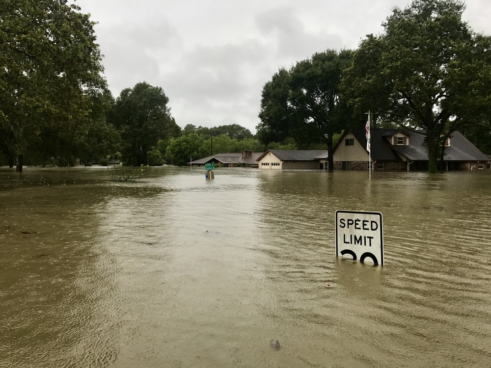
Living in a flood-prone area like Knippa, TX, makes it crucial to understand how to protect your property and comply with regulatory requirements. One of the most important documents you may need is a flood elevation certificate. This document not only helps establish your property’s elevation relative to the base flood elevation (BFE) but also determines flood insurance premiums and compliance with local building codes. Whether you’re buying property, constructing a home, or simply ensuring you’re not overpaying for flood insurance, obtaining a flood elevation certificate in Texas is a strategic and necessary move.
The Importance of a Flood Elevation Certificate in Knippa, TX
Knippa, Texas, while small and rural, is not immune to the effects of severe weather and flooding. The town is located in Uvalde County, which has experienced flood events due to its proximity to rivers and the semi-arid climate that can quickly turn rainfall into dangerous runoff. For property owners in Knippa, a flood elevation certificate is not just a bureaucratic formality—it’s a document that can significantly impact your insurance premiums and your legal ability to build or renovate structures.
A flood elevation certificate provides the Federal Emergency Management Agency (FEMA), insurance companies, and local government officials with critical information about a building’s elevation. This includes the lowest floor elevation, the location of machinery and utilities, and the BFE for the area. This data determines whether a property is compliant with floodplain management ordinances and helps underwriters accurately assess flood risk.
Having this certificate on file can dramatically lower National Flood Insurance Program (NFIP) premiums if your home is above the BFE, or it can help you understand what improvements may be needed if your property is below it. Additionally, lenders may require it for properties in high-risk flood zones, making it essential for real estate transactions in flood-prone areas like Knippa.
Who Can Issue a Flood Elevation Certificate in Texas?
In Texas, including Knippa, a flood elevation certificate can only be completed and signed by licensed professionals authorized by FEMA. These include state-licensed surveyors, engineers, or architects. They use advanced tools and techniques to measure your building’s elevation in relation to FEMA’s designated BFE for your property.
To ensure accuracy and compliance, it’s critical to hire a professional who is familiar with FEMA standards and local floodplain ordinances. Surveying firms in nearby cities such as Uvalde, San Antonio, or even regional offices that serve rural counties often offer elevation certificate services. Many have experience working directly with FEMA’s flood maps and understand the documentation standards required for the NFIP.
Local government offices, such as the Uvalde County Floodplain Administrator or the city engineer (if applicable), may also provide guidance or maintain a list of approved professionals. Some municipalities participate in the NFIP’s Community Rating System (CRS), which encourages lower flood insurance premiums in exchange for proactive flood management, including accurate record-keeping of elevation certificates.
The Step-by-Step Process to Obtain a Flood Elevation Certificate in Knippa
The process of obtaining a flood elevation certificate in Knippa, TX, begins with determining whether your property is located in a FEMA-designated Special Flood Hazard Area (SFHA). You can check this online using FEMA’s Flood Map Service Center by inputting your property address. If your property falls within an SFHA, your lender, insurer, or local ordinance may require a certificate.
The next step is hiring a licensed surveyor or engineer. In Texas, many firms offer online scheduling and can provide a cost estimate based on your property’s size, location, and complexity. Prices can vary, but generally range between $300 and $800, depending on accessibility, urgency, and travel fees, especially in rural areas like Knippa.
Once hired, the surveyor visits the property and collects elevation data using GPS instruments or laser levels. They identify the lowest adjacent grade, the lowest floor of the structure, and the location of mechanical equipment. This information is then compared to the BFE listed in FEMA’s Flood Insurance Rate Map (FIRM) to assess whether the building complies with local and federal floodplain requirements.
After collecting and analyzing the data, the professional completes FEMA’s Elevation Certificate form, which includes diagrams, measurements, and photographs. This finalized document can then be submitted to your insurance company, mortgage lender, or local government office as needed.
Maintaining and Using Your Flood Elevation Certificate
Once you’ve obtained a flood elevation certificate for your Knippa property, it’s vital to store it securely and maintain copies for future use. Most certificates remain valid as long as there are no changes to the structure or significant updates to FEMA’s flood maps for your area. However, if you make structural changes—such as adding a new floor, elevating the foundation, or relocating utilities—you may need a new certificate to reflect those changes.
Using your elevation certificate effectively can result in significant cost savings on flood insurance. By proving that your structure sits above the BFE, you reduce your perceived risk and potentially lower your NFIP premiums. In some cases, the savings can be substantial—hundreds or even thousands of dollars annually.
Moreover, the certificate can be used during property sales to provide potential buyers with transparent risk information. Some realtors even use elevation certificates as a selling point, especially when the property is safely above flood elevation and therefore not subject to exorbitant insurance costs.
If you believe your property is incorrectly included in a high-risk zone, you may use the elevation certificate to file a Letter of Map Amendment (LOMA) with FEMA. This process can result in the property being removed from the SFHA designation, which can eliminate the need for flood insurance altogether.
Resources and Local Support in Knippa, TX
In Knippa and throughout Uvalde County, residents can turn to a variety of resources for assistance with flood elevation certificates. Start by contacting the Uvalde County Floodplain Administrator, who may be based in the county engineering or planning department. This official can help determine whether you need a certificate, provide guidance on flood zones, and share lists of qualified surveyors or engineers.
FEMA’s Flood Map Service Center is an invaluable online tool that offers free access to current FIRMs and helps property owners identify flood zones by address. Additionally, the Texas Division of Emergency Management and the Texas General Land Office provide statewide guidance on floodplain management and can direct you to local resources.
For insurance-related questions, the NFIP Help Center and local insurance agents who specialize in flood coverage can help interpret the results of your certificate and determine premium impacts. If you are applying for a LOMA or appealing a flood zone designation, FEMA’s eLOMA online portal offers step-by-step submission assistance for eligible cases.
It’s also wise to connect with neighbors and community leaders in Knippa. In rural towns, word-of-mouth referrals for reputable surveyors and engineers are often more reliable than online reviews. Additionally, if you’re part of a homeowners’ association, they may already have certificates or recommendations on file for your subdivision.
While Knippa may not have the same bureaucratic infrastructure as larger cities, the steps to obtain a flood elevation certificate remain clear and attainable. With the right resources and a certified professional by your side, you can ensure your property complies with floodplain regulations, minimizes insurance costs, and remains protected from flood-related risks.
Conclusion
Acquiring a flood elevation certificate in Knippa, TX is a proactive and often essential step for homeowners and property developers. It’s a vital document that affects insurance rates, legal compliance, and even future property value. By understanding the process, engaging with qualified professionals, and leveraging local and federal resources, you can navigate the requirements with confidence and ensure your home or investment remains secure in the face of potential flooding in this Texas town.
Need Land Surveyors in Texas?
At Smyth Surveyors, Inc., we offer professional, official, and dependable land surveying in Texas. Our staff are all trained and licensed with our owner holding an L.S.L.S license. We can offer surveying for gas and oil well locations, pipeline right-of-way acquisition and construction alignment, determination of original survey boundaries, title boundary surveys, topographic surveys, and construction staking. If you are looking for a surveying company that has a prestigious record and an impeccable reputation look no further than Smyth Surveyors, Inc. Contact us today to speak with one of our friendly project managers and set up some time with us!
Purchasing a home is one of the most significant investments a person can make in their lifetime. Whether it’s your first home, an upgrade for your growing family, or an investment property, ensuring your transaction is secure and well-documented is essential. This is where a mortgage survey comes into play—especially in specific regions like La Pryor, TX. Though often overlooked or misunderstood, a mortgage survey can be one of the most important steps in protecting both your financial investment and peace of mind when purchasing real estate in Texas.
What a Mortgage Survey Is
A mortgage survey, also referred to as a property survey or land survey, is a specialized report that outlines the boundaries, structures, easements, and potential encroachments of a property. It is usually required by lenders during the home buying process in Texas, including communities like La Pryor and throughout the broader state. The survey verifies that the property being financed aligns with the legal description in the deed and that there are no boundary disputes or violations of zoning laws.
In practical terms, a mortgage survey identifies where your property begins and ends. It ensures that existing structures like fences, driveways, garages, or sheds don’t extend beyond legal limits or intrude upon neighboring properties or utility easements. For homes in La Pryor, TX—a region known for its rural charm and large parcels of land—these surveys are especially critical because boundary lines can be vast, irregular, and often undocumented.
Without a mortgage survey, buyers may find themselves entangled in legal conflicts, unable to secure title insurance, or dealing with post-sale surprises that diminish the property’s value or usability. That’s why lenders almost always request a recent survey before approving the loan.
The Role of Mortgage Surveys in Texas Real Estate Transactions
In Texas, real estate laws and land ownership rights are treated with rigorous legal scrutiny. The Texas real estate market is diverse—ranging from tightly-packed urban subdivisions to sprawling ranch properties. In places like La Pryor, where homes and land are often situated in more open rural settings, mortgage surveys become crucial for establishing clear, enforceable property boundaries.
Many homes in rural Texas may not have been sold for generations, and existing surveys (if any) may be outdated or inaccurate. Surveyors in Texas are licensed by the Texas Board of Professional Land Surveying and must comply with precise measurement standards and documentation requirements. A modern, accurate mortgage survey ensures that your property complies with state laws and that the title can be transferred cleanly, free of legal defects.
In fact, the Texas Real Estate Commission (TREC) includes a section in its One to Four Family Residential Contract (Resale) that addresses the need for a survey. This contract allows the buyer to specify whether a new mortgage survey is required or whether a previous one can be reused—provided it is approved by the title company and lender. However, in areas like La Pryor, TX, where boundaries might have shifted over time or where property lines were historically based on informal agreements, a fresh survey is often the safest route.
Common Issues Uncovered by a Mortgage Survey
Homebuyers in La Pryor, TX might assume that because a property looks well-defined—fenced in, maintained, or clearly bordered—it must be legally sound. Unfortunately, appearances can be deceiving. Mortgage surveys routinely uncover problems that could lead to costly disputes or future restrictions on your use of the property.
One common issue is encroachment—when a neighbor’s structure (like a fence or garage) extends onto your property or vice versa. While this may not seem like a significant concern at the time of purchase, it can cause major legal disputes down the road, especially if either party decides to build or sell. A mortgage survey brings these issues to light before the closing, giving buyers the opportunity to resolve them or renegotiate terms.
Another typical problem is easements—legal allowances that permit utility companies or municipalities to access parts of your land. Easements aren’t always visible but could significantly impact how you use your property. For example, you might find that a seemingly perfect location for a swimming pool is unusable because of an underground gas pipeline easement. A mortgage survey identifies all such easements clearly so there are no surprises.
Additionally, the survey checks for zoning violations, ensuring that structures on the property meet local regulations and codes. This is particularly relevant in Texas, where zoning laws can vary dramatically by county or municipality. In La Pryor, TX, the relaxed rural lifestyle may not always translate to lax regulations—every structure must still comply with county codes, especially for financing to be approved.
How a Mortgage Survey Protects Your Investment
Beyond satisfying lender requirements, a mortgage survey acts as a critical tool for risk mitigation. Buying a property without verifying its boundaries or legality through a survey is akin to purchasing a vehicle without a title—it exposes you to uncertainty, conflict, and potential loss.
In La Pryor and other parts of Texas, land parcels can come with a rich and complex ownership history. A mortgage survey ensures you’re not just relying on the seller’s word or outdated paperwork. Instead, you’re armed with a professionally documented outline of exactly what you’re buying.
This is particularly valuable for resale. If you plan to sell the property later, having a recent and valid mortgage survey can streamline the process, making the property more attractive to future buyers and lenders. It demonstrates that the land and structures have been clearly documented and vetted for legal compliance.
Also, if you plan to build or modify any part of the property after purchase—such as adding a shed, deck, driveway, or pool—a survey ensures you won’t violate boundaries, setbacks, or easements. In the long run, this saves money and potential legal trouble.
The cost of a mortgage survey in Texas, including rural areas like La Pryor, typically ranges from $400 to $700 depending on the size and complexity of the land. Compared to the tens or hundreds of thousands of dollars at stake in the purchase, the cost is minimal—and the protection it offers is substantial.
Mortgage Surveys and Peace of Mind in La Pryor, TX
For homebuyers in La Pryor, TX, the rural nature of the region means land and property rights are foundational aspects of the local culture and economy. Whether you’re buying a single-family home, a ranch, or an undeveloped lot, understanding the legal and physical boundaries of your investment is non-negotiable.
La Pryor residents often enjoy expansive properties, open views, and a slower pace of life. But with these benefits come unique challenges—rural properties may have legacy boundary agreements, unrecorded easements, or informal land-use arrangements with neighbors. A mortgage survey formalizes what may have previously been agreed upon by handshake or family tradition.
Moreover, lenders in Texas understand the importance of a mortgage survey, which is why most will require one before closing. They know that land disputes can delay foreclosure proceedings, impact resale value, or introduce title defects. In a sense, the lender is protecting their stake in your investment—and by doing so, they’re protecting you too.
Conclusion
A mortgage survey is not just a bureaucratic checkbox; it’s a comprehensive assessment of your future property’s integrity. It’s your assurance that what you see is truly what you’re getting. In a place like La Pryor, TX—where property pride and legal clarity matter—it’s one of the smartest investments you can make during the homebuying journey.
Whether required by your lender or chosen by you for peace of mind, getting a mortgage survey in Texas is an essential step toward securing your home, your land, and your future.
Need Land Surveyors in Texas?
At Smyth Surveyors, Inc., we offer professional, official, and dependable land surveying in Texas. Our staff are all trained and licensed with our owner holding an L.S.L.S license. We can offer surveying for gas and oil well locations, pipeline right-of-way acquisition and construction alignment, determination of original survey boundaries, title boundary surveys, topographic surveys, and construction staking. If you are looking for a surveying company that has a prestigious record and an impeccable reputation look no further than Smyth Surveyors, Inc. Contact us today to speak with one of our friendly project managers and set up some time with us!
In the heart of Texas, land surveying has evolved dramatically from its traditional compass-and-chain origins to a sophisticated, technology-driven discipline. With rapid advances in remote sensing, artificial intelligence, and geographic information systems, today’s topographic surveying company in Texas is at the forefront of an industry-wide transformation. These modern technologies are empowering surveyors to deliver faster, more precise, and more cost-effective services, reshaping the way we manage land use, infrastructure, and environmental resources across the Lone Star State.
The Revolution of Aerial Surveying and Drones
A significant leap in land surveying throughout Texas has been the rise of drone-based aerial mapping. Traditional ground-based surveys, while highly accurate, are time-consuming and sometimes impractical over vast or difficult terrain. By integrating unmanned aerial vehicles (UAVs) equipped with high-resolution cameras and LiDAR sensors, a modern topographic surveying company can quickly capture expansive datasets with remarkable precision. Drones allow surveyors to map thousands of acres in a fraction of the time it would take on foot, even in areas that might be dangerous or impossible to access directly, such as floodplains, dense forests, or rugged hills.
These aerial images are processed with powerful photogrammetry software to build detailed 3D models of the landscape. Beyond mere topographic elevation, these models deliver insights into vegetation, water flow, and changes to the land surface over time. In Texas, with its diverse geography ranging from arid deserts to coastal plains, drone-based surveys are invaluable for everything from ranch management to urban planning and transportation infrastructure projects. As regulations around commercial drone flights have become clearer and more favorable, this trend is only accelerating, establishing aerial surveying as an industry standard rather than an optional tool.
LiDAR Technology: Precision from Above
While drones are revolutionizing the method of data capture, the sensor technology they carry is equally transformative. LiDAR — short for Light Detection and Ranging — is at the cutting edge of Texas land surveying. This technology uses laser pulses to measure distances with extraordinary accuracy, generating dense point clouds that reveal the landscape in striking detail. Unlike traditional photogrammetry, which relies on images, LiDAR can penetrate vegetation and detect bare earth, making it especially useful in heavily wooded regions of east Texas.
LiDAR’s advantages extend to floodplain mapping, disaster recovery, and environmental conservation efforts. In regions frequently hit by hurricanes or severe flooding, rapid and precise elevation data is critical for emergency planning and rebuilding. A topographic surveying company in Texas often employs LiDAR as its go-to solution for providing this essential data to public agencies, engineers, and private developers. The result is a far clearer understanding of the land’s natural and artificial features, enabling better and more sustainable decision-making.
Advancements in Geographic Information Systems (GIS)
Data collected in the field is only as useful as the ability to analyze, interpret, and share it. That is where Geographic Information Systems (GIS) come in, giving Texas land surveyors the tools to transform raw data into actionable intelligence. GIS platforms allow surveyors to layer different datasets — from LiDAR-derived elevation to historical property records — and view them in an integrated, interactive environment. This is incredibly valuable for city planners, engineers, and real estate professionals who rely on comprehensive data to make informed choices.
Modern GIS software supports everything from 3D visualization to predictive modeling. For example, engineers can model future flood events by simulating rainfall on a 3D terrain model, helping Texas cities protect critical infrastructure before disaster strikes. Additionally, GIS tools can track property boundaries, easements, and land use restrictions with pinpoint accuracy, making the entire land surveying process more transparent and legally defensible. As GIS continues to evolve with features like web-based platforms and real-time data sharing, collaboration among stakeholders has never been easier or more efficient, ensuring a high-quality outcome for projects large and small.
Artificial Intelligence and Automation in Surveying
Another powerful force reshaping the world of topographic and land surveying in Texas is artificial intelligence (AI). Traditionally, interpreting large volumes of survey data required time-consuming manual labor, often involving tedious point-by-point classification of terrain features. Now, AI-powered algorithms can process massive datasets far more efficiently, identifying patterns and extracting relevant features from point clouds and images with minimal human intervention.
AI also enhances predictive capabilities. For example, machine learning models can analyze historical flooding or erosion data to predict where issues are likely to arise in the future. This allows surveyors and planners to proactively address vulnerabilities rather than merely reacting to them. In Texas, where rapid population growth and extreme weather events frequently intersect, these predictive tools are particularly important. A topographic surveying company can leverage AI to deliver smarter, faster, and more resilient land assessments that keep communities and businesses safe.
Automation goes hand-in-hand with AI. Robotic total stations and autonomous data collectors can operate with minimal human input, performing repetitive measurements with extreme precision and consistency. This reduces human error and frees up skilled surveyors to focus on higher-level analysis and problem-solving. Texas surveyors embracing these technologies are positioning themselves at the cutting edge of their profession, offering their clients greater confidence and speed than ever before.
The Future of Surveying in Texas
Looking forward, the future of topographic and land surveying in Texas is one of even greater integration and innovation. As 5G wireless networks expand, real-time data transfer will enable surveyors in the field to instantly collaborate with engineers in the office. The rise of the Internet of Things (IoT) will further connect sensors and monitoring equipment across construction sites, ranchlands, and flood-control infrastructure, providing constant updates on shifting ground conditions and structural stability.
Sustainability will also be a driving theme. Advanced survey technologies can support environmental stewardship by identifying and protecting sensitive ecosystems, helping landowners and developers maintain compliance with state and federal regulations. In a state as ecologically diverse and economically vital as Texas, these capabilities are essential for balancing growth with conservation.
Finally, the push toward ever-more advanced 3D and even 4D modeling — adding the dimension of time — will open new horizons for understanding how landscapes change. From planning a master-planned community near Dallas to restoring a river delta on the Gulf Coast, these models will offer a dynamic view of how natural and human-made processes evolve over years or even decades.
Conclusion
The traditional craft of land surveying has been elevated to a high-tech discipline, powered by innovations in drones, LiDAR, GIS, AI, and automation. A topographic surveying company operating in Texas today is not just a keeper of maps, but a vital partner in planning for the state’s future — one that is safer, smarter, and more sustainable. As the industry continues to embrace these modern technologies, land surveying will remain a crucial piece of the Texas success story, ensuring that the Lone Star State thrives in a world of constant change.
Need Land Surveyors in Texas?
At Smyth Surveyors, Inc., we offer professional, official, and dependable land surveying in Texas. Our staff are all trained and licensed with our owner holding an L.S.L.S license. We can offer surveying for gas and oil well locations, pipeline right-of-way acquisition and construction alignment, determination of original survey boundaries, title boundary surveys, topographic surveys, and construction staking. If you are looking for a surveying company that has a prestigious record and an impeccable reputation look no further than Smyth Surveyors, Inc. Contact us today to speak with one of our friendly project managers and set up some time with us!
Changing weather patterns have had a profound impact on communities across the United States, and Concan, TX is no exception. Situated along the Frio River in the heart of Texas Hill Country, Concan has long been recognized for its picturesque scenery and recreational opportunities. However, in recent years, increasingly unpredictable weather events have created new challenges related to flooding, impacting local land surveying practices, flood elevation certificates, and the overall resilience of the region. Understanding how these shifting weather patterns influence flood elevation and risk is crucial for residents, developers, and policymakers in Concan, TX, who must adapt to these changing realities to safeguard lives and property.
The Impact of Increased Rainfall Variability
One of the most significant climate-driven shifts affecting Concan, TX is the rise in rainfall variability. Historically, the Hill Country region has experienced seasonal rains with relatively predictable patterns. Today, however, intense downpours are becoming more frequent and more severe, often interspersed with periods of prolonged drought. This volatility is reshaping the hydrology of local rivers and creeks, including the Frio River, where sudden and powerful surges can overwhelm previously sufficient flood mitigation systems. In this environment, flood elevations — the vertical measurement from a reference point to the potential floodwater surface — can change dramatically from year to year. For property owners in Concan, understanding these fluctuating flood elevations is no longer a theoretical exercise but a practical necessity.
As heavy storms become more common, the need for a reliable Flood Elevation Certificate has grown. This document, usually prepared by licensed land surveying professionals in Texas, verifies the elevation of a structure relative to the Base Flood Elevation (BFE). With increasing rainfall and flash flood events, FEMA flood maps are frequently updated, requiring residents and builders to re-examine their flood risk in a rapidly changing environment. Land Surveying in Concan, TX has thus become a vital tool in providing the data necessary to support insurance decisions, permitting processes, and safety planning.
Rising Temperatures and Their Effect on Flood Dynamics
While rainfall is a key driver of flooding, rising temperatures in Texas also play a subtle but important role. Warmer weather increases evaporation rates, which can intensify periods of drought and leave soils parched and less capable of absorbing heavy rain when storms do arrive. As a result, runoff volumes can be far greater than in the past, with water flowing over hardened, sun-baked ground straight into rivers, streams, and low-lying neighborhoods. In Concan, TX, where vacation homes, cabins, and businesses cluster near the Frio River, this phenomenon means floods can develop faster and reach higher elevations than previously anticipated.
Flood modeling systems are still catching up with the cumulative impact of these temperature-related changes. Traditional models that assumed relatively consistent infiltration and groundwater recharge rates may now be underestimating how quickly floodwaters can rise. As a result, property owners who once considered their land safe based on older surveys may find that their Flood Elevation Certificate no longer accurately reflects the current risk. In these situations, hiring professional land surveying services in Texas becomes essential to revalidate property elevations and to plan flood-resistant designs for new construction or renovations.
Land Use Changes and Compounded Flood Risks
Beyond weather alone, human-driven changes to the landscape in Concan, TX have further complicated flood elevation dynamics. Over the last several decades, more homes, roads, and parking lots have been constructed throughout the region to support tourism and recreation around the Frio River. These developments often add significant amounts of impermeable surfaces, which accelerate the speed and quantity of stormwater runoff. When these land use changes are combined with increasingly erratic weather patterns, the result is a perfect storm for more severe and unpredictable flooding.
Flood elevation and risk assessments must now account for both climate factors and the built environment. Updated land surveys that incorporate new impervious surfaces are essential for providing an accurate picture of potential water flow paths and flood extents. In Texas, these surveys are frequently used to update Flood Elevation Certificates, which then inform local planning boards, insurance underwriters, and emergency management agencies. In Concan, with its rapid seasonal population growth and heavy tourist influx during summer, these certificates play a crucial role in maintaining safety and resilience. They serve not only to protect property owners but also to support broader community disaster preparedness efforts.
The Role of Flood Elevation Certificates in a Changing Climate
Against this backdrop of shifting weather patterns, higher temperatures, and expanding development, the importance of maintaining a current and accurate Flood Elevation Certificate cannot be overstated. In Concan, TX, these certificates have evolved from a box-checking exercise into an essential planning tool that guides insurance premiums, construction codes, and emergency evacuation strategies. They provide a standardized reference for how high floodwaters might rise in a given location, allowing property owners to make informed decisions about protecting their homes and businesses.
Because flood risk is now so dynamic, property owners are encouraged to review and, if necessary, update their certificates regularly. Modern land surveying techniques in Texas — using GPS, lidar, and advanced GIS modeling — have made it easier than ever to generate highly accurate flood elevation data. These tools can account for changes in river channels, sediment build-up, and shifting topographies caused by heavy rains and floods. By investing in a new or updated Flood Elevation Certificate, Concan residents can gain peace of mind, knowing they are prepared for the increasing risks of extreme weather.
Furthermore, local governments and agencies use aggregated data from these certificates to guide regional flood management policies. As the climate continues to evolve, floodplain maps and hazard mitigation plans will depend on up-to-date elevation surveys to allocate resources, design new infrastructure, and develop flood warning systems. In Concan, this proactive approach is essential to preserving its status as a vibrant, safe community.
Future Strategies for Adapting to Flood Risk in Concan
Looking ahead, Concan, TX faces a complex challenge: how to adapt to more intense and unpredictable flooding without sacrificing the natural beauty and economic vitality that make the area so appealing. Land Surveying professionals will continue to play a central role in this effort, providing the technical expertise required to measure, model, and map flood elevations with ever greater precision. As part of a broader resilience strategy, community leaders may also need to encourage the use of more flood-resistant building materials, elevate critical infrastructure, and expand green infrastructure projects that help absorb rainwater naturally.
Public education will be critical to these efforts. Many homeowners and business owners in Concan may still not fully understand the value of their Flood Elevation Certificate or the meaning of floodplain designations. Outreach campaigns, workshops, and incentives for updating certificates can help close this knowledge gap. Equally important will be partnerships between local officials, surveyors, insurance companies, and residents to ensure that flood mitigation efforts are coordinated and comprehensive.
Finally, as Texas continues to experience dramatic weather swings — from record droughts to torrential rain — a mindset of flexibility and preparedness will serve Concan best. Communities that recognize the reality of climate change and proactively update their flood risk assessments will be best positioned to protect people, property, and their treasured Hill Country lifestyle. By respecting the power of water and acknowledging that flood elevations are no longer static but dynamic, Concan can build a more resilient and secure future.
Conclusion
Changing weather patterns are forcing a reevaluation of flood risk and flood elevation in Concan, TX. With heavier rains, higher temperatures, and ongoing land use changes, the stakes are higher than ever. Through vigilant land surveying, updated Flood Elevation Certificates, and community-wide education, Concan can rise to meet these challenges and safeguard its people and its future.
Need Land Surveyors in Texas?
At Smyth Surveyors, Inc., we offer professional, official, and dependable land surveying in Texas. Our staff are all trained and licensed with our owner holding an L.S.L.S license. We can offer surveying for gas and oil well locations, pipeline right-of-way acquisition and construction alignment, determination of original survey boundaries, title boundary surveys, topographic surveys, and construction staking. If you are looking for a surveying company that has a prestigious record and an impeccable reputation look no further than Smyth Surveyors, Inc. Contact us today to speak with one of our friendly project managers and set up some time with us!