Are There Differences Between Reduce Levels And Benchmark Surveys?
In the world of land surveying, terminology and precision matter a great deal. Surveying techniques are essential in fields such as construction and engineering, where accurate data can make the difference between success and failure. Among the many terms that come up in discussions of surveying, two concepts that often get confused are Reduced Levels (RL) and benchmark surveys. While they are related in some ways, understanding the distinctions between these two techniques is crucial for anyone involved in projects that rely on mapping or land measurements. In this blog, we’ll explore the differences between Reduce Levels and benchmark surveys and why they are both indispensable tools in construction and surveying.
Understanding Reduced Levels (RL)
Reduced Levels (RL) is a term that refers to the height of a point in relation to a chosen reference point, typically the mean sea level (MSL). RL stands for Reduced Level and is a key concept in the surveying world, especially when it comes to ensuring that structures are being built at the correct heights and elevations. Reduced levels are typically used to determine the relative elevation of various points on a piece of land. This information is crucial for any construction project, from roads to buildings, as it ensures that everything is constructed at the proper height above or below sea level.
Surveyors use instruments such as levels, theodolites, or total stations to measure RLs at various points. By taking multiple readings across a site, they create an elevation profile that indicates the differences in height between different areas. The goal of using RL is to ensure that the ground elevations are accurately understood and recorded so that buildings, roads, drainage systems, and other structures are appropriately planned and constructed.
For example, if a surveyor is working on a construction site for a new building, they may use RL to determine the base level of the foundation. This ensures that the structure is level, preventing future issues with flooding, uneven settling, or other complications that could arise from improper elevation.
Benchmark Surveys: Purpose and Use
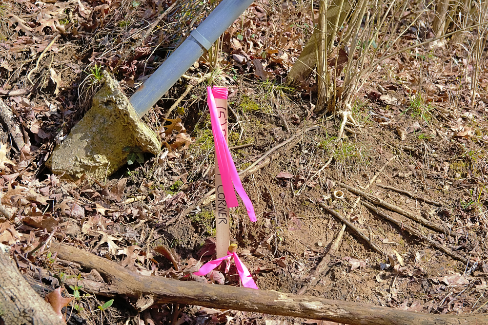
Benchmark surveys, on the other hand, serve a different purpose in surveying and mapping. A benchmark is a fixed reference point with a known and established elevation. This reference point is used to measure other points’ elevations in relation to the benchmark’s known height. Benchmark surveys help create a uniform system of elevation measurements, ensuring that survey data across vast areas can be consistently referenced and compared.
Benchmarks are often installed in permanent structures, such as buildings, bridges, or even large rocks in the ground, and their elevations are accurately measured and recorded. Once a benchmark is established, it serves as a reliable point of reference for all subsequent surveys in that area. In this sense, benchmark surveys are crucial because they act as the foundation for all other elevation-related measurements in a particular region. They help surveyors and construction professionals to understand and reference land elevation accurately over large distances and in multiple locations.
In large-scale projects, such as infrastructure development or land surveying for governmental purposes, benchmark surveys are essential. They provide a common standard that various surveying teams can use, ensuring that the elevations they record are consistent and reliable. For example, if a city plans to build a new freeway, the benchmark surveys performed along the path of the road will ensure that all measurements of elevation remain consistent, even as the project spans across various regions.
Key Differences Between Reduced Levels and Benchmark Surveys
While Reduced Levels and benchmark surveys both involve measuring elevation, they differ significantly in their approach and application. One of the main differences is that Reduced Levels are relative measurements taken from a specific point on the land, often a temporary point, and are used to calculate the height of various locations across a site. In contrast, benchmark surveys use fixed reference points that have a known, established elevation to provide a consistent system of measurement.
Another distinction lies in the purpose of these measurements. Reduced Levels are more commonly used in smaller-scale, site-specific surveying tasks, such as when constructing buildings or measuring the height of land for local development projects. These levels help surveyors ensure that the ground is accurately measured at different locations to facilitate the construction of foundations, roads, drainage, and other structures. Benchmark surveys, however, are used in large-scale or long-term projects where consistency in elevation measurements across different regions is necessary. They are particularly useful when surveying large areas of land for government purposes, city planning, or infrastructure projects that require coordination over a broad distance.
The physical placement of the reference points also sets these two surveying techniques apart. In Reduced Level surveys, reference points are often temporary and specific to the project at hand. Once the project is complete, these temporary points may no longer be relevant. Benchmark surveys, however, establish permanent, long-lasting reference points that can be used by future generations of surveyors.
Furthermore, while both techniques require careful measurement and accuracy, the instruments and tools used can also differ. Surveyors working with Reduced Levels typically rely on precision instruments like levels, theodolites, or total stations to measure height differences between points. For benchmark surveys, additional equipment such as GPS systems or specialized leveling instruments may be used to accurately mark and record the fixed reference point’s location and elevation.
Importance of Both in Construction and Surveying
Both Reduced Levels and benchmark surveys play integral roles in construction and land development. Construction projects require highly detailed and accurate measurements to ensure structural integrity and safety. For example, when preparing the ground for a building or infrastructure project, surveyors will measure the Reduced Levels to ensure that the foundation is placed at the correct height. This prevents potential issues with water drainage, uneven settling, or foundation damage.
On the other hand, benchmark surveys are essential for large-scale projects and mapping. Governments and municipalities often rely on benchmark surveys to standardize elevation measurements across vast areas. This ensures that all construction and planning work adheres to consistent reference points, facilitating large infrastructure projects, environmental conservation efforts, and urban development.
Both types of surveys are also vital for ensuring that the surrounding environment is protected. By accurately measuring and mapping the landscape, surveyors can ensure that construction projects do not interfere with natural features or ecosystems. For example, accurate RL measurements can help prevent damage to nearby water sources or ensure that elevation changes do not exacerbate flooding risks. Benchmark surveys, through their consistency and permanence, provide long-term protection, ensuring that any future developments or projects can refer back to a trusted reference point.
The Bottom Line
While Reduced Levels and benchmark surveys may seem similar at first glance, they serve different yet complementary functions in surveying and construction. Reduced Levels are used to measure the relative height of specific points on the land for smaller-scale projects, ensuring that structures are built at the right elevation. Benchmark surveys, however, establish permanent reference points with known elevations, providing consistency and accuracy for large-scale or long-term projects. Together, these two techniques are crucial in construction, land development, and environmental mapping. Whether working on a single building or a nationwide infrastructure project, understanding the differences between these two surveying methods is essential for ensuring the success and safety of any project.
Need Land Surveyors in Texas?
At Smyth Surveyors, Inc., we offer professional, official, and dependable land surveying in Texas. Our staff are all trained and licensed with our owner holding an L.S.L.S license. We can offer surveying for gas and oil well locations, pipeline right-of-way acquisition and construction alignment, determination of original survey boundaries, title boundary surveys, topographic surveys, and construction staking. If you are looking for a surveying company that has a prestigious record and an impeccable reputation look no further than Smyth Surveyors, Inc. Contact us today to speak with one of our friendly project managers and set up some time with us!