How is Mapping a Monument Different for a Surveyor in Texas?

How is Mapping a Monument Different for a Surveyor in Texas?
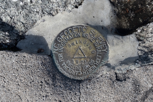
When it comes to the field of surveying, land surveyors are often tasked with various projects that involve mapping and measuring different types of land and structures. One such project that comes with its own unique challenges is mapping a monument. In this blog post, we will explore the process of mapping a monument in Texas and discuss how it differs from other surveying tasks.
Understanding the Historical Significance:
Before a surveyor can begin mapping a monument, it is crucial to understand its historical significance. Monuments often hold deep cultural and historical importance for communities and countries. Therefore, surveyors must invest time in researching the significance and background of the monument they are about to map. This understanding allows them to approach the mapping process with the necessary respect and appreciation.
Preservation Considerations:
Mapping a monument involves a delicate balance between accurately measuring and documenting its features while ensuring its preservation. Surveyors must be mindful of not causing any damage to the monument during the mapping process. This includes using non-invasive techniques and equipment that will not harm the structure, such as laser scanning, photogrammetry, and ground-penetrating radar. By prioritizing preservation, surveyors can contribute to the long-term conservation of historical monuments.
Dealing with Irregular Shapes:
Unlike topographic surveying for a regular piece of land or structure, monuments often have irregular shapes and intricate features. Surveyors must be skilled in capturing these unique characteristics accurately. This may involve employing advanced techniques and specialized equipment, such as total stations and 3D laser scanners, to obtain precise measurements. The role of a surveyor, in this case, becomes crucial in ensuring that the mapped representation of the monument is a true reflection of its shape and form.
Measuring Height and Dimensions:
In addition to capturing the unique shape, surveyors must also measure the height and dimensions of the monument accurately. Determining the exact height of a monument can be a complex task, especially if it is tall or has intricate design elements. Surveyors in Texas may need to use various instruments such as theodolites, rangefinders, and differential leveling techniques to obtain precise measurements. This data is vital for creating accurate architectural drawings and plans of the monument.
Accounting for Weather and Conditions:
Mapping a monument can often be a time-sensitive task, as it is crucial to consider weather and environmental conditions. Surveyors must account for factors such as lighting, temperature, and precipitation, as these can impact the accuracy of measurements and data collection. In some cases, specific weather conditions may create challenges, such as strong winds affecting stability or fog hindering visibility. Experienced surveyors are adept at adjusting their processes and equipment to adapt to these changing conditions.
Researching Historical Records:
To provide a comprehensive and accurate mapping of a monument, surveyors often need to consult historical records and documents. This includes architectural drawings, photographs, and other historical sources that can offer insights into the structure’s original form and dimensions. By conducting thorough research, surveyors can compare their findings with historical records to ensure the mapping is as precise and faithful to the original design as possible.
Collaboration with Historians and Architects:
Mapping a monument is rarely a solo endeavor. Surveyors often collaborate closely with historians and architects to fully understand the monument’s background, significance, and design elements. This collaboration helps to ensure that the mapping process aligns with the broader objectives of conservation and historical accuracy. The expertise of historians and architects can offer valuable insights that translate into more detailed and comprehensive mapping results.
Summary:
Mapping a monument presents unique challenges for surveyors. The process requires a deep understanding of historical significance, preservation considerations, adjustments for irregular shapes, precise measurements of height and dimensions, accounting for weather conditions, consulting historical records, and collaboration with experts. By incorporating these considerations into their work, surveyors play a crucial role in documenting and preserving the cultural heritage that monuments represent.
Need Land Surveyors in Texas?
At Smyth Surveyors, Inc., we offer professional, official, and dependable surveying in Texas. Our staff are all trained and licensed with our owner holding an L.S.L.S license. We can offer surveying for gas and oil well locations, pipeline right-of-way acquisition and construction alignment, determination of original survey boundaries, title boundary surveys, topographic surveys, and construction staking. If you are looking for a surveying company that has a prestigious record and an impeccable reputation look no further than Smyth Surveyors, Inc. Contact us today to speak with one of our friendly project managers and set up some time with us!