What is the Meaning of Cartography When Designing a Texas Map?
What is the Meaning of Cartography When Designing a Texas Map?
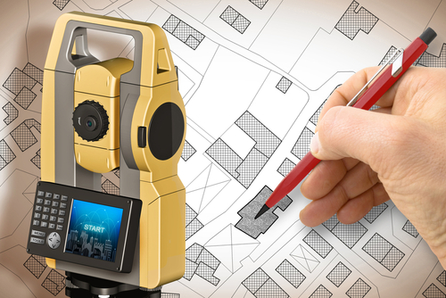
Cartography is the art and science of making maps. It involves the creation, study, and interpretation of maps, which are visual representations of the Earth’s surface or a specific area. When it comes to designing a map, cartography plays a crucial role in ensuring that the map accurately represents the geography, features, and information it intends to convey. In this blog post, our land surveyors will explore the meaning of cartography in the context of designing a map in Texas and the key considerations involved.
1. Understanding the Purpose
The first step in cartography when designing a map is to understand the purpose of the map. Different maps serve different purposes, whether it is a world map, a political map, a topographic map, or a thematic map. The purpose will determine the content, scale, and level of detail needed to effectively convey the information. For example, a navigation map requires clear labeling of roads and landmarks, while a geological map focuses on rock types and formations. Understanding the purpose helps guide the design process.
2. Gathering and Analyzing Data
Cartography relies heavily on data collection and analysis. A map designer needs to gather relevant information about the area they are mapping, such as terrain, water bodies, political boundaries, or demographic data. This data can come from various sources, including satellite imagery, aerial and boundary surveys, census reports, or existing maps. The designer then analyzes the data to identify patterns, trends, and significant features that need to be represented on the map.
3. Selecting a Map Projection
A crucial aspect of cartography in Texas is selecting an appropriate map projection. A map projection is a mathematical transformation that represents the three-dimensional Earth onto a two-dimensional surface. Different projections have strengths and weaknesses, and the choice depends on the purpose of the map and the area being represented. Common map projections include Mercator, Robinson, Lambert Conformal Conic, and Azimuthal Equidistant. The projection affects the accuracy of distances, shapes, and areas on the map.
4. Symbolization and Visualization
One of the key elements of cartography in map design is symbolization and visualization. This involves deciding how to represent different features and information on the map using symbols, colors, labels, and other visual elements. Symbolization allows for the efficient representation of a variety of features, such as cities, roads, vegetation, elevation contours, or cultural landmarks. These symbols need to be clear, concise, and easily understood by map users.
5. Symbology and Color Choices
When it comes to symbolization and color choices, careful consideration must be given to the readability and aesthetics of the map. Using too many symbols or colors can make the map cluttered and confusing. Map designers must strike a balance between providing essential information and creating a visually appealing map. Additionally, color choices can play a significant role in conveying different types of information or highlighting specific features. For example, a blue color may represent water bodies, while green may represent vegetation.
6. Labeling and Typography
Another important aspect of cartography in map design is the proper labeling and typography. Labels and typography help provide additional information and context. Map designers need to choose clear, legible fonts and font sizes for labels to ensure that they can be easily read. Placement and positioning of labels is also essential to avoid clutter and confusion, allowing users to quickly access the necessary information without visual distractions.
7. Scale and Generalization
Scale is a critical consideration in cartography when designing a map. It refers to the ratio between the actual size of the area being represented on the map and its size on the map itself. The scale determines the level of detail that can be included in the map. For example, a large-scale map of a city may show individual streets and buildings, while a small-scale map of a country may only display major highways and cities. Generalization is the process of simplifying and reducing detail to fit the chosen scale.
Summary
Cartography plays a vital role in designing a map by ensuring accurate representation of the Earth’s surface or a specific area. From understanding the purpose to gathering and analyzing data, selecting a map projection, symbolization and visualization, symbology and color choices, labeling and typography, to considering the scale and generalization, cartography encompasses various elements that must be carefully addressed. By taking into account these considerations, map designers in Texas can create informative and visually appealing maps that effectively communicate information to their intended users.
Need Land Surveyors in Texas?
At Smyth Surveyors, Inc., we offer professional, official, and dependable surveying. Our staff are all trained and licensed with our owner holding an L.S.L.S license. We can offer surveying for gas and oil well locations, pipeline right-of-way acquisition and construction alignment, determination of original survey boundaries, title boundary surveys, topographic surveys, and construction staking. If you are looking for a surveying company that has a prestigious record and an impeccable reputation look no further than Smyth Surveyors, Inc. Contact us today to speak with one of our friendly project managers and set up some time with us!