How Is A Dumpy Level Used In Surveying?

A dumpy level is a commonly used tool in surveying that helps determine the relative heights or elevations of different points on a piece of land. In this blog, we will discuss how a dumpy level is used in surveying, the components of a dumpy level, and the step-by-step process of using a dumpy level in a surveying project.
Understanding Dumpy Level
A dumpy level, also known as an automatic level or builder’s level, is a simple and precise instrument used in surveying and construction to measure height differences. It consists of a telescope mounted on a tripod, with a horizontal circle at the base of the telescope and a bubble level for ensuring the instrument is placed at a level position. The telescope can be rotated horizontally and vertically, enabling accurate measurements of angles and elevations.
Components of a Dumpy Level
A dumpy level typically consists of several components, including:
– Telescope: The main component of the dumpy level, which is used for sighting and measuring angles.
– Leveling Head: The mechanism that allows the telescope to be adjusted horizontally and vertically to ensure it is level.
– Tripod: A stable support for the dumpy level, typically with adjustable legs to accommodate uneven terrain.
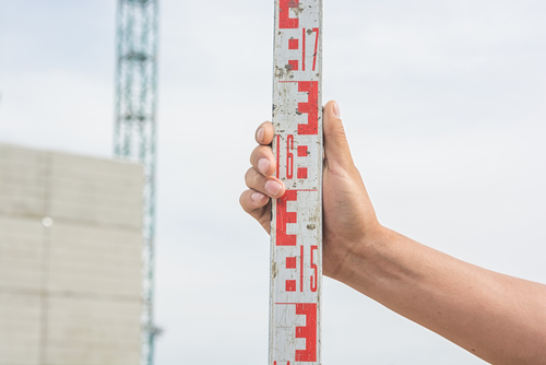
– Staff: A measuring rod held vertically by an assistant at various points to measure elevations relative to the dumpy level.
Using a Dumpy Level in Surveying
1. Set up the Dumpy Level: The first step in using a dumpy level is to set up the instrument on a stable tripod. Ensure that the tripod is securely placed on solid ground and use the bubble level to ensure the dumpy level is level.
2. Sighting the Target: Look through the telescope and rotate it horizontally and vertically to sight the target or staff held by an assistant. Use the focusing knob to adjust the focus of the telescope and aim the crosshairs at the target.
3. Taking Measurements: Once the dumpy level is set up and sighted on the target, take measurements of the height difference by reading the staff held by the assistant. The staff is typically marked with graduations in feet, inches, or metric units, allowing you to accurately measure the height of the staff relative to the dumpy level.
4. Recording Data: Record the measurements taken using the dumpy level, along with the corresponding points on the surveyed area. This data will be used to create elevation profiles, contour maps, or topographic surveys, depending on the purpose of the surveying project.
5. Moving to the Next Point: Repeat the process of setting up the dumpy level, sighting the target, taking measurements, and recording data at each point on the surveyed area. This will allow you to establish the relative elevations of different points and create an accurate survey map of the area.
Applications of Dumpy Level in Surveying
Dumpy levels are commonly used in various surveying and construction projects, including:
– Topographic Surveys: Mapping the contours and elevations of a landscape for land development or engineering projects.
– Setting Levels: Establishing reference points and benchmark elevations for construction projects such as roads, buildings, and drainage systems.
– Monitoring Land Deformation: Measuring changes in land elevations over time to monitor subsidence, settlement, or structural stability.
Summary
A dumpy level is a versatile and essential tool in the field of surveying, providing accurate measurements of height differences and elevations in various projects. By understanding how to properly use a dumpy level and its components, surveyors can efficiently gather data and create detailed survey maps for effective land management and development. Whether it’s creating topographic surveys, setting levels for construction projects, or monitoring land deformation, the dumpy level remains a valuable instrument for accurate and reliable surveying work.
Need Land Surveyors in Texas?
At Smyth Surveyors, Inc., we offer professional, official, and dependable land surveying in Texas. Our staff are all trained and licensed with our owner holding an L.S.L.S license. We can offer surveying for gas and oil well locations, pipeline right-of-way acquisition and construction alignment, determination of original survey boundaries, title boundary surveys, topographic surveys, and construction staking. If you are looking for a surveying company that has a prestigious record and an impeccable reputation look no further than Smyth Surveyors, Inc. Contact us today to speak with one of our friendly project managers and set up some time with us!