What is a Survey for Texas Flood Elevation Certification?
 What is a Survey for Texas Flood Elevation Certification?
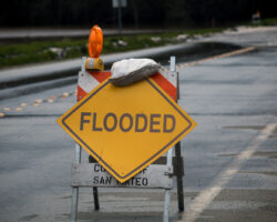
Floods are a common natural disaster that can cause extensive damage and disruption to both residential and commercial properties. In the United States, flood elevation certificates given by land surveyors are used to determine the flood risk of a property and if flood insurance is necessary. A survey for flood elevation certification is a process that involves a survey of a property to determine its elevation in relation to the surrounding floodplain. This blog post will delve into the details of flood elevation certification surveys in Texas.
What is a Flood Elevation Certificate?
A flood elevation certificate is an official document that lists a property’s elevation in relation to the nearby floodplain. This certificate is important for determining the flood risk for a particular property and obtaining flood insurance. A flood elevation certificate is typically required by local, state, or federal governments before flood insurance can be obtained.
The Federal Emergency Management Agency (FEMA) is responsible for establishing floodplain management regulations in the United States. FEMA produces standardized forms for use in floodplain management, including the Standard Flood Hazard Determination Form (SFHDF) and the Elevation Certificate (EC). The EC is used to determine the proper flood insurance premiums for a particular property and must be completed by a professional land surveyor.
What is a Survey for Flood Elevation Certification?
A survey for flood elevation certification is a process that involves a professional land surveyor, who will determine the elevation of a property in relation to the surrounding floodplain. The survey will measure ground elevations, the foundation and floor elevations of the building, and any additional relevant information necessary to determine the flood risk of the property. The surveyor will also look for important indicators such as changes in terrain, water management systems, and nearby waterways and flood control structures.
The surveyor will then use this information to complete an Elevation Certificate (EC) and submit it to the appropriate topographic surveying agency in Texas. This certificate will then be used by insurance companies to determine the flood insurance premiums for a particular property. The certificate will contain information such as the property’s location, the structure’s layout, and the building’s elevation in relation to the nearest floodplain.
Why Is a Survey for Flood Elevation Certification Important?
A survey for flood elevation certification is important for many reasons. Most importantly, a certificate can determine the flood risk of a property and the necessity of flood insurance. Properties that are deemed high-risk will require flood insurance as a condition of their mortgage loan. Flood insurance is often the only financial protection available to property owners affected by floods.
A survey for flood elevation certification can also be used to assess the flood risk of a property for land development purposes. Having an accurate flood elevation certificate can allow developers to minimize risks associated with building on flood-prone land. In addition, having a flood elevation certificate can provide an understanding of the flood risk of a property and improve the safety of the residents.
How to Get a Survey for Flood Elevation Certification
A land surveyor is required to complete a survey for flood elevation certification. When choosing a surveyor, it is important to ensure that they are licensed and experienced in flood elevation certification surveys. If you’re unsure of where to start, you can check with your local government agency that oversees floodplain management. They will likely have a list of approved surveyors and regulations in place.
During the survey, the surveyor may ask to access the property, including the crawl space and attic, to obtain accurate measurements. They may also ask for information such as blueprints, surveys, or other records related to the property.
Once the survey is completed, the surveyor will create an official report that includes the elevation certificate. This document can then be submitted to the relevant government agencies to comply with the regulations and obtain flood insurance as needed.
Conclusion
Flood elevation certification surveys are an essential tool in assessing the flood risk of a property in Texas. They provide an accurate assessment of the elevation of a property in relation to the surrounding floodplain, which can be used to help property owners obtain flood insurance and assess safety risks. It is vital that these surveys are conducted by licensed and experienced topographic surveying professionals to ensure the accuracy and quality of the results. Prioritizing a flood elevation certification survey can significantly aid in the protection of your property and its occupants in the event of a flood. Contact us today to learn more!