How to Understand a Texas Map’s Legend Feature
How to Understand a Texas Map’s Legend Feature
Maps are essential tools for navigation, whether you’re exploring a new city or planning a hiking trip in the wilderness. They provide a visual representation of geographical information and help us understand the Texas landscape. However, reading a map can be challenging if you’re not familiar with its legend. In this blog post, our land surveyors will discuss how to understand a map’s legend and make the most of its features.
1. Introduction to Map Legends
A map legend, also known as a key, is a critical component of any map. It provides a key to decoding the symbols and colors used on the map, making it easier to interpret the information. The legend is usually found in a corner of the map and lists various features and their corresponding symbols. Understanding the legend is crucial for accurately interpreting the map and navigating the terrain.
2. Symbols and Colors
Symbols and colors are the building blocks of a map’s legend. Each symbol represents a specific feature or item on the map, such as roads, landmarks, or bodies of water. For example, a dotted line may represent a hiking trail, while a solid line could indicate a major road. Colors are also used to differentiate between various features. For instance, blue might represent water bodies, green could indicate forests or parks, and yellow might indicate urban areas or buildings. Familiarize yourself with the symbols and colors used on the map, as they will be crucial in understanding the information presented.
3. Scale and Distance
Another vital element of a map’s legend is the scale. The scale represents the relationship between the distance on the map and the actual distance on the ground. It is usually expressed as a ratio, such as 1:10,000, where one unit on the map represents 10,000 units on the ground. Understanding the scale is crucial for estimating distances and planning routes. For example, if the scale is 1:50,000, and you measure a distance of 5 centimeters on the map, the actual distance on the ground would be 250,000 centimeters or 2.5 kilometers.
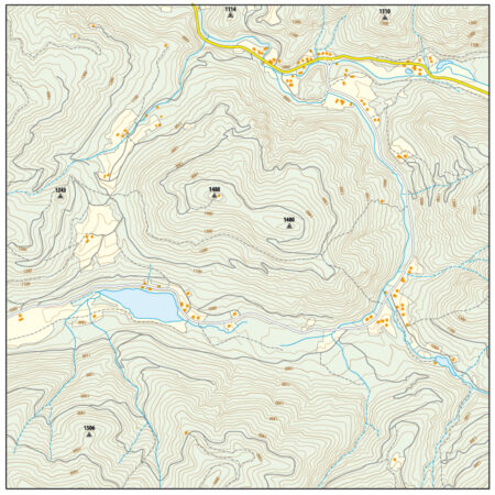
4. Contour Lines and Elevation
Contour lines are curved lines on a map that represent changes in elevation. They are an essential element of topographical maps and help readers understand the shape of the land. The contour lines connect points of equal elevation in Texas, indicating the hills, valleys, and mountains on the map. By closely examining the contour lines and their spacing, you can determine the steepness of the terrain and plan your route accordingly. Understanding contour lines is particularly important for hikers, mountaineers, and outdoor enthusiasts.
5. Points of Interest and Landmarks
Maps often include points of interest and landmarks, such as tourist attractions, historical sites, or natural wonders. These features are usually represented by symbols or icons on the map, with corresponding labels in the legend. By referring to the legend, you can identify these points of interest and plan your visit or explore the area. Landmarks can be anything from museums and monuments to parks and viewpoints. The legend will provide valuable information about these features, including their names and significance.
6. Orientation and North Arrow
To read a map accurately, you need to understand its orientation. The orientation helps you identify the cardinal directions, such as north, south, east, and west. A map typically includes a north arrow or compass rose, which indicates the direction of north. By aligning the map with the actual landscape and the north arrow, you can determine the direction you are facing and plan your navigation accordingly. Understanding the orientation is crucial for avoiding getting lost and ensuring you are on the right track.
7. Map Scale and Legend Iconography
When analyzing the map’s legend, pay attention to the map scale and the iconography used. Different maps may use slightly different symbols or color palettes, so it’s essential to consult the legend specific to the map you are using. Familiarize yourself with the legend’s iconography by referring to a key or index, which provides detailed information about each symbol or color. Understanding the specific symbols used will enhance your map-reading skills and help you interpret the information accurately.
Summary
Understanding a map’s legend is key to decoding its features and making the most of its information. By familiarizing yourself with symbols, colors, scales, contour lines, points of interest, and orientation, you can confidently navigate any map and effectively plan your journeys. Maps are powerful tools, and with a clear understanding of their legends, you can explore new territories with ease and confidence.
Need Land Surveyors in Texas?
At Smyth Surveyors, Inc., we offer professional, official, and dependable topographic surveying. Our staff are all trained and licensed with our owner holding an L.S.L.S license. We can offer surveying for gas and oil well locations, pipeline right-of-way acquisition and construction alignment, determination of original survey boundaries, title boundary surveys, topographic surveys, and construction staking. If you are looking for a surveying company that has a prestigious record and an impeccable reputation look no further than Texas’s own Smyth Surveyors, Inc. Contact us today to speak with one of our friendly project managers and set up some time with us!