Introduction to Land and Boundary Surveying in Uvalde, TX
Land and boundary surveying represents one of the most critical professional services in real estate, construction, and property management. Boundary surveyors in Uvalde, TX play an essential role in determining exact property lines, establishing legal boundaries, and resolving disputes between neighboring property owners. These skilled professionals use advanced technology and decades of established surveying practices to create accurate maps and documentation that protect property rights and facilitate smooth real estate transactions.
The practice of surveying has existed for thousands of years, with evidence suggesting that ancient civilizations used surveying techniques to manage agricultural lands and construct monumental buildings. Today’s land surveyors in Uvalde, TX continue this tradition while incorporating cutting-edge technology such as GPS systems, laser measurement tools, and sophisticated software programs. This combination of traditional knowledge and modern innovation allows surveyors to deliver precise results that meet all legal and regulatory requirements.
When property owners in Uvalde, TX need to understand their land boundaries, they rely on professional surveyors to conduct thorough investigations. These investigations involve examining historical records, analyzing previous surveys, conducting field measurements, and creating detailed documentation that clearly establishes property lines. Whether you are planning a construction project, purchasing property, or dealing with a boundary dispute, understanding what boundary surveyors do can help you appreciate the value they bring to your transaction or project.
The Process of Professional Surveying
The surveying process begins long before surveyors step foot on a property. Boundary surveyors in Uvalde, TX first conduct extensive research into property records, deed documents, and historical surveys. This research phase is crucial because it provides the foundation for all subsequent field work. Surveyors examine courthouse records, title documents, and previous survey maps to understand how the property has been described and measured over time.
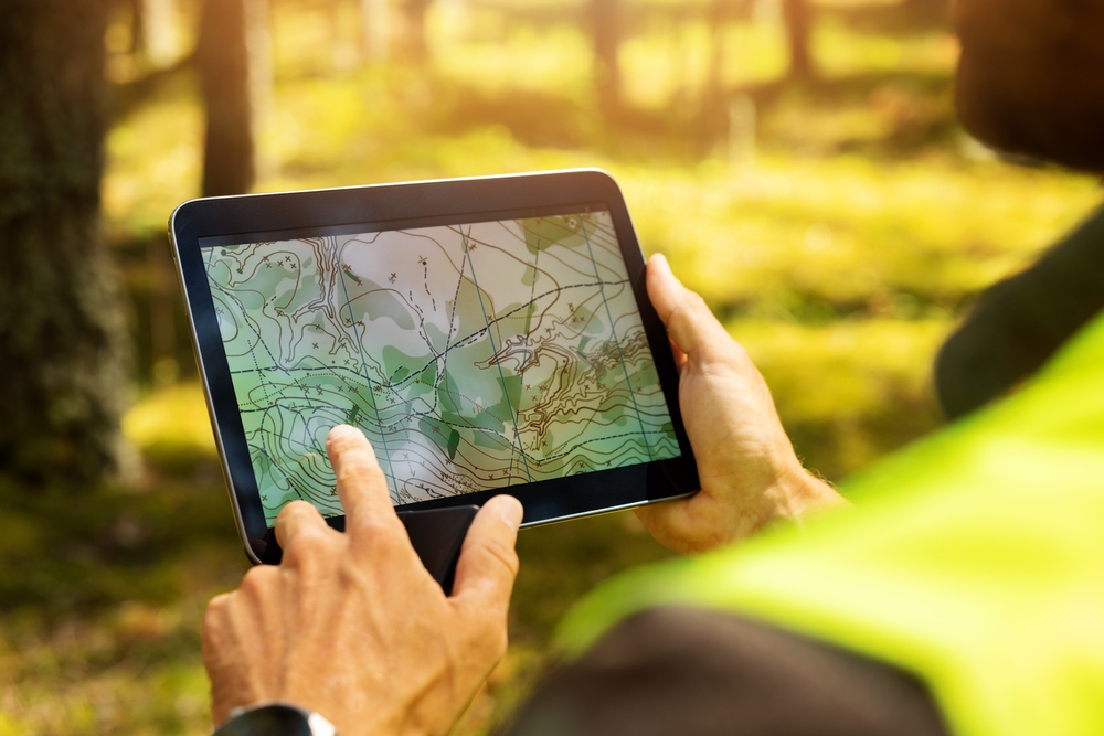
Once the research phase is complete, land surveyors in Uvalde, TX move into the field survey portion of the project. This phase involves physically visiting the property to take precise measurements and locate existing boundary markers such as corners, stakes, or monuments. Using modern GPS technology and laser measurement equipment, surveyors establish exact positions and distances between property boundaries. This fieldwork requires expertise, attention to detail, and understanding of how various environmental factors can affect measurement accuracy.
After completing field work, surveyors process all collected data using specialized software programs. This analysis phase involves comparing field measurements against historical records and determining the legal boundaries based on the property’s deed and local regulations. The surveyor must resolve any discrepancies between historical data and current field conditions, which sometimes requires additional research or legal interpretation.
Finally, boundary surveyors in Uvalde, TX prepare comprehensive reports and maps documenting their findings. These documents become legal records that establish property boundaries and can be used in real estate transactions, construction projects, or legal proceedings. The final survey map includes all relevant measurements, boundary descriptions, and certification by the licensed surveyor, making it an official document recognized by courts and government agencies throughout Texas.
Why Boundary Surveyors Matter in Uvalde
Property boundaries matter tremendously in Uvalde, TX and throughout the surrounding area. Disputes between neighbors often arise from unclear boundary lines, encroaching structures, or misunderstandings about where one property ends and another begins. Professional boundary surveyors in Uvalde, TX help prevent costly and stressful legal battles by establishing clear, documented boundaries that both parties can trust.
The importance of accurate surveying becomes especially apparent during real estate transactions. Buyers want to know exactly what land they are purchasing, and lenders require accurate surveys before approving mortgages. Land surveyors in Uvalde, TX provide the documentation that lenders and title companies need to ensure that property boundaries are clear and unencumbered. Without this professional verification, buyers risk purchasing property with boundary issues that could create problems for years to come.
For construction projects, accurate boundary surveys are absolutely essential. Contractors need to know exactly where they can build, and local zoning regulations often require specific setbacks from property lines. Boundary surveyors in Uvalde, TX ensure that construction projects comply with local ordinances and do not encroach on neighboring properties. This careful attention to boundaries protects contractors from legal liability and ensures that projects can proceed smoothly without complications.
Uvalde, TX features a diverse landscape with properties ranging from small residential lots in town to large rural tracts. Each type of property presents unique surveying challenges. Land surveyors in Uvalde, TX have experience working with all property types and understand local terrain, vegetation, and development patterns that can affect surveying work. Their familiarity with Uvalde’s specific conditions makes them invaluable partners for anyone dealing with property boundary issues.
Advanced Technology in Modern Surveying
Contemporary boundary surveyors in Uvalde, TX rely on technology that would have seemed impossible just a few decades ago. Global Positioning System technology allows surveyors to establish precise coordinates that are accurate to within inches or centimeters. This level of accuracy far exceeds what earlier surveying methods could achieve and provides a scientific foundation for all boundary determinations.
Laser measurement technology represents another significant advancement in surveying. These instruments allow surveyors to measure distances across difficult terrain and through vegetation with remarkable precision. Combined with traditional measuring techniques, laser technology enables land surveyors in Uvalde, TX to tackle complex surveying projects efficiently while maintaining the highest accuracy standards.
Drone technology is increasingly becoming part of the surveying toolkit. Aerial imagery captured by drones provides surveyors with comprehensive views of large properties and helps identify potential issues that might not be visible from ground level. This technology proves especially valuable for large rural properties in areas surrounding Uvalde, TX where traditional surveying methods might require significantly more time and resources.
Software programs designed specifically for surveying allow boundary surveyors in Uvalde, TX to process complex data sets and create accurate representations of property boundaries. These programs incorporate mathematical modeling, historical data analysis, and legal boundary interpretations to produce comprehensive survey maps and reports. The sophistication of modern surveying software ensures that results are consistent, reliable, and compliant with all applicable Texas surveying standards.
When to Hire Professional Surveyors
Property owners in Uvalde, TX should consider hiring boundary surveyors in several specific situations. If you are purchasing property, hiring a surveyor provides independent verification that boundary descriptions in the deed match actual ground conditions. This protection can prevent future disputes and clarify your actual property rights.
If you are experiencing a boundary dispute with a neighbor, land surveyors in Uvalde, TX can provide objective, professionally documented evidence about where the actual boundary line exists. Courts recognize surveyor testimony and documentation as authoritative evidence in property disputes, making professional surveying an important tool for resolving disagreements.
Before undertaking any significant construction or landscaping project, boundary surveyors in Uvalde, TX can verify that your plans comply with property line requirements and local zoning regulations. This verification prevents costly mistakes and legal complications down the road.
If you are dividing property or transferring ownership of a portion of your land, boundary surveyors in Uvalde, TX must create new survey maps showing the legal boundaries of each resulting parcel. These surveys ensure that each portion of property is properly documented and legally transferable.
Conclusion
Boundary surveyors in Uvalde, TX provide essential services that protect property rights, facilitate real estate transactions, and prevent costly disputes. Whether you are buying property, constructing a building, or managing a boundary question, professional land surveyors in Uvalde, TX bring expertise, advanced technology, and legal knowledge that make surveying services invaluable. Understanding what these professionals do and when to hire them helps ensure that your property matters are handled correctly and that your legal interests are fully protected.
Need Land Surveyors in Texas?
At Smyth Surveyors, Inc., we offer professional, official, and dependable land surveying in Texas. Our staff are all trained and licensed with our owner holding an L.S.L.S license. We can offer surveying for gas and oil well locations, pipeline right-of-way acquisition and construction alignment, determination of original survey boundaries, title boundary surveys, topographic surveys, and construction staking. If you are looking for a surveying company that has a prestigious record and an impeccable reputation look no further than Smyth Surveyors, Inc. Contact us today to speak with one of our friendly project managers and set up some time with us!