The Impact of Climate Change on Flood Risks in Texas
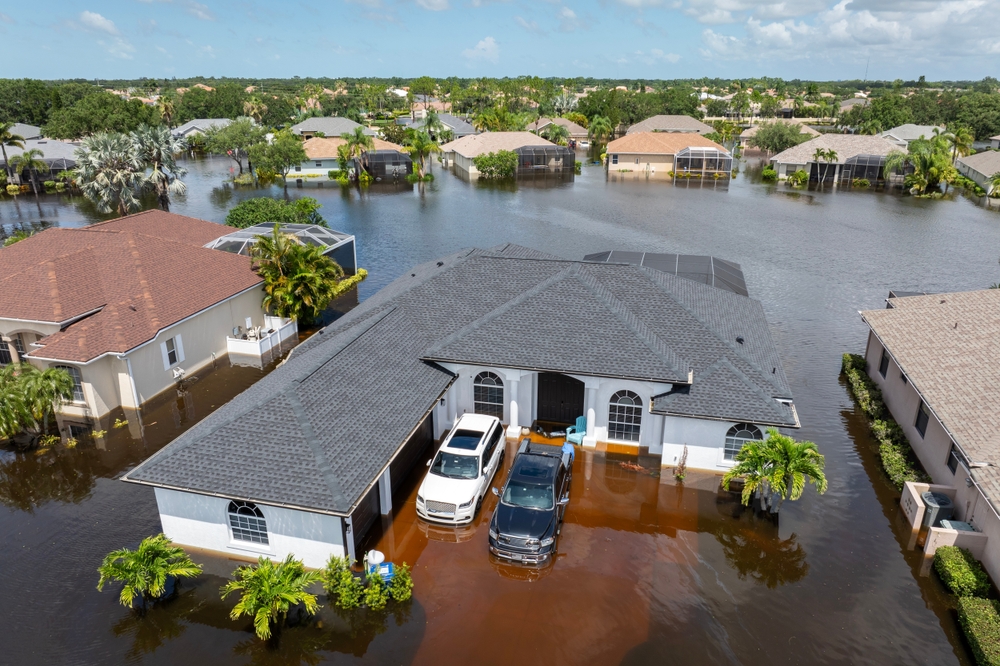
Flooding has always been a serious concern in Texas, but in recent years, the risk has increased significantly due to the accelerating impacts of climate change. Rising global temperatures have led to more frequent and intense storms, erratic weather patterns, and shifting rainfall trends, all of which contribute to higher flood risks across the state. From densely populated urban centers like Houston to rural communities such as La Pryor, TX, no part of the state is immune.
Texas has experienced a range of catastrophic flood events in the past few decades, with billions of dollars in damage and countless lives disrupted. Now, with the added uncertainty of climate change, understanding and mitigating these risks has never been more urgent. One of the essential tools in flood risk assessment and property protection is the flood elevation certificate, a document that plays a critical role in determining flood insurance rates and evaluating a property’s elevation relative to the base flood level.
This blog explores how climate change is reshaping the flood landscape in Texas, the increasing importance of flood elevation data, and what residents and policymakers can do to prepare.
Changing Rainfall Patterns and Intensity
Climate change has had a noticeable effect on rainfall patterns in Texas, making storms not only more unpredictable but also more intense. The state has seen an increase in the frequency of extreme weather events, particularly hurricanes and tropical storms, which often bring intense downpours in short periods. This kind of rainfall overloads natural waterways and urban drainage systems, leading to flash floods and prolonged inundation in vulnerable areas.
In regions like La Pryor, TX, where the landscape is generally flat and the drainage infrastructure is limited, these sudden deluges can be devastating. What used to be rare 100-year flood events are now happening more frequently, challenging the existing standards for flood risk modeling. The flood elevation certificate becomes even more crucial in such scenarios, as it helps homeowners and insurers understand the relative safety of a property and determine accurate insurance premiums.
Rural communities that once considered themselves relatively safe are discovering that increased rainfall, combined with outdated floodplain maps, may leave them more exposed than previously thought. Modern elevation data and updated certificates are essential tools to reassess and prepare for these evolving risks.
Rising Sea Levels and Coastal Vulnerability
While much of Texas is inland, its vast coastline makes it particularly vulnerable to the dual threats of rising sea levels and storm surges. Cities like Galveston, Corpus Christi, and Houston are already seeing the effects, with higher baseline water levels making it easier for even minor storms to cause significant coastal flooding.
The ripple effects reach inland as well. As storm surges push water further up rivers and bayous, flooding can affect communities dozens of miles from the coast. Residents of places like La Pryor, TX, may feel removed from these direct coastal influences, but the interconnectedness of Texas’s hydrological systems means that no region is entirely isolated from the broader climatic changes.
For homeowners across the state, understanding flood elevation is critical. The flood elevation certificate provides key information about the elevation of a building’s lowest floor relative to the expected flood level, helping assess how susceptible a property is to rising waters. As sea levels continue to rise, homes previously deemed “safe” may need to be reevaluated and retrofitted, and having an accurate certificate is the first step in that process.
Urban Development and Impervious Surfaces
Rapid urbanization in Texas has led to a significant increase in impervious surfaces such as concrete and asphalt. These surfaces prevent water from naturally soaking into the ground, instead funneling it into storm drains and creeks, often at volumes that exceed design capacities. As a result, even moderate rainfall can lead to urban flooding, especially in poorly planned areas.
Major metropolitan areas such as Austin, Dallas, and Houston have struggled with these challenges, with floods damaging infrastructure, disrupting daily life, and causing long-term economic consequences. As more people move to Texas and housing developments expand, small towns like La Pryor, TX, are also beginning to experience the side effects of this trend. New developments often overlook the cumulative impact of reduced permeability and increased runoff, further straining existing drainage systems.
One way communities can mitigate this risk is through better planning and zoning policies that incorporate flood risk data. Accurate flood elevation certificates provide essential insights into how land and structures interact with potential floodwaters. These certificates not only help with insurance but also inform responsible development practices, ensuring that new construction does not worsen flooding for others.
The Role of FEMA and Insurance Regulations
The Federal Emergency Management Agency (FEMA) plays a vital role in managing flood risk nationwide. Through its National Flood Insurance Program (NFIP), FEMA provides flood insurance to homeowners, renters, and businesses. However, eligibility and pricing under this program depend heavily on a property’s elevation relative to the base flood elevation. That’s where the flood elevation certificate comes in.
For property owners in Texas, particularly in flood-prone areas, obtaining this certificate is often a requirement for purchasing flood insurance through the NFIP. The document includes detailed information such as the building’s location, lowest floor elevation, and flood zone designation. All of this data helps FEMA assess risk more accurately and assign a fair insurance premium.
In areas like La Pryor, TX, where official flood zone maps may be outdated or incomplete, elevation certificates can help bridge the information gap. Local surveyors and engineers play an important role in gathering and submitting this data, helping residents qualify for insurance and understand their vulnerability.
As climate change continues to shift the boundaries of flood zones, FEMA is revising its mapping and risk rating methods. These changes may lead to higher insurance premiums for some homeowners, particularly those in previously low-risk zones that are now more flood-prone. Keeping flood elevation certificates up to date is critical for residents who want to avoid surprises and ensure they’re adequately protected.
Adapting to the New Normal: Community and Policy Responses
Texas communities are beginning to recognize that climate-driven flooding is not a future threat, but a present reality. Municipal governments, nonprofits, and individual homeowners are all playing a role in adapting to this new normal. Resilience planning, infrastructure upgrades, and better land-use policies are all part of the broader strategy to manage flood risk in a warming world.
Local governments can help by investing in green infrastructure such as wetlands restoration, rain gardens, and permeable pavements, which reduce surface runoff and improve natural water absorption. Educating homeowners about the importance of flood elevation certificates is another critical component, as it empowers individuals to make informed decisions about their property and insurance needs.
In rural communities like La Pryor, TX, these efforts are just as important. Though the resources may be more limited than in urban centers, local leadership and collaboration with state and federal agencies can yield effective flood mitigation strategies. Involving residents in the planning process and ensuring they understand how to obtain and use flood elevation certificates can lead to more resilient, informed communities.
At the policy level, integrating climate projections into floodplain mapping, building codes, and infrastructure design will help Texas prepare for a wetter, more volatile future. The key is not just reacting to disaster but planning ahead with reliable data and proactive strategies.
Conclusion
The threat of flooding in Texas is intensifying under the influence of climate change. From shifting rainfall patterns and rising sea levels to rapid urban development and outdated infrastructure, the factors contributing to flood risk are complex and interconnected. Understanding these dynamics is essential for communities, especially in vulnerable areas such as La Pryor, TX, where flood protection resources may be limited.
One of the most practical and powerful tools available to homeowners, developers, and policymakers is the flood elevation certificate. This document provides crucial information that can guide insurance decisions, building practices, and community planning. As Texas faces an uncertain climatic future, relying on accurate elevation data and incorporating it into everyday decisions will be vital for reducing risk and enhancing resilience.
Climate change is not just a global issue; it’s a deeply local one as well. By focusing on local solutions, informed by tools like flood elevation certificates and driven by community engagement, Texas can rise to meet the challenges of a changing environment.
Need Land Surveyors in Texas?
At Smyth Surveyors, Inc., we offer professional, official, and dependable land surveying in Texas. Our staff are all trained and licensed with our owner holding an L.S.L.S license. We can offer surveying for gas and oil well locations, pipeline right-of-way acquisition and construction alignment, determination of original survey boundaries, title boundary surveys, topographic surveys, and construction staking. If you are looking for a surveying company that has a prestigious record and an impeccable reputation look no further than Smyth Surveyors, Inc. Contact us today to speak with one of our friendly project managers and set up some time with us!