Introduction to Topographic Surveying in Texas
Topographic surveying is a critical process in Texas for professionals involved in land development, construction, environmental planning, and infrastructure projects. With Texas’ vast and diverse landscapes, ranging from rolling hills and river valleys to arid plains and coastal zones, accurate mapping and data collection are essential for making informed decisions. A topographic survey gathers detailed information about the natural and man-made features of a given area, including elevations, contours, slopes, vegetation, drainage systems, and built structures. These surveys form the foundation for project planning, ensuring efficiency, safety, and regulatory compliance.
In Texas, the importance of topographic surveying continues to grow due to the rapid expansion of urban areas, industrial facilities, and renewable energy projects. Whether it’s mapping a residential subdivision in Austin, analyzing flood-prone regions near Houston, or supporting oil and gas infrastructure in West Texas, developers and engineers rely on precise land data provided by a professional topographic surveying company. Understanding the fundamentals of this process, the technologies used, and the unique geographical considerations specific to Texas can help landowners, contractors, and planners make better decisions.
Understanding Topographic Surveying in Texas
Topographic surveying involves capturing accurate, three-dimensional representations of land surfaces. The data collected is used to create maps and models that show variations in elevation, locations of natural features, and man-made structures. Unlike boundary surveys, which focus primarily on property lines, topographic surveys provide a more detailed picture of the terrain and are essential for planning construction projects, environmental assessments, and land-use strategies.
In Texas, where the terrain varies dramatically between regions, surveyors must account for a wide range of conditions. For example, the Hill Country west of Austin is characterized by rugged limestone ridges and deep canyons, requiring specialized equipment and techniques. In contrast, the Gulf Coast’s flat plains demand different surveying approaches, especially in areas prone to flooding or subsidence.
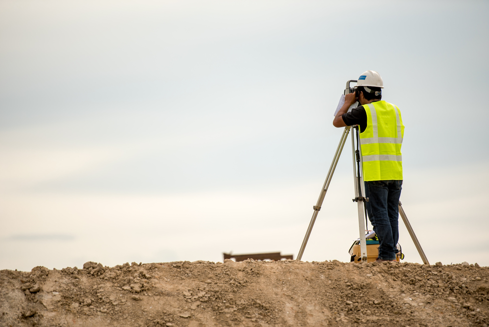
A reputable topographic surveying company in Texas employs cutting-edge technologies, including GPS-based positioning systems, drones equipped with LiDAR (Light Detection and Ranging) sensors, robotic total stations, and advanced software for modeling and analysis. These innovations allow surveyors to collect more data with greater accuracy and efficiency than ever before. Furthermore, Texas’ strict environmental and land-use regulations often require detailed topographic data before construction can begin, making the role of surveyors indispensable.
The Role of a Topographic Surveying Company in Texas
Choosing the right topographic surveying company in Texas is a critical step for any project. These companies provide expertise not only in data collection but also in interpreting and presenting survey results that meet local regulations and client needs. A professional surveying team typically works alongside engineers, architects, environmental consultants, and construction managers to ensure that site development plans are accurate and compliant.
In major metropolitan areas like Dallas, Houston, San Antonio, and Austin, topographic surveying companies are often tasked with handling complex urban projects. These may include high-rise developments, road expansions, or stormwater management systems. In rural areas, surveyors may work on agricultural projects, oil and gas operations, or wind and solar energy sites.
A reliable surveying company in Texas ensures precision and consistency by following industry standards set by organizations such as the Texas Board of Professional Land Surveying (TBPLS) and the American Society for Photogrammetry and Remote Sensing (ASPRS). They also provide detailed reports, CAD drawings, and digital terrain models that integrate seamlessly into broader project workflows. Given the size and diversity of Texas, local expertise is also vital — understanding regional topography, soil conditions, and climate patterns often makes the difference between a successful and problematic project.
Applications of Topographic Surveying in Texas
Topographic surveying has countless applications across Texas’ diverse industries and landscapes. In real estate development, accurate surveys ensure that subdivisions, commercial complexes, and industrial parks are designed to match the terrain and comply with zoning and environmental regulations. In transportation, Texas’ rapidly growing highway networks and urban transit systems rely on topographic surveys to map existing conditions, plan alignments, and manage grading and drainage.
Environmental management is another area where topographic surveying plays a crucial role. From mapping wetlands and floodplains to supporting conservation projects, survey data helps stakeholders make informed decisions that protect natural resources while balancing development needs. With Texas’ susceptibility to hurricanes, flooding, and drought, precise elevation data is often required to design resilient infrastructure and mitigate potential hazards.
The energy sector, a major driver of the Texas economy, also depends heavily on topographic surveying. Surveyors are involved in pipeline planning, well site preparation, wind farm layouts, and solar energy installations. For renewable energy projects in particular, understanding slope angles, sunlight exposure, and soil stability is essential for optimizing efficiency and safety.
Conclusion
Topographic surveying in Texas is far more than a technical process — it is the foundation for informed decision-making across industries, from construction and energy to environmental management and urban planning. The state’s diverse geography, rapid growth, and regulatory requirements make working with an experienced topographic surveying company essential for success. By leveraging advanced technologies, expert knowledge, and local insights, surveyors provide critical data that enables developers, engineers, and policymakers to plan and execute projects efficiently and responsibly.
As Texas continues to evolve, the demand for precise, high-quality topographic surveying will only grow. Whether you are a landowner preparing for development, an engineer designing infrastructure, or an environmental planner assessing sensitive terrain, investing in professional surveying services ensures accurate data, reduces risks, and supports long-term sustainability. In a state as vast and varied as Texas, topographic surveying isn’t just valuable — it’s indispensable.
Need Land Surveyors in Texas?
At Smyth Surveyors, Inc., we offer professional, official, and dependable land surveying in Texas. Our staff are all trained and licensed with our owner holding an L.S.L.S license. We can offer surveying for gas and oil well locations, pipeline right-of-way acquisition and construction alignment, determination of original survey boundaries, title boundary surveys, topographic surveys, and construction staking. If you are looking for a surveying company that has a prestigious record and an impeccable reputation look no further than Smyth Surveyors, Inc. Contact us today to speak with one of our friendly project managers and set up some time with us!