What Is A Survey Station?
Surveying is a fundamental practice in the fields of civil engineering, construction, and geography, serving as a critical process for accurate mapping and measurements. At the heart of this practice is a survey station. This article will explore what a survey station is, its purpose, types, setup process, and the importance it holds in modern projects.
Definition of a Survey Station
A survey station is a fixed reference point used in surveying to measure angles, distances, and elevations accurately. These stations form the basis for conducting land surveys and collecting the data necessary for creating maps, plans, and boundaries. Survey stations are carefully chosen points established in locations that provide clear visibility to other relevant points for precise triangulation.
Purpose of a Survey Station
Survey stations serve several essential purposes in the surveying process, such as:
- Reference for Measurements: Survey stations act as stable reference points from which measurements are taken. This ensures accuracy and consistency in the data collected.
- Establishing Boundaries: They are used to demarcate property lines, define construction zones, and confirm legal land divisions.
- Topographic Mapping: Survey stations help in creating detailed topographic maps that represent the terrain’s shape, height, and other physical features.
- Construction Layouts: In construction projects, survey stations guide the accurate placement of structures, ensuring that they align with design specifications.
- Monitoring and Control: Survey stations are used for monitoring the movement of land, especially in areas prone to subsidence, landslides, or structural shifts.
Types of Survey Stations
Survey stations are generally categorized based on their purpose and function. Below are the primary types:
Primary Survey Stations
These are the main control points established during the first phase of a survey. Primary stations are often permanent and marked using monuments, concrete markers, or metal pins. They cover large areas and serve as the foundation for further detailed surveying.
Secondary Survey Stations
Secondary stations are established within the vicinity of primary stations and cover smaller areas. They provide additional reference points for detailed measurements.
Temporary Survey Stations
In some cases, surveyors need temporary points for short-term projects. These stations are set up as needed and dismantled once the project is complete. They are often marked using simple stakes, flags, or small markers.
Underground Survey Stations
For projects involving tunnels, underground mining, or subways, underground survey stations are established to ensure precision in subterranean construction. These stations are meticulously set to align with above-ground points to avoid errors.
Equipment Used at Survey Stations
The accuracy and reliability of a survey station depend heavily on the tools and equipment used. Common instruments include:
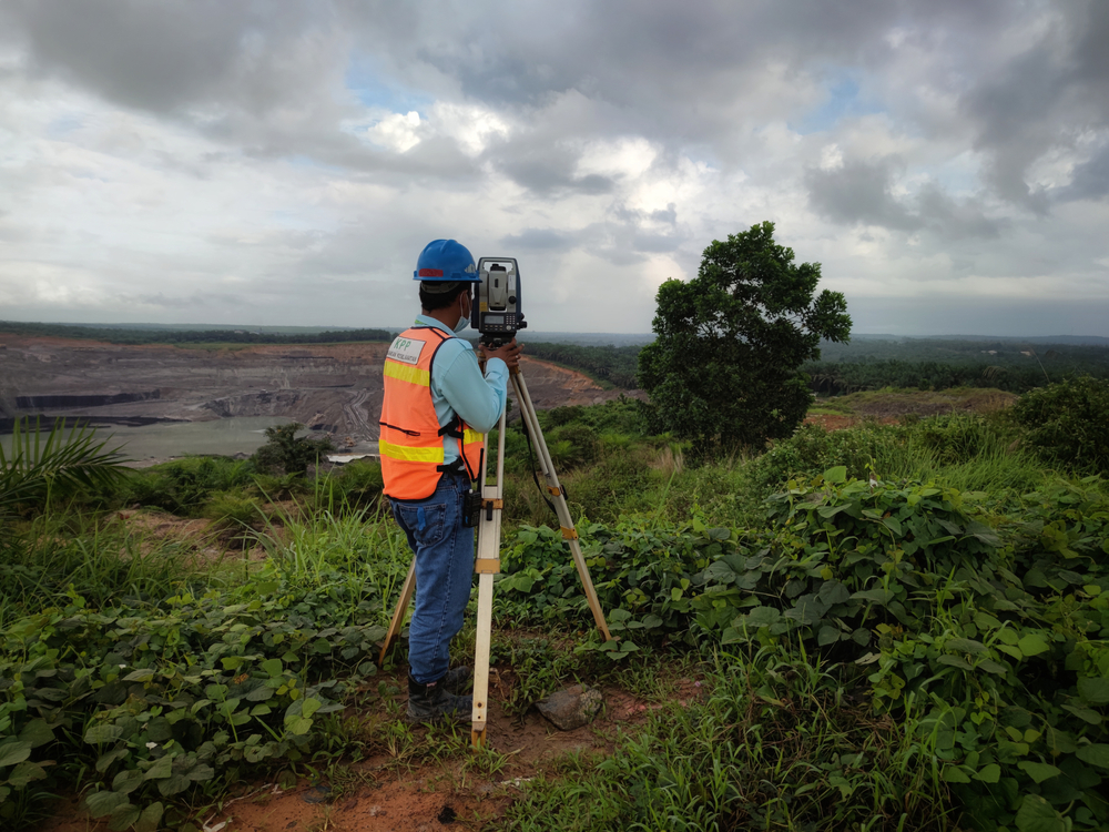
- Total Station: An advanced device that combines an electronic theodolite and an electronic distance meter (EDM) to measure angles and distances.
- Theodolite: A precision instrument used to measure horizontal and vertical angles.
- GPS (Global Positioning System): High-precision GPS equipment is often used to determine the exact coordinates of survey stations.
- Prisms and Targets: Used for reflecting signals back to the total station for accurate distance measurement.
- Leveling Instruments: Equipment like automatic levels or laser levels is used for measuring differences in elevation.
Establishing a Survey Station
Setting up a survey station involves a systematic process to ensure that measurements are reliable and accurate. Here is an overview of the key steps:
1. Site Selection
The first step in establishing a survey station is choosing an appropriate location. The site must offer clear visibility to other stations or points of interest and be free from obstructions like buildings, trees, or uneven terrain.
2. Marker Installation
Once the site is selected, a physical marker is placed to indicate the survey station. Permanent markers may be made of concrete, brass, or steel, while temporary markers may consist of stakes or paint.
3. Coordinate Determination
The precise location of the station is determined using GPS devices or through triangulation methods. This step ensures that the station’s coordinates are accurate and can be referenced later.
4. Verification
Before data collection begins, the station’s setup is verified to ensure the instruments are level, properly calibrated, and aligned with known reference points.
5. Documentation
All information related to the station, such as its coordinates, elevation, and surroundings, is recorded for future use. This documentation ensures that the station can be re-established if needed.
Applications of Survey Stations
Survey stations play a crucial role in a wide range of industries and projects. Some notable applications include:
Land Development
Survey stations are essential in urban planning and land development projects, helping to accurately divide land into plots and ensure compliance with zoning regulations.
Transportation Infrastructure
Projects like roads, bridges, and railways rely heavily on survey stations for precise alignment and elevation control to ensure structural stability.
Environmental Studies
In environmental monitoring, survey stations help track changes in topography due to natural events such as erosion, flooding, or earthquakes.
Large-Scale Construction
Survey stations guide the construction of large-scale projects, such as dams, skyscrapers, and industrial complexes, ensuring that each element is built according to design specifications.
Mining and Tunneling
In mining operations and underground tunneling, survey stations are critical for ensuring that excavation follows precise paths and avoids safety hazards.
Importance of Survey Stations
Survey stations are indispensable in ensuring precision, reliability, and efficiency in surveying tasks. Below are key reasons why they are vital:
- Accuracy: Survey stations provide fixed points that minimize errors in measurements and calculations.
- Consistency: They allow surveyors to maintain consistent reference points over time, crucial for long-term projects.
- Legal Significance: Properly established survey stations are used in legal matters involving property disputes, land ownership, and boundary delineation.
- Time and Cost Efficiency: By serving as reliable benchmarks, survey stations reduce the need for repeated measurements, saving time and resources.
- Data Integrity: The use of permanent and well-documented stations ensures that survey data remains valid and traceable.
Challenges in Survey Station Establishment
While survey stations are vital, there are challenges associated with their setup and maintenance, including:
- Environmental Factors: Natural obstacles like dense vegetation, extreme weather, and rough terrain can hinder the establishment of survey stations.
- Accessibility: Remote locations or difficult terrain may make it challenging to access sites for survey station placement.
- Technological Limitations: Older or less advanced equipment may not provide the accuracy needed for complex projects.
- Maintenance: Permanent survey stations require regular maintenance to ensure that markers remain intact and accurate over time.
Conclusion
Survey stations form the backbone of the surveying process, offering fixed reference points that enable precise measurements and data collection. Whether for mapping, construction, or environmental monitoring, survey stations ensure that projects remain accurate, efficient, and compliant with design and legal standards. By understanding the types, purposes, and setup process of survey stations, professionals can enhance the accuracy and reliability of their work, leading to successful project outcomes.
Need Land Surveyors in Texas?
At Smyth Surveyors, Inc., we offer professional, official, and dependable land surveying in Texas. Our staff are all trained and licensed with our owner holding an L.S.L.S license. We can offer surveying for gas and oil well locations, pipeline right-of-way acquisition and construction alignment, determination of original survey boundaries, title boundary surveys, topographic surveys, and construction staking. If you are looking for a surveying company that has a prestigious record and an impeccable reputation look no further than Smyth Surveyors, Inc. Contact us today to speak with one of our friendly project managers and set up some time with us!